Old Maps of East Selah, Washington
Explore 12 old maps of East Selah, spanning from 1936 to today. These high-resolution historic maps reveal how streets, neighborhoods, landmarks, and natural features evolved over time — perfect for genealogy, metal detecting, research, and local history exploration.
What you can do with these maps:
- See how East Selah changed over time: Compare historical maps to modern-day views to trace roads, homesites, rail lines & more.
- View detailed metadata: Each map includes creators, publishers, year, scale, and archive source.
- Overlay maps with satellite & LiDAR: Visualize the past alongside modern tools to explore terrain & human change.
- Trusted historical sources: Maps sourced from the USGS, Library of Congress, and other archives.
- Access maps your way: View online, download high-res files, or order prints for personal or research use.
Start exploring old maps of East Selah to uncover forgotten places, hidden landmarks, and the deep history beneath your feet.
East Selah, WA maps
(12)- 1936 Map of Yakima East
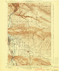
 1936 Yakima East1936 Print · USGSYakima and the Moxee Valley are shown here in the mid-1930s as the regional irrigation and rail networks were fully established. Genealogists and local historians can trace family locations near Pease Ranch, Moxee City, and schools like Central Sch.
 - 1941 Map of Yakima East
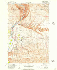
 1941 Yakima East1941 Print · USGSThe Yakima Valley was a hub of irrigation and rail transport in the early 1940s, as intensive canal networks reshaped the landscape. Local historians can trace family homesteads along Beaudry Road and Charon Rd, or locate the First Reformed Ch and the State Fairgrounds.2 unique versions available
 - 1950 Map of Yakima, 1951 Print
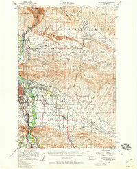
 1950 Yakima1951 Print · USGSThe Yakima Valley and the towering Cascades meet in this mid-century survey of South Central Washington. Genealogists and local historians can trace the irrigation-era growth of Yakima, the historic Fort Simcoe outpost, and the White Swan Mission on the Yakima Indian Reservation.
 - 1953 Map of Pomona, 1957 Print
 1953 Pomona1957 Print · USGSThe Yakima Valley's mid-century transition is documented here as irrigation projects and military expansion reshaped the land. Researchers can trace the Northern Pacific tracks through Pomona or locate military infrastructure like the Post Headquarters and Target Range.4 unique versions available
 - 1953 Map of Yakima East, 1958 Print
 1953 Yakima East1958 Print · USGSThe Yakima Valley in the early fifties shows a landscape of military reservations and expanding irrigation. Trace the growth of Moxee City and Union Gap or locate family roots at Holland Cem and Central School.3 unique versions available
 - 1958 Map of Yakima, 1964 Print
 1958 Yakima1964 Print · USGSThe Yakima Valley in the late fifties shows a landscape of mountain peaks and irrigated plains at the height of its rail-era development. Researchers can trace the lineage of early settlements through sites like Fort Simcoe, the Wenas Cemetery, and the Yakima Indian Agency School.3 unique versions available
 - 1961 Map of Yakima
 1961 Yakima1961 Print · USGSCentral Washington thrived in the mid-century as an agricultural powerhouse defined by the Yakima River. Trace local roots through Medicine Valley School, Fort Simcoe, and the rail lines of the Northern Pacific RR.
 - 2011 Map of Pomona, 2011 Print
 2011 Pomona2011 Print · USGSCovers East Selah, including Yakima, Pomona Heights, and other nearby areas
 - 2013 Map of Pomona, 2013 Print
 2013 Pomona2013 Print · USGSCovers East Selah, including Yakima, Pomona Heights, and other nearby areas
 - 2017 Map of Pomona, 2017 Print
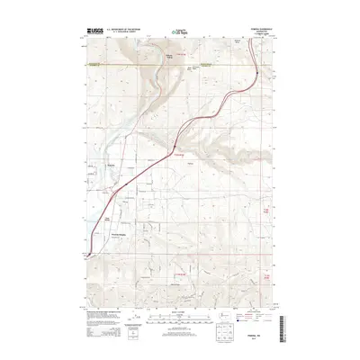
 2017 Pomona2017 Print · USGSCovers East Selah, including Yakima, Pomona Heights, and other nearby areas
 - 2020 Map of Pomona, 2020 Print
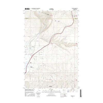
 2020 Pomona2020 Print · USGSCovers East Selah, including Yakima, Pomona Heights, and other nearby areas
 - 2023 Map of Pomona, 2023 Print
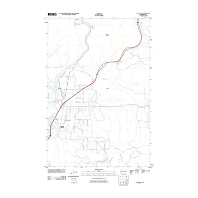
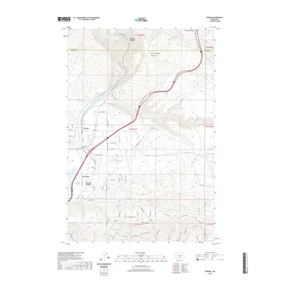
 2023 Pomona2023 Print · USGSNorth of Yakima in the early 2020s, the river and its vital irrigation network supported a landscape of valley settlements and high-desert ridges. Researchers can trace the paths of the Roza Canal and BNSF Railway through Pomona and East Selah.
End of results
Showing maps 1-12 of 12
Top cities near East Selah
- Yakima historical maps
- Selah historical maps
- Union Gap historical maps
- Wapato historical maps
- Moxee historical maps
- Ahtanum historical maps
See more
Frequently asked questions
- What are the different types of historical maps available for East Selah?
- What is the oldest map of East Selah?
- Where can I purchase historical maps of East Selah for my home or office?
- Where can I download high-res historical maps of East Selah?
- Are there historical topographic maps available for East Selah?
- Is there historical aerial imagery available for East Selah?
- Where are historical maps of East Selah sourced from?