Old Maps of Milton, West Virginia for Genealogy
Trace your family roots with 22 historic maps of Milton. These high-res maps reveal old neighborhoods, homesites, landmarks, and streets — helping you uncover where your ancestors lived and how the area evolved over time.
- Explore historic neighborhoods: Identify where your relatives may have lived in the 1800s or 1900s.
- Compare maps over time: Trace the changes in streets, buildings, and landmarks for multi-generational research.
- Perfect for genealogy & ancestry research: Used by family historians and researchers to map out lineage and migration.
These maps are an incredible resource for exploring your personal connection to Milton's past.
Milton, WV maps
(22)- 1892 Map of Huntington, 1895 Print
 1892 Huntington1895 Print · USGSWest Virginia and Ohio meet along the river in the late nineteenth century, showing the rail-fueled growth of Huntington and Wayne. Local historians can trace the paths of the Chesapeake and Ohio Railroad past Barboursville and find early landmarks like Blue Sulphur Sp's and Davis Mill.
 - 1898 Map of Huntington
 1898 Huntington1898 Print · USGSNear the turn of the century, the Ohio River valley was transforming through the expansion of the Chesapeake and Ohio RR. Modern researchers can trace early nineteenth-century settlements from the bustling streets of Huntington to the inland hubs of Hamlin and Barboursville.3 unique versions available
 - 1902 Map of Milton
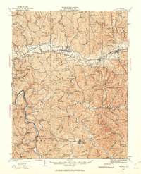
 1902 Milton1902 Print · USGSTeays Valley and the western Virginia hill country are shown here at the turn of the century, as the railroad era transformed the region's commerce. Genealogists can trace early homesteads and landmarks like Howell Mill, Salt Rock, and the Ben Johnson Ford.3 unique versions available
 - 1931 Map of Milton, 1963 Print
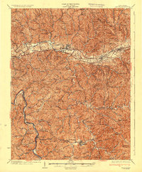
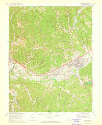
 1931 Milton1963 Print · USGSWestern West Virginia at the height of the railroad era shows a landscape of river-valley towns and ridge-top communities. Trace the vanished world of rural education and commerce at Howell Mill, Skyhigh Sch, and the busy rail stop at Milton.
 - 1935 Map of Milton
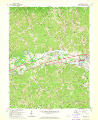
 1935 Milton1935 Print · USGSCabell and Lincoln Counties appear here in the mid-1930s, defined by the winding river valleys and ridge-top communities of the Appalachian Plateau. Genealogists can trace early homesteads and social hubs through numerous sites like Howell Mill, Skyhigh Sch, and Bethesda Ch.3 unique versions available
 - 1957 Map of Huntington, 1966 Print
 1957 Huntington1966 Print · USGSThe industrial heart of the Ohio River valley is captured here in the mid-sixties, showing the growth of Huntington and Ashland. Researchers can trace the extensive rail networks of the Chesapeake and Ohio RR and locate sites like the Chief Cornstalk Hunting Ground.3 unique versions available
 - 1958 Map of Milton, 1959 Print
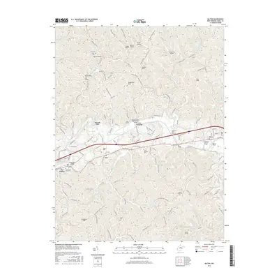
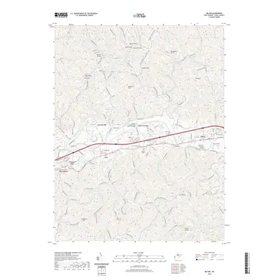
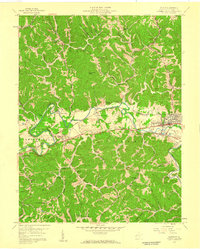 1958 Milton1959 Print · USGSThe Mud River valley in the late fifties centered on the railroad hub of Milton and the historic Midland Trail. Researchers can trace rural lineages through numerous community landmarks like Bethesda Ch, Howells Mill, and the Watson Sch.
 - 1958 Map of Hurricane, 1960 Print
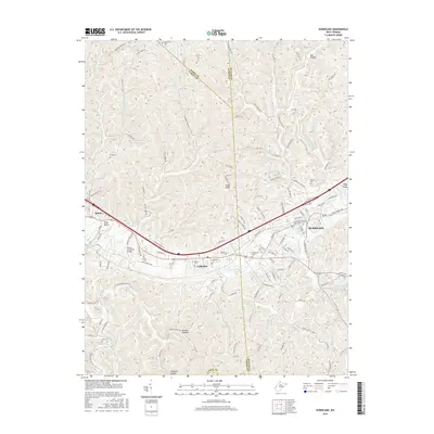
 1958 Hurricane1960 Print · USGSThe Teays Valley corridor was maturing in the late fifties as a vital link between Huntington and Charleston. Genealogists and historians can trace the foundations of local life through the Morris Memorial Hospital, Lake Washington, and numerous rural institutions like Providence Ch.
 - 1960 Map of Huntington
 1960 Huntington1960 Print · USGSThe tri-state river valley thrived in the late fifties as a hub of heavy industry and Appalachian rail transit. Genealogists and historians can trace the connection between river towns like Ashland and Portsmouth or locate family homesteads near Coleman Ridge.
 - 1972 Map of Hurricane, 1973 Print
 1972 Hurricane1973 Print · USGSThe West Virginia communities of Culloden and Hurricane are shown during a period of steady growth in the early seventies. Genealogists and local historians can locate many small landmarks like Bedford Chapel, Valley View Cem, and the Mountain State Christian Sch.2 unique versions available
 - 1972 Map of Milton, 1973 Print
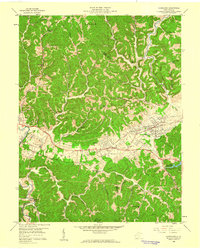
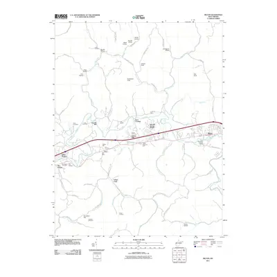
 1972 Milton1973 Print · USGSMilton and Ona are shown in the early seventies, a time when the river valley was a busy corridor for the Chesapeake and Ohio Railroad. Genealogists and local historians can trace rural landmarks from Howells Mill to many country churches like Bethesda Ch.
 - 1982 Map of Huntington, 1983 Print
 1982 Huntington1983 Print · USGSThe tri-state region around Huntington and Ashland is shown in the early 1980s, documenting a landscape shaped by river commerce and coal-country railroads. Trace family roots and old routes through Barboursville, the Gas Field, and the Tug Fork valley.
 - 2011 Map of Hurricane, 2011 Print
 2011 Hurricane2011 Print · USGSCovers Milton, including Hurricane, Culloden, and other nearby areas
 - 2011 Map of Milton, 2011 Print
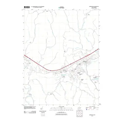
 2011 Milton2011 Print · USGSCovers Milton, including Indian Meadows, Howells Mill, and other nearby areas
 - 2014 Map of Milton, 2014 Print
 2014 Milton2014 Print · USGSCovers Milton, including Indian Meadows, Howells Mill, and other nearby areas
 - 2014 Map of Hurricane, 2014 Print
 2014 Hurricane2014 Print · USGSCovers Milton, including Hurricane, Culloden, and other nearby areas
 - 2016 Map of Milton, 2016 Print
 2016 Milton2016 Print · USGSCovers Milton, including Indian Meadows, Howells Mill, and other nearby areas
 - 2016 Map of Hurricane, 2016 Print
 2016 Hurricane2016 Print · USGSCovers Milton, including Hurricane, Culloden, and other nearby areas
 - 2019 Map of Milton, 2019 Print
 2019 Milton2019 Print · USGSCovers Milton, including Indian Meadows, Howells Mill, and other nearby areas
 - 2019 Map of Hurricane, 2019 Print
 2019 Hurricane2019 Print · USGSCovers Milton, including Hurricane, Culloden, and other nearby areas
 - 2023 Map of Hurricane, 2023 Print
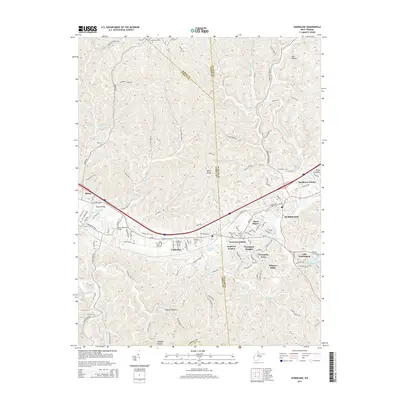
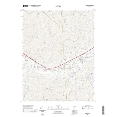
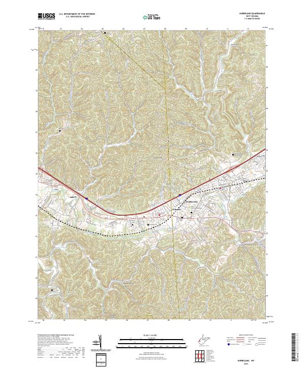 2023 Hurricane2023 Print · USGSThe Teays Valley corridor comes into focus in the early 2020s, showing the modern layout of Hurricane, Milton, and Culloden. Genealogists can trace family plots at Valley View Memorial Park Cem, Zoar Cem, and Martin Cem among the many ridgelines.
 - 2023 Map of Milton, 2023 Print
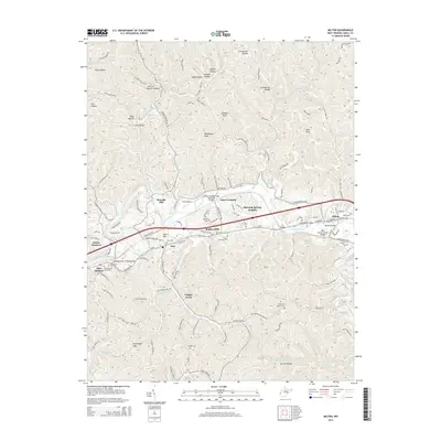
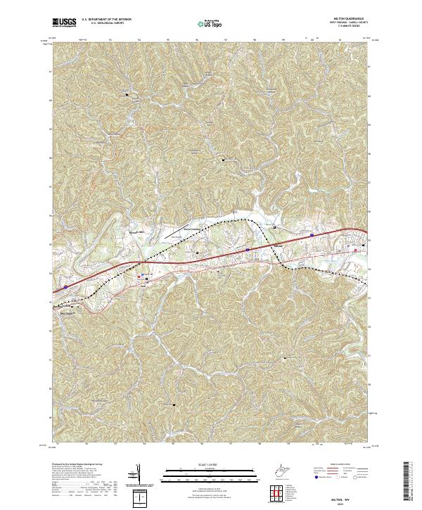 2023 Milton2023 Print · USGSThe Mud River valley and its surrounding ridges come into focus in this contemporary survey of West Virginia's Cabell County. Researchers can trace family history through numerous burial sites including Arthur Cem, McComas Cem, and the Sulphur Burial Park.
End of results
Showing maps 1-22 of 22
Top cities near Milton
- Huntington historical maps
- Teays Valley historical maps
- Hurricane historical maps
- Barboursville historical maps
- Culloden historical maps
- Winfield historical maps
See more
Frequently asked questions
- What are the different types of historical maps available for Milton?
- What is the oldest map of Milton?
- Where can I purchase historical maps of Milton for my home or office?
- Where can I download high-res historical maps of Milton?
- Are there historical topographic maps available for Milton?
- Is there historical aerial imagery available for Milton?
- Where are historical maps of Milton sourced from?