Old Maps of Hancock County, West Virginia
Explore 23 old maps of Hancock County, spanning from 1904 to today. These high-resolution historic maps reveal how streets, neighborhoods, landmarks, and natural features evolved over time — perfect for genealogy, metal detecting, research, and local history exploration.
What you can do with these maps:
- See how Hancock County changed over time: Compare historical maps to modern-day views to trace roads, homesites, rail lines & more.
- View detailed metadata: Each map includes creators, publishers, year, scale, and archive source.
- Overlay maps with satellite & LiDAR: Visualize the past alongside modern tools to explore terrain & human change.
- Trusted historical sources: Maps sourced from the USGS, Library of Congress, and other archives.
- Access maps your way: View online, download high-res files, or order prints for personal or research use.
Start exploring old maps of Hancock County to uncover forgotten places, hidden landmarks, and the deep history beneath your feet.
Hancock County, WV maps
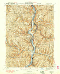
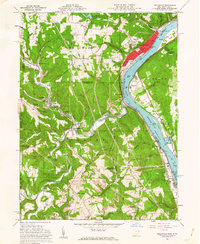
(23)- 1904 Map of Wellsville
 1904 Wellsville1904 Print · USGSCovers Hancock County, including East Liverpool, Wellsville, and other nearby areas3 unique versions available
 - 1904 Map of Steubenville
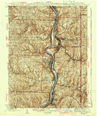
 1904 Steubenville1904 Print · USGSCovers Hancock County, including Weirton, Steubenville, and other nearby areas5 unique versions available
 - 1935 Map of Steubenville, 1958 Print
 1935 Steubenville1958 Print · USGSCovers Hancock County, including Weirton, Steubenville, and other nearby areas
 - 1937 Map of Wellsville, 1960 Print
 1937 Wellsville1960 Print · USGSCovers Hancock County, including East Liverpool, Wellsville, and other nearby areas
 - 1942 Map of Steubenville
 1942 Steubenville1942 Print · USGSCovers Hancock County, including Weirton, Steubenville, and other nearby areas2 unique versions available
 - 1944 Map of Wellsville
 1944 Wellsville1944 Print · USGSCovers Hancock County, including East Liverpool, Wellsville, and other nearby areas2 unique versions available
 - 1951 Map of Canton
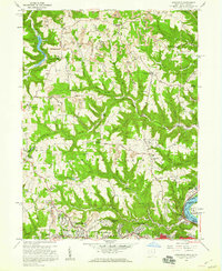
 1951 Canton1951 Print · USGSCovers Hancock County, including Pittsburgh, Akron, and other nearby areas
 - 1953 Map of Canton
 1953 Canton1953 Print · USGSCovers Hancock County, including Pittsburgh, Akron, and other nearby areas
 - 1957 Map of Canton, 1971 Print
 1957 Canton1971 Print · USGSCovers Hancock County, including Pittsburgh, Akron, and other nearby areas3 unique versions available
 - 1958 Map of Knoxville, 1960 Print
 1958 Knoxville1960 Print · USGSCovers Hancock County, including Weirton, Steubenville, and other nearby areas2 unique versions available
 - 1958 Map of Weirton, 1960 Print
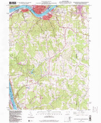
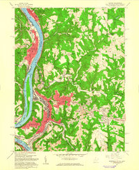 1958 Weirton1960 Print · USGSCovers Hancock County, including Weirton, Steubenville, and other nearby areas2 unique versions available
 - 1960 Map of Wellsville, 1962 Print
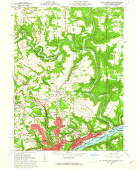
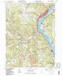
 1960 Wellsville1962 Print · USGSCovers Hancock County, including Wellsville, New Cumberland, and other nearby areas6 unique versions available
 - 1960 Map of East Liverpool North, 1962 Print
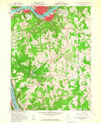
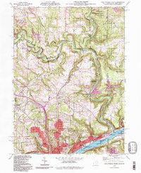
 1960 East Liverpool North1962 Print · USGSCovers Hancock County, including East Liverpool, Glasgow, and other nearby areas6 unique versions available
 - 1960 Map of East Liverpool South, 1962 Print
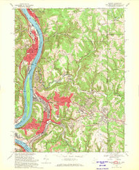
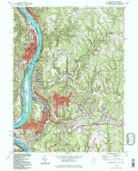
 1960 East Liverpool South1962 Print · USGSCovers Hancock County, including East Liverpool, Chester, and other nearby areas6 unique versions available
 - 1962 Map of Canton
 1962 Canton1962 Print · USGSCovers Hancock County, including Pittsburgh, Akron, and other nearby areas2 unique versions available
 - 1968 Map of Weirton, 1970 Print
 1968 Weirton1970 Print · USGSCovers Hancock County, including Weirton, Steubenville, and other nearby areas3 unique versions available
 - 1968 Map of Knoxville, 1970 Print
 1968 Knoxville1970 Print · USGSCovers Hancock County, including Weirton, Steubenville, and other nearby areas3 unique versions available
 - 1986 Map of Pittsburgh West
 1986 Pittsburgh West1986 Print · USGSCovers Hancock County, including Pittsburgh, Bethel Park, and other nearby areas3 unique versions available
 - 1986 Map of East Liverpool
 1986 East Liverpool1986 Print · USGSCovers Hancock County, including Pittsburgh, Ross Township, and other nearby areas2 unique versions available
 - 1994 Map of Wellsville, 1998 Print
 1994 Wellsville1998 Print · USGSCovers Hancock County, including Wellsville, New Cumberland, and other nearby areas
 - 1994 Map of East Liverpool North, 1998 Print
 1994 East Liverpool North1998 Print · USGSCovers Hancock County, including East Liverpool, Glasgow, and other nearby areas
 - 1994 Map of Weirton, 1998 Print
 1994 Weirton1998 Print · USGSCovers Hancock County, including Weirton, Steubenville, and other nearby areas
 - 1996 Map of East Liverpool South, 1999 Print
 1996 East Liverpool South1999 Print · USGSCovers Hancock County, including East Liverpool, Chester, and other nearby areas
End of results
Showing maps 1-23 of 23
Frequently asked questions
- What are the different types of historical maps available for Hancock County?
- What is the oldest map of Hancock County?
- Where can I purchase historical maps of Hancock County for my home or office?
- Where can I download high-res historical maps of Hancock County?
- Are there historical topographic maps available for Hancock County?
- Is there historical aerial imagery available for Hancock County?
- Where are historical maps of Hancock County sourced from?