2000s (21st Century) Maps of Cinco, West Virginia
Explore 2 historic maps of Cinco from the 2000s (21st Century). These maps offer a rare glimpse into what life looked like during the 2000s — showing old roads, neighborhoods, homes, and landmarks that have changed or disappeared over time.
Whether you're researching your family's past, planning a metal detecting trip, or studying how Cinco's landscape evolved across the 2000s, these high-resolution maps are a powerful tool for exploring the history of this region.
- Focus on a specific era: All maps on this page are from the 2000s, giving you a focused view of this time period.
- See what’s changed: Compare century-old streets, trails, and buildings to today's modern landscape using overlays and satellite layers.
- Research with precision: Use these maps for genealogy, historical research, land use analysis, or educational projects.
- View, download, or print: Maps are fully viewable online in high resolution, and can be downloaded or printed for your own records.
Start exploring Cinco's history through authentic maps from the 2000s. This is your window into the past.
Cinco, WV maps
(2)- 2000 Map of Quick, 2001 Print
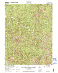 2000 Quick2001 Print · USGSKanawha County’s creek-carved valleys are captured here at the turn of the millennium, showing a landscape shaped by rural industry and small-town roots. Local historians can trace the positions of the Book Mine, the Hansford Sch, and settlements like Quick and Blount.
 - 2023 Map of Quick, 2023 Print
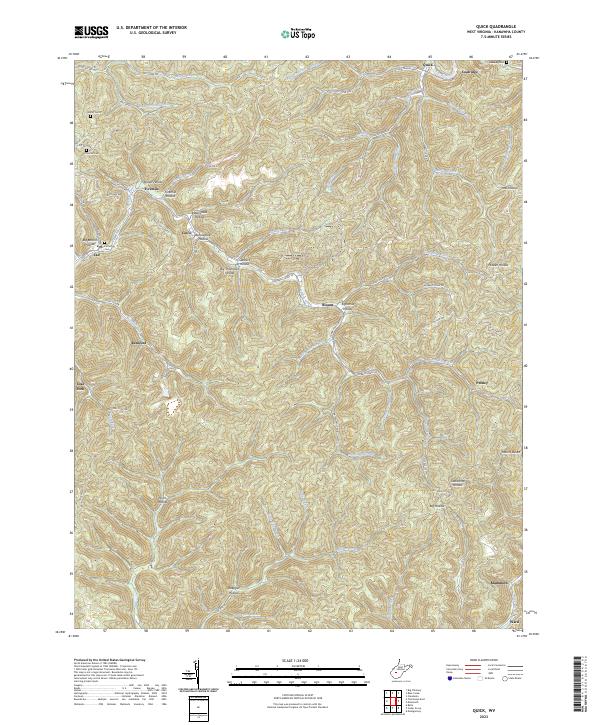 2023 Quick2023 Print · USGSThe creek valleys of Kanawha County appear in high detail on this contemporary survey of the West Virginia coalfields. Researchers can trace family origins through several burial sites like Patterson Cem and Hunter Cem, or locate old company towns at Putney and Mammoth.
End of results
Showing maps 1-2 of 2
Top cities near Cinco
- Charleston historical maps
- South Charleston historical maps
- Montgomery historical maps
- Marmet historical maps
- Chesapeake historical maps
- Rand historical maps
See more
Frequently asked questions
- What are the different types of historical maps available for Cinco?
- What is the oldest map of Cinco?
- Where can I purchase historical maps of Cinco for my home or office?
- Where can I download high-res historical maps of Cinco?
- Are there historical topographic maps available for Cinco?
- Is there historical aerial imagery available for Cinco?
- Where are historical maps of Cinco sourced from?