1900s (20th Century) Maps of Amherstdale-Robinette, West Virginia
Explore 15 historic maps of Amherstdale-Robinette from the 1900s (20th Century). These maps offer a rare glimpse into what life looked like during the 1900s — showing old roads, neighborhoods, homes, and landmarks that have changed or disappeared over time.
Whether you're researching your family's past, planning a metal detecting trip, or studying how Amherstdale-Robinette's landscape evolved across the 1900s, these high-resolution maps are a powerful tool for exploring the history of this region.
- Focus on a specific era: All maps on this page are from the 1900s, giving you a focused view of this time period.
- See what’s changed: Compare century-old streets, trails, and buildings to today's modern landscape using overlays and satellite layers.
- Research with precision: Use these maps for genealogy, historical research, land use analysis, or educational projects.
- View, download, or print: Maps are fully viewable online in high resolution, and can be downloaded or printed for your own records.
Start exploring Amherstdale-Robinette's history through authentic maps from the 1900s. This is your window into the past.
Amherstdale-Robinette, WV maps
(15)- 1910 Map of Bald Knob
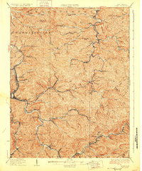
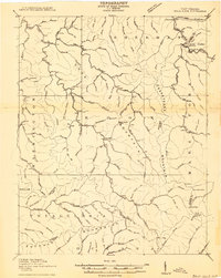 1910 Bald Knob1910 Print · USGSSouthern West Virginia in the early twentieth century was a landscape of remote mountain gaps and emerging rail corridors. Genealogists and historians can trace early settlements like Jarrolds Valley and Van, or locate historic crossing points like Walnut Gap and Indian Gap.2 unique versions available
 - 1912 Map of Bald Knob
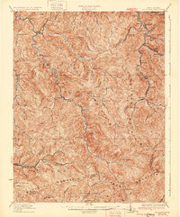
 1912 Bald Knob1912 Print · USGSBoone County and the surrounding coalfields are captured in the early twentieth century as rail lines began to penetrate the deep Appalachian hollows. Genealogists and historians can trace early settlements at Whitesville, Jarrolds Valley, and Gordon alongside the growing C. and O. R. R. line.3 unique versions available
 - 1913 Map of Logan
 1913 Logan1913 Print · USGSThe West Virginia coalfields are seen here during their early industrial expansion in the years before the Great War. Genealogists and researchers can trace family landmarks and rail-side settlements like Logan, Pecks Mill, and Ethel along the Guyandot River.3 unique versions available
 - 1926 Map of Logan, 1963 Print
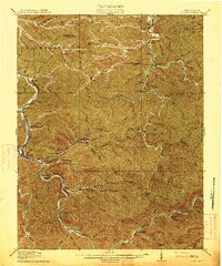
 1926 Logan1963 Print · USGSWest Virginia's southern coalfields are shown here in the mid-1920s, a period of intense industrial and rail development along the Guyandotte River. Researchers can trace the development of coal camps and local schools, from Pecks Mill and Clothier to the Crooked Creek School and Five Block Macneer PO.
 - 1928 Map of Logan
 1928 Logan1928 Print · USGSThe Guyandotte River valley and the southern coalfields are shown in detail during the late twenties. Genealogists can trace family homes near rural landmarks like Isom School, Pecks Mill, and the many station stops along the Chesapeake and Ohio railroad.3 unique versions available
 - 1928 Map of Bald Knob, 1956 Print
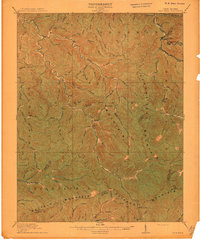
 1928 Bald Knob1956 Print · USGSBoone, Logan, and Raleigh counties are mapped here in the late twenties at the height of the coal-rail boom. You can trace early industrial rail lines like the Chesapeake and Ohio and locate vanished local landmarks like Bothwell Sch and Jackson (Bim PO).
 - 1931 Map of Bald Knob
 1931 Bald Knob1931 Print · USGSBoone and Logan counties are shown in the late twenties, an era when the coal and timber industries were driving the expansion of the Chesapeake and Ohio RR. Genealogists can trace family footprints at Bothwell Sch, Jackson (Blair PO), and Jerrolds Valley.2 unique versions available
 - 1955 Map of Bluefield
 1955 Bluefield1955 Print · USGSThe Central Appalachian borderlands come alive in the mid-fifties, showing the coal and rail networks connecting Bluefield to Beckley. Researchers can trace the industrial landscape of the New River Ordnance Plant and the terrain of Burkes Garden.
 - 1957 Map of Bluefield, 1967 Print
 1957 Bluefield1967 Print · USGSThe heart of Central Appalachia in the mid-fifties is defined by the winding rail lines and river valleys of the coalfields. Researchers can trace the industrial footprints of towns like Welch and Princeton or locate landmarks such as the Bluestone Reservoir and Claytor Lake.2 unique versions available
 - 1961 Map of Bluefield
 1961 Bluefield1961 Print · USGSThe coalfields and mountain ridges of southern West Virginia and southwest Virginia are captured in the early sixties. Genealogists can trace family ties through rail-linked towns like Princeton and Richlands or along the shores of Bluestone Reservoir.
 - 1963 Map of Amherstdale, 1964 Print
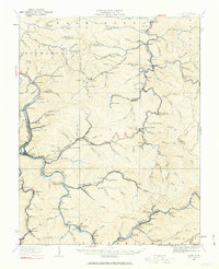
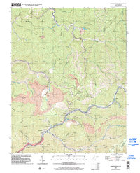
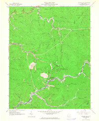 1963 Amherstdale1964 Print · USGSLogan County coal country is shown here in the early 1960s, documenting the dense network of mining towns along Buffalo Creek. Researchers can locate family sites and industrial history at Amherstdale, Accoville, and the Riley Cemetery near Becco.4 unique versions available
 - 1968 Map of Lorado, 1971 Print
 1968 Lorado1971 Print · USGSCoal towns and industrial rail lines dominate the West Virginia mountains in the late sixties. Genealogists and historians can trace families and operations in Lorado, Lundale, and Pardee along the winding Buffalo Creek.3 unique versions available
 - 1982 Map of Beckley, 1984 Print
 1982 Beckley1984 Print · USGSSouthern West Virginia coal country is captured here in the early eighties as industrial heritage met new wilderness protections. Genealogists and historians can trace the rail-linked communities of Beckley, Oak Hill, and the coal camps near Macdonald.
 - 1996 Map of Amherstdale, 2002 Print
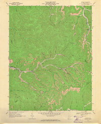
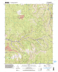
 1996 Amherstdale2002 Print · USGSThe West Virginia coalfields are captured here in the mid-nineties, showing the intensive industrial landscape of the Buffalo Creek valley. Trace the legacy of mining towns like Amherstdale and Accoville alongside deep Mine works and the CSX rail lines.
 - 1996 Map of Lorado, 2003 Print
 1996 Lorado2003 Print · USGSThe West Virginia coalfields are captured in detail during the late nineties, showing the industrial density of the Logan and Wyoming county borders. Genealogists and historians can trace the mining settlements of Lorado, Craneco, and Pardee along the banks of Buffalo Creek.
End of results
Showing maps 1-15 of 15
Top cities near Amherstdale-Robinette
- Mallory historical maps
- Logan historical maps
- Oceana historical maps
- Man historical maps
- Pineville historical maps
- Accoville historical maps
See more
Top neighborhoods of Amherstdale-Robinette
- Braeholm historical maps
- Fanco historical maps
- Latrobe historical maps
- Lundale historical maps
- Stowe historical maps
- Becco historical maps
See more
Frequently asked questions
- What are the different types of historical maps available for Amherstdale-Robinette?
- What is the oldest map of Amherstdale-Robinette?
- Where can I purchase historical maps of Amherstdale-Robinette for my home or office?
- Where can I download high-res historical maps of Amherstdale-Robinette?
- Are there historical topographic maps available for Amherstdale-Robinette?
- Is there historical aerial imagery available for Amherstdale-Robinette?
- Where are historical maps of Amherstdale-Robinette sourced from?