Old Maps of Monclo, West Virginia for Metal Detecting
Plan your next treasure hunt with 17 historic maps of Monclo. Find old homesites, ghost towns, trails, and gathering spots that may be lost to time — perfect for identifying promising metal detecting locations.
- Locate forgotten sites: Uncover places like long-lost settlements, abandoned rail lines, or gathering spots.
- Plan better hunts: Use map overlays combined with LiDAR or satellite views to narrow in on historically rich areas.
- Made for detectorists: Thousands of hobbyists use these maps to discover relics, coins, and hidden history.
Use these historic maps to boost your research and find new opportunities beneath the surface of Monclo.
Monclo, WV maps
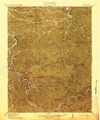
(17)- 1891 Map of Oceana
 1891 Oceana1891 Print · USGSSouthern West Virginia in the late nineteenth century was a world of deep valleys and isolated mountain settlements. Genealogists and historians can trace early family sites along the Guyandotte River near Oceana, Logan C.H., and Whites Mills.
 - 1893 Map of Oceana
 1893 Oceana1893 Print · USGSSouthern West Virginia’s rugged coal country is captured here in the late nineteenth century, showing a landscape of deep hollows and high ridges. Researchers can trace ancestral homes and early industry at Logan C.H., Whites Mills, and Jarrold's Valley.
 - 1898 Map of Oceana
 1898 Oceana1898 Print · USGSSouthern West Virginia in the late nineteenth century remains a landscape of isolated mountain settlements and complex river drainages. Genealogists can trace early homesteads and family-named landmarks near Oceana, Pineville, and Baileysville before the rise of the modern coal industry.4 unique versions available
 - 1913 Map of Logan
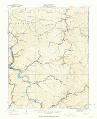
 1913 Logan1913 Print · USGSThe West Virginia coalfields are seen here during their early industrial expansion in the years before the Great War. Genealogists and researchers can trace family landmarks and rail-side settlements like Logan, Pecks Mill, and Ethel along the Guyandot River.3 unique versions available
 - 1926 Map of Logan, 1963 Print
 1926 Logan1963 Print · USGSWest Virginia's southern coalfields are shown here in the mid-1920s, a period of intense industrial and rail development along the Guyandotte River. Researchers can trace the development of coal camps and local schools, from Pecks Mill and Clothier to the Crooked Creek School and Five Block Macneer PO.
 - 1928 Map of Logan
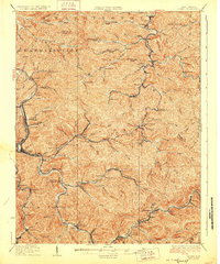 1928 Logan1928 Print · USGSThe Guyandotte River valley and the southern coalfields are shown in detail during the late twenties. Genealogists can trace family homes near rural landmarks like Isom School, Pecks Mill, and the many station stops along the Chesapeake and Ohio railroad.3 unique versions available
 - 1955 Map of Bluefield
 1955 Bluefield1955 Print · USGSThe Central Appalachian borderlands come alive in the mid-fifties, showing the coal and rail networks connecting Bluefield to Beckley. Researchers can trace the industrial landscape of the New River Ordnance Plant and the terrain of Burkes Garden.
 - 1957 Map of Bluefield, 1967 Print
 1957 Bluefield1967 Print · USGSThe heart of Central Appalachia in the mid-fifties is defined by the winding rail lines and river valleys of the coalfields. Researchers can trace the industrial footprints of towns like Welch and Princeton or locate landmarks such as the Bluestone Reservoir and Claytor Lake.2 unique versions available
 - 1961 Map of Bluefield
 1961 Bluefield1961 Print · USGSThe coalfields and mountain ridges of southern West Virginia and southwest Virginia are captured in the early sixties. Genealogists can trace family ties through rail-linked towns like Princeton and Richlands or along the shores of Bluestone Reservoir.
 - 1963 Map of Clothier, 1964 Print
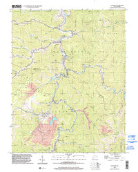
 1963 Clothier1964 Print · USGSThe coal-river valleys of Boone and Logan Counties are captured here during the peak of the mid-century mining era. Genealogists and historians can trace family plots like Browning Cem and Ferrell Cem alongside rail-side towns like Clothier and Sharples.3 unique versions available
 - 1982 Map of Beckley, 1984 Print
 1982 Beckley1984 Print · USGSSouthern West Virginia coal country is captured here in the early eighties as industrial heritage met new wilderness protections. Genealogists and historians can trace the rail-linked communities of Beckley, Oak Hill, and the coal camps near Macdonald.
 - 1996 Map of Clothier, 2002 Print
 1996 Clothier2002 Print · USGSBoone and Logan Counties reveal a landscape of coal production and mountain settlements in the mid-nineties. Genealogists and historians can trace community roots through numerous family landmarks like Adkins Cem and the Sharples High Sch.
 - 2011 Map of Clothier, 2011 Print
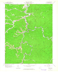
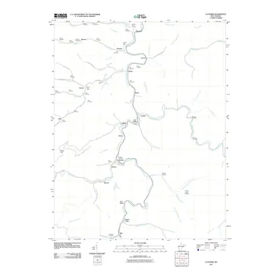 2011 Clothier2011 Print · USGSCovers Monclo, including Dobra, Sharples, and other nearby areas
 - 2014 Map of Clothier, 2014 Print
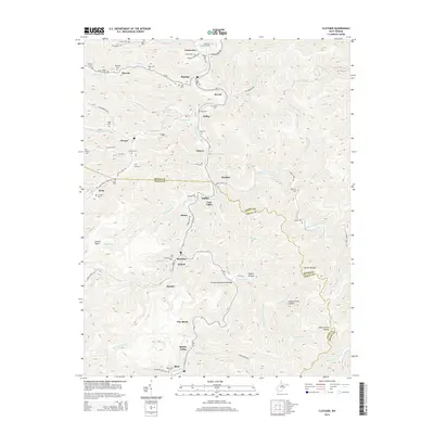 2014 Clothier2014 Print · USGSCovers Monclo, including Dobra, Sharples, and other nearby areas
 - 2016 Map of Clothier, 2016 Print
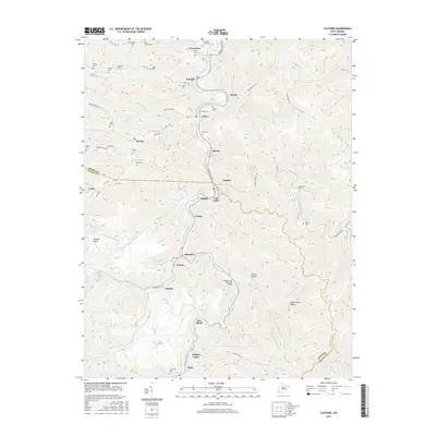 2016 Clothier2016 Print · USGSCovers Monclo, including Dobra, Sharples, and other nearby areas
 - 2019 Map of Clothier, 2019 Print
 2019 Clothier2019 Print · USGSCovers Monclo, including Dobra, Sharples, and other nearby areas
 - 2023 Map of Clothier, 2023 Print
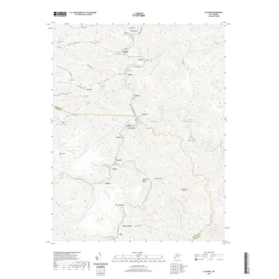
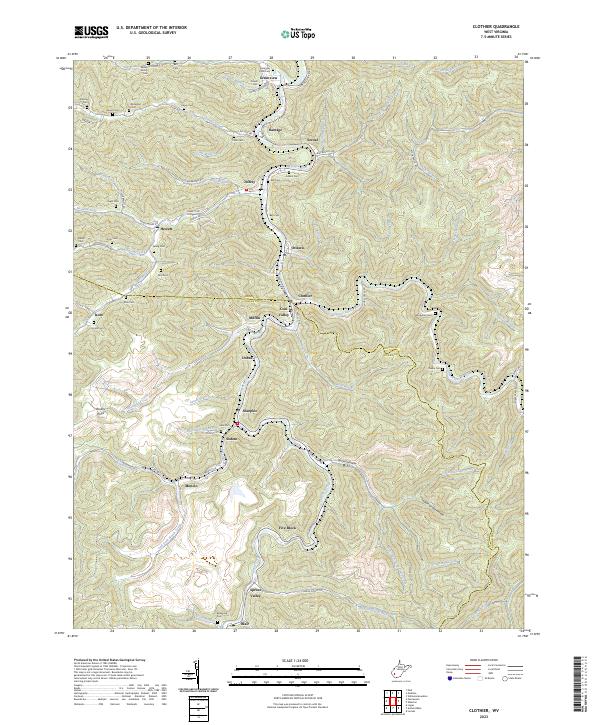 2023 Clothier2023 Print · USGSSpanning the Boone and Logan county line in the early twenty-first century, this area reveals a landscape defined by coal country hollows. Genealogists and historians can trace family burial sites like Hager Cem and Adkins Cem near settlements such as Sharples and Greenview.
End of results
Showing maps 1-17 of 17
Top cities near Monclo
- Madison historical maps
- Mallory historical maps
- Logan historical maps
- Oceana historical maps
- Chapmanville historical maps
- Holden historical maps
See more
Frequently asked questions
- What are the different types of historical maps available for Monclo?
- What is the oldest map of Monclo?
- Where can I purchase historical maps of Monclo for my home or office?
- Where can I download high-res historical maps of Monclo?
- Are there historical topographic maps available for Monclo?
- Is there historical aerial imagery available for Monclo?
- Where are historical maps of Monclo sourced from?