Old Maps of War, West Virginia
Explore 17 old maps of War, spanning from 1891 to today. These high-resolution historic maps reveal how streets, neighborhoods, landmarks, and natural features evolved over time — perfect for genealogy, metal detecting, research, and local history exploration.
What you can do with these maps:
- See how War changed over time: Compare historical maps to modern-day views to trace roads, homesites, rail lines & more.
- View detailed metadata: Each map includes creators, publishers, year, scale, and archive source.
- Overlay maps with satellite & LiDAR: Visualize the past alongside modern tools to explore terrain & human change.
- Trusted historical sources: Maps sourced from the USGS, Library of Congress, and other archives.
- Access maps your way: View online, download high-res files, or order prints for personal or research use.
Start exploring old maps of War to uncover forgotten places, hidden landmarks, and the deep history beneath your feet.
War, WV maps
(17)- 1891 Map of Tazewell
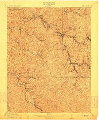
 1891 Tazewell1891 Print · USGSThe Clinch Valley highlands are shown here in the late nineteenth century, capturing the early settlement of the Virginia and West Virginia borderlands. Local historians can trace the foundations of Jeffersonville and rural outposts like Baptist Valley and Cedar Bluff.
 - 1895 Map of Tazewell
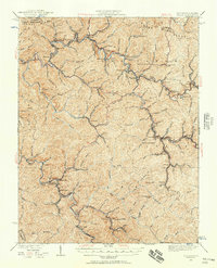
 1895 Tazewell1895 Print · USGSSouthwest Virginia and the West Virginia coalfields are captured in the 1890s as the rail network transformed these mountain valleys. Researchers can trace early settlements and stores along the Norfolk and Western RR, from Tazewell to the mines near Welch and Vivian.
 - 1897 Map of Tazewell
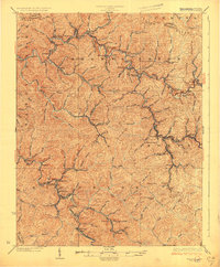
 1897 Tazewell1897 Print · USGSThe rugged coal and timber lands of the border country appear here in the 1890s as the rail network expands. Genealogists can trace family roots at Mc Neil Store, follow the early growth of Welch, and locate homesteads near Shack Mills.8 unique versions available
 - 1912 Map of Welch
 1912 Welch1912 Print · USGSMcDowell County's coal country comes alive in this pre-war survey, centered on the junction of the Norfolk and Western RR and the Tug Fork. Trace the early development of mining towns like Coalwood, Gary, and Kimball or locate vanished post offices such as Yukon PO.2 unique versions available
 - 1924 Map of Welch, 1957 Print
 1924 Welch1957 Print · USGSSouthern West Virginia’s coal country is captured here during the 1920s, showing the height of the rail-and-mine economy. Researchers can trace the legacy of company towns and family homesteads near Welch, Coalwood, and the Warrior Mine.2 unique versions available
 - 1926 Map of Welch
 1926 Welch1926 Print · USGSMcDowell County's coal country comes alive in the mid-1920s, showing the height of the region's rail-and-river industrial development. Genealogists can pinpoint vanished post offices like Pando Juverna PO and old rural campuses such as Mill Creek School and Shannon Branch School.3 unique versions available
 - 1955 Map of Bluefield
 1955 Bluefield1955 Print · USGSThe Central Appalachian borderlands come alive in the mid-fifties, showing the coal and rail networks connecting Bluefield to Beckley. Researchers can trace the industrial landscape of the New River Ordnance Plant and the terrain of Burkes Garden.
 - 1957 Map of Bluefield, 1967 Print
 1957 Bluefield1967 Print · USGSThe heart of Central Appalachia in the mid-fifties is defined by the winding rail lines and river valleys of the coalfields. Researchers can trace the industrial footprints of towns like Welch and Princeton or locate landmarks such as the Bluestone Reservoir and Claytor Lake.2 unique versions available
 - 1961 Map of Bluefield
 1961 Bluefield1961 Print · USGSThe coalfields and mountain ridges of southern West Virginia and southwest Virginia are captured in the early sixties. Genealogists can trace family ties through rail-linked towns like Princeton and Richlands or along the shores of Bluestone Reservoir.
 - 1967 Map of War, 1971 Print
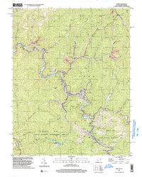
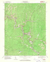 1967 War1971 Print · USGSThe McDowell County coalfields are captured here in the late sixties, showing the industrial density of the Dry Fork and War Creek valleys. Genealogists can trace family footprints in War, Berwind, and Caretta, or locate vanished Tipple and Strip Mine sites.2 unique versions available
 - 1981 Map of Bluefield
 1981 Bluefield1981 Print · USGSThe coalfields and mountain ridges of the Virginia-West Virginia border are captured here during the early eighties. Genealogists and historians can trace the rail lines of the Norfolk and Western RR connecting Coalwood, Welch, and the unique geological basin of Burkes Garden.2 unique versions available
 - 2001 Map of War, 2003 Print
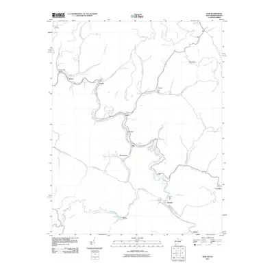
 2001 War2003 Print · USGSMcDowell County's mining and mountain communities are captured here just after the turn of the millennium. Trace the industrial and family history of War, Berwind, and Bartley while following old routes along the Dry Fork.
 - 2011 Map of War, 2011 Print
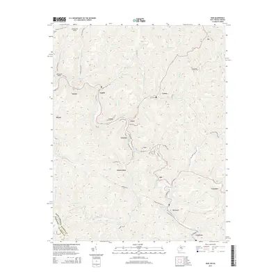
 2011 War2011 Print · USGSCovers War, including Berwind, Bartley, and other nearby areas
 - 2014 Map of War, 2014 Print
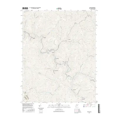
 2014 War2014 Print · USGSCovers War, including Berwind, Bartley, and other nearby areas
 - 2016 Map of War, 2016 Print
 2016 War2016 Print · USGSCovers War, including Berwind, Bartley, and other nearby areas
 - 2019 Map of War, 2019 Print
 2019 War2019 Print · USGSCovers War, including Berwind, Bartley, and other nearby areas
 - 2023 Map of War, 2023 Print
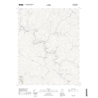
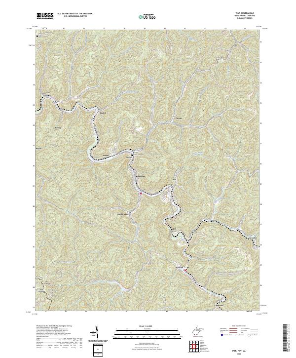 2023 War2023 Print · USGSSouthern West Virginia coal country is mapped in detail during the early 2020s, showing the tight-knit valley settlements along the Dry Fork. Researchers can trace the layout of Warriormine, Caretta, and Berwind or locate family sites like the Deskins Cem.
End of results
Showing maps 1-17 of 17
Top cities near War
- Richlands historical maps
- Tazewell historical maps
- Raven historical maps
- Welch historical maps
- Cedar Bluff historical maps
- Gary historical maps
See more
Top neighborhoods of War
Frequently asked questions
- What are the different types of historical maps available for War?
- What is the oldest map of War?
- Where can I purchase historical maps of War for my home or office?
- Where can I download high-res historical maps of War?
- Are there historical topographic maps available for War?
- Is there historical aerial imagery available for War?
- Where are historical maps of War sourced from?