Old Maps of Wheeling, West Virginia
Explore 14 old maps of Wheeling, spanning from 1902 to today. These high-resolution historic maps reveal how streets, neighborhoods, landmarks, and natural features evolved over time — perfect for genealogy, metal detecting, research, and local history exploration.
What you can do with these maps:
- See how Wheeling changed over time: Compare historical maps to modern-day views to trace roads, homesites, rail lines & more.
- View detailed metadata: Each map includes creators, publishers, year, scale, and archive source.
- Overlay maps with satellite & LiDAR: Visualize the past alongside modern tools to explore terrain & human change.
- Trusted historical sources: Maps sourced from the USGS, Library of Congress, and other archives.
- Access maps your way: View online, download high-res files, or order prints for personal or research use.
Start exploring old maps of Wheeling to uncover forgotten places, hidden landmarks, and the deep history beneath your feet.
Wheeling, WV maps
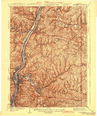
(14)- 1902 Map of Wheeling
 1902 Wheeling1902 Print · USGSCovers Wheeling, including Martins Ferry, Bellaire, and other nearby areas7 unique versions available
 - 1935 Map of Wheeling, 1957 Print
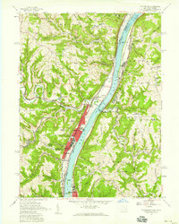
 1935 Wheeling1957 Print · USGSCovers Wheeling, including Martins Ferry, Bellaire, and other nearby areas
 - 1942 Map of Wheeling
 1942 Wheeling1942 Print · USGSCovers Wheeling, including Martins Ferry, Bellaire, and other nearby areas2 unique versions available
 - 1951 Map of Canton
 1951 Canton1951 Print · USGSCovers Wheeling, including Pittsburgh, Akron, and other nearby areas
 - 1953 Map of Canton
 1953 Canton1953 Print · USGSCovers Wheeling, including Pittsburgh, Akron, and other nearby areas
 - 1956 Map of Wheeling, 1958 Print
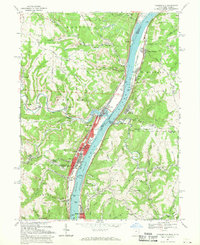
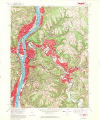
 1956 Wheeling1958 Print · USGSCovers Wheeling, including Martins Ferry, Bellaire, and other nearby areas2 unique versions available
 - 1957 Map of Tiltonsville, 1959 Print
 1957 Tiltonsville1959 Print · USGSCovers Wheeling, including Martins Ferry, Tiltonsville, and other nearby areas2 unique versions available
 - 1957 Map of Canton, 1971 Print
 1957 Canton1971 Print · USGSCovers Wheeling, including Pittsburgh, Akron, and other nearby areas3 unique versions available
 - 1962 Map of Canton
 1962 Canton1962 Print · USGSCovers Wheeling, including Pittsburgh, Akron, and other nearby areas2 unique versions available
 - 1968 Map of Tiltonsville, 1970 Print
 1968 Tiltonsville1970 Print · USGSCovers Wheeling, including Martins Ferry, Tiltonsville, and other nearby areas3 unique versions available
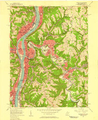
 - 1968 Map of Wheeling, 1971 Print
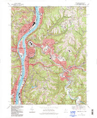
 1968 Wheeling1971 Print · USGSCovers Wheeling, including Martins Ferry, Bellaire, and other nearby areas4 unique versions available
 - 1986 Map of Pittsburgh West
 1986 Pittsburgh West1986 Print · USGSCovers Wheeling, including Pittsburgh, Bethel Park, and other nearby areas3 unique versions available
 - 1994 Map of Wheeling, 1998 Print
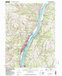
 1994 Wheeling1998 Print · USGSCovers Wheeling, including Martins Ferry, Bellaire, and other nearby areas
 - 1997 Map of Tiltonsville, 2000 Print
 1997 Tiltonsville2000 Print · USGSCovers Wheeling, including Martins Ferry, Tiltonsville, and other nearby areas2 unique versions available
End of results
Showing maps 1-14 of 14
Top cities near Wheeling
- Moundsville historical maps
- Martins Ferry historical maps
- Saint Clairsville historical maps
- St. Clairsville historical maps
- Colerain historical maps
- Bellaire historical maps
See more
Top neighborhoods of Wheeling
- Leewood Park historical maps
- Greggsville historical maps
- Pleasant Valley historical maps
- South Island historical maps
- Vineyard Hills historical maps
- Warwood Terrace historical maps
See more
Frequently asked questions
- What are the different types of historical maps available for Wheeling?
- What is the oldest map of Wheeling?
- Where can I purchase historical maps of Wheeling for my home or office?
- Where can I download high-res historical maps of Wheeling?
- Are there historical topographic maps available for Wheeling?
- Is there historical aerial imagery available for Wheeling?
- Where are historical maps of Wheeling sourced from?