1950s Maps of Elmwood Heights, West Virginia
Explore 2 historic maps of Elmwood Heights from the 1950s. These maps offer a rare glimpse into what life looked like during the 1950s — showing old roads, neighborhoods, homes, and landmarks that have changed or disappeared over time.
Whether you're researching your family's past, planning a metal detecting trip, or studying how Elmwood Heights's landscape evolved across the 1950s, these high-resolution maps are a powerful tool for exploring the history of this region.
- Focus on a specific era: All maps on this page are from the 1950s, giving you a focused view of this time period.
- See what’s changed: Compare century-old streets, trails, and buildings to today's modern landscape using overlays and satellite layers.
- Research with precision: Use these maps for genealogy, historical research, land use analysis, or educational projects.
- View, download, or print: Maps are fully viewable online in high resolution, and can be downloaded or printed for your own records.
Start exploring Elmwood Heights's history through authentic maps from the 1950s. This is your window into the past.
Elmwood Heights, WV maps
(2)- 1956 Map of Clarksburg, 1966 Print
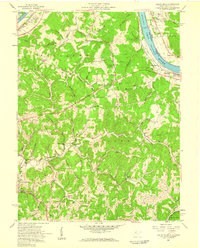
 1956 Clarksburg1966 Print · USGSThe Ohio River valley and the industrial heart of West Virginia are seen here in the mid-1950s as rail and river commerce thrived. Researchers can trace historic transport lines like the Baltimore and Ohio RR and locate ancestral homes in Clarksburg, Moundsville, or Parkersburg.2 unique versions available
 - 1957 Map of Valley Mills, 1959 Print
 1957 Valley Mills1959 Print · USGSWood County at the Ohio River's edge during the late fifties reveals a landscape of river locks and rising ridgelands. Genealogists and researchers can trace family landmarks like Henderson Cem, the Boreman Sch, and the riverside community of Waverly.5 unique versions available
End of results
Showing maps 1-2 of 2
Top cities near Elmwood Heights
- Parkersburg historical maps
- Marietta historical maps
- Vienna historical maps
- Belpre historical maps
- Waterford historical maps
- Blennerhassett historical maps
See more
Frequently asked questions
- What are the different types of historical maps available for Elmwood Heights?
- What is the oldest map of Elmwood Heights?
- Where can I purchase historical maps of Elmwood Heights for my home or office?
- Where can I download high-res historical maps of Elmwood Heights?
- Are there historical topographic maps available for Elmwood Heights?
- Is there historical aerial imagery available for Elmwood Heights?
- Where are historical maps of Elmwood Heights sourced from?