2020s Maps of Gingles, Wisconsin
Explore 3 historic maps of Gingles from the 2020s. These maps offer a rare glimpse into what life looked like during the 2020s — showing old roads, neighborhoods, homes, and landmarks that have changed or disappeared over time.
Whether you're researching your family's past, planning a metal detecting trip, or studying how Gingles's landscape evolved across the 2020s, these high-resolution maps are a powerful tool for exploring the history of this region.
- Focus on a specific era: All maps on this page are from the 2020s, giving you a focused view of this time period.
- See what’s changed: Compare century-old streets, trails, and buildings to today's modern landscape using overlays and satellite layers.
- Research with precision: Use these maps for genealogy, historical research, land use analysis, or educational projects.
- View, download, or print: Maps are fully viewable online in high resolution, and can be downloaded or printed for your own records.
Start exploring Gingles's history through authentic maps from the 2020s. This is your window into the past.
Gingles, WI maps
(3)- 2022 Map of Odanah, 2022 Print
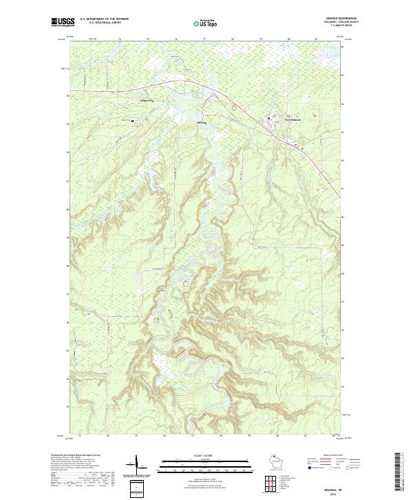 2022 Odanah2022 Print · USGSNorthern Wisconsin wetlands and river junctions define this area in the 2020s. Researchers can trace the communities of Odanah and Diaperville or find family history at the Odanah Cem near the Bad River.
 - 2022 Map of Ashland East, 2022 Print
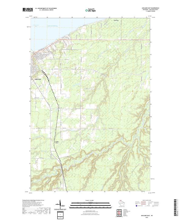 2022 Ashland East2022 Print · USGSThe Wisconsin shoreline of Lake Superior comes alive in this contemporary view of the port city and its surrounding marshlands. Genealogists and local historians can trace family properties and landmarks near the White River, Bayfront, and Chequamegon Bay.
 - 2022 Map of Ashland West, 2022 Print
 2022 Ashland West2022 Print · USGSCoastal Wisconsin at the edge of Lake Superior reveals a landscape of protected wetlands and civic hubs. Researchers can trace the layout of Ashland alongside the Whittlesey Creek National Wildlife Refuge and Mount Hope Cem.
End of results
Showing maps 1-3 of 3
Top cities near Gingles
- Ashland historical maps
- Washburn historical maps
- Sanborn historical maps
- White River historical maps
- Mellen historical maps
- New Odanah historical maps
See more
Top neighborhoods of Gingles
Frequently asked questions
- What are the different types of historical maps available for Gingles?
- What is the oldest map of Gingles?
- Where can I purchase historical maps of Gingles for my home or office?
- Where can I download high-res historical maps of Gingles?
- Are there historical topographic maps available for Gingles?
- Is there historical aerial imagery available for Gingles?
- Where are historical maps of Gingles sourced from?