2020s Maps of Hoard, Wisconsin
Explore 4 historic maps of Hoard from the 2020s. These maps offer a rare glimpse into what life looked like during the 2020s — showing old roads, neighborhoods, homes, and landmarks that have changed or disappeared over time.
Whether you're researching your family's past, planning a metal detecting trip, or studying how Hoard's landscape evolved across the 2020s, these high-resolution maps are a powerful tool for exploring the history of this region.
- Focus on a specific era: All maps on this page are from the 2020s, giving you a focused view of this time period.
- See what’s changed: Compare century-old streets, trails, and buildings to today's modern landscape using overlays and satellite layers.
- Research with precision: Use these maps for genealogy, historical research, land use analysis, or educational projects.
- View, download, or print: Maps are fully viewable online in high resolution, and can be downloaded or printed for your own records.
Start exploring Hoard's history through authentic maps from the 2020s. This is your window into the past.
Hoard, WI maps
(4)- 2022 Map of Owen, 2022 Print
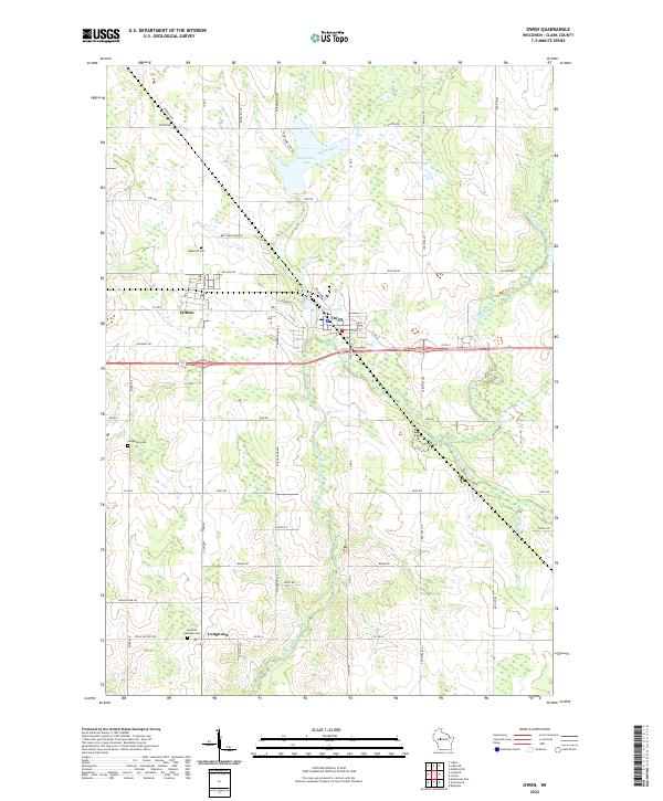 2022 Owen2022 Print · USGSWisconsin's Clark County landscape is captured here in the early twenty-first century as the communities of Owen and Withee continue their long history. Researchers can trace rural family routes and find local burial sites at Nazareth Cem or Longwood Cem.
 - 2022 Map of Curtiss, 2022 Print
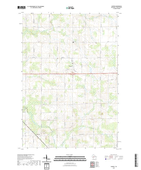 2022 Curtiss2022 Print · USGSThis rural Clark County landscape is centered on the village of Curtiss and the nearby crossroads of Atwood during the early 2020s. Genealogists and local historians can locate early burial grounds at Pine Hill Cem or trace the several branches of the South Fork Popple River.
 - 2022 Map of Medford SW, 2022 Print
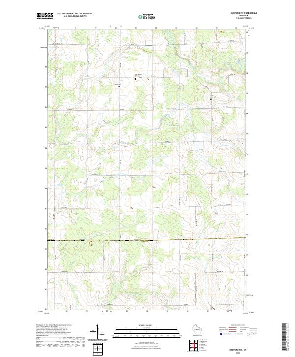 2022 Medford SW2022 Print · USGSWisconsin's rural borderlands between Taylor and Clark counties appear here in the early twenty-first century, showing a landscape of family farms and quiet country roads. Genealogists can locate family-named landmarks and local burial sites like Amish Cem, Little Black Cem, and the Our Saviours Lutheran Church Cem.
 - 2022 Map of Lublin SE, 2022 Print
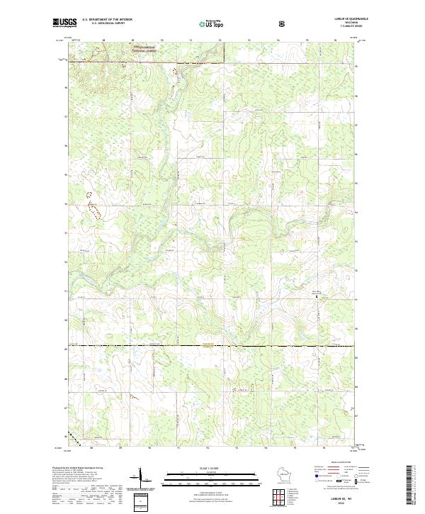 2022 Lublin SE2022 Print · USGSThe Taylor and Clark county line runs through this rural landscape in the 2020s, dominated by the timberlands of the Chequamegon National Forest. Researchers can locate family landmarks like Saint Marys Catholic Cem or trace the drainage of Trappers Cr and the Black River.
End of results
Showing maps 1-4 of 4
Top cities near Hoard
- Medford historical maps
- Spencer historical maps
- Abbotsford historical maps
- Colby historical maps
- Little Black historical maps
- Greenwood historical maps
See more
Frequently asked questions
- What are the different types of historical maps available for Hoard?
- What is the oldest map of Hoard?
- Where can I purchase historical maps of Hoard for my home or office?
- Where can I download high-res historical maps of Hoard?
- Are there historical topographic maps available for Hoard?
- Is there historical aerial imagery available for Hoard?
- Where are historical maps of Hoard sourced from?