Old Maps of Dodge County, Wisconsin
Explore 219 old maps of Dodge County, spanning from 1890 to today. These high-resolution historic maps reveal how streets, neighborhoods, landmarks, and natural features evolved over time — perfect for genealogy, metal detecting, research, and local history exploration.
What you can do with these maps:
- See how Dodge County changed over time: Compare historical maps to modern-day views to trace roads, homesites, rail lines & more.
- View detailed metadata: Each map includes creators, publishers, year, scale, and archive source.
- Overlay maps with satellite & LiDAR: Visualize the past alongside modern tools to explore terrain & human change.
- Trusted historical sources: Maps sourced from the USGS, Library of Congress, and other archives.
- Access maps your way: View online, download high-res files, or order prints for personal or research use.
Start exploring old maps of Dodge County to uncover forgotten places, hidden landmarks, and the deep history beneath your feet.
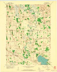
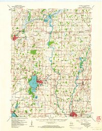
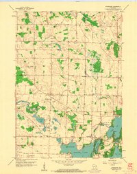
Dodge County, WI maps
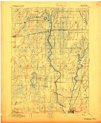
(219)- 1890 Map of Sun Prairie
 1890 Sun Prairie1890 Print · USGSEastern Dane County was a landscape of budding rail towns and glacial ridges in the late nineteenth century. Genealogists and local historians can trace the early footprints of Sun Prairie, Deerfield, and Marshall along the active corridors of the Chicago and Northwestern Railroad.2 unique versions available
 - 1891 Map of Waterloo
 1891 Waterloo1891 Print · USGSJefferson County was an agricultural and rail landscape during the 1890s, defined by its winding river systems and glacial lakes. Genealogists can trace property locations near Lake Mills, Aztalan, and the Crawfish River during this period of early growth.
 - 1892 Map of Watertown
 1892 Watertown1892 Print · USGSJefferson and Dodge counties at the close of the nineteenth century are defined by their winding river valleys and newly established rail corridors. Genealogists can trace family roots in early settlements like Watertown, Ixonia, and Sullivan, or follow the Rock River to its junction with the Oconomowoc River.
 - 1892 Map of Oconomowoc
 1892 Oconomowoc1892 Print · USGSWaukesha County's lake country is captured in the early 1890s, revealing a landscape defined by glacial waters and nascent rail lines. Researchers can trace the early development of Delafield and Hartland or locate old stops like Lakeside Station and Giffords.4 unique versions available
 - 1894 Map of Waterloo
 1894 Waterloo1894 Print · USGSJefferson County was an expanding hub of rail and river commerce in the 1890s as several major lines connected new settlements. You can trace early township boundaries and find the footprints of Lake Mills and Waterloo alongside the Rock River.2 unique versions available
 - 1894 Map of Watertown
 1894 Watertown1894 Print · USGSSouthern Wisconsin at the close of the nineteenth century reveals a landscape shaped by glacial ridges and the iron horse. Genealogists can trace family footprints in settlements like Watertown, Ixonia, and Sullivan, or follow the rail lines that connected Lac La Belle to the wider region.5 unique versions available
 - 1896 Map of Sun Prairie
 1896 Sun Prairie1896 Print · USGSEastern Dane County in the 1880s is captured here as a landscape of glacial ridges and emerging rail towns. Genealogists and local historians can trace early homesteads and rail stops like Deansville, Cottage Grove, and London.2 unique versions available
 - 1904 Map of Hartford
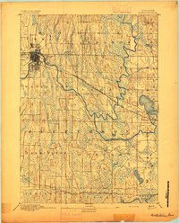
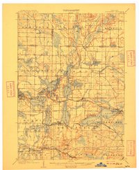
 1904 Hartford1904 Print · USGSThe Kettle Moraine region of Washington and Dodge counties comes into focus in this early century survey of Wisconsin’s glacial landscape. Genealogists can trace family roots through small settlements like Schleisingerville, Hochheim, and St. Lawrence, or locate landmarks like Holy Hill and Pike Lake.3 unique versions available
 - 1905 Map of Sun Prairie, 1959 Print
 1905 Sun Prairie1959 Print · USGSIn the early twentieth century, this part of Dane County was a thriving network of rail-stop towns and dairy farms. Genealogists and historians can trace the original rail paths of the Milwaukee Road through settlements like Sun Prairie, Deerfield, and Marshall.
 - 1907 Map of Sun Prairie
 1907 Sun Prairie1907 Print · USGSEastern Dane County at the turn of the century shows a landscape of rail-connected dairy towns and glacial wetlands. Genealogists and historians can trace family locations near York Center, Liberty Mound, and the old rail junction at London.8 unique versions available
 - 1909 Map of Oconomowoc
 1909 Oconomowoc1909 Print · USGSThe Lake Country of Waukesha County is captured here at the height of its early resort era. You can trace family roots in Oconomowoc, locate the historic Nashotah Mission, and find long-lost stops like Waukesha Beach and Lakeside Sta.6 unique versions available
 - 1910 Map of Waterloo
 1910 Waterloo1910 Print · USGSJefferson County’s river valleys and rail hubs are preserved here during the Edwardian era. Genealogists and historians can trace the rail-and-river economy through landmarks like Jefferson Junction, Hoopers Mill, and the early shoreline of Rock Lake.2 unique versions available
 - 1955 Map of Randolph, 1956 Print
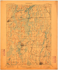
 1955 Randolph1956 Print · USGSDodge and Columbia counties are seen here in the mid-fifties, dominated by prairie farming and the rail lines connecting towns like Friesland and Cambria. Researchers can trace the heritage of rural education and faith through sites like Penrhos Sch and Rosedale Ch.2 unique versions available
 - 1955 Map of Columbus, 1956 Print
 1955 Columbus1956 Print · USGSColumbia County’s dairy and rail corridor is captured here in the mid-fifties, centered on the growing community of Columbus. Genealogists can trace family names at St Joseph Cem or locate the many country schools like McKinley Sch and Hampden Sch.2 unique versions available
 - 1955 Map of Beaver Dam, 1957 Print
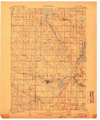
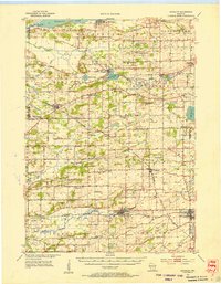
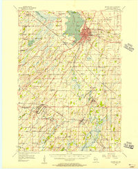 1955 Beaver Dam1957 Print · USGSDodge County's rich agricultural and rail landscape is captured here in the mid-1950s. Genealogists can trace family roots through dozens of rural landmarks, from St Columbkille Cem to local schoolhouses like English Prairie Sch and Jackson Sch.2 unique versions available
 - 1955 Map of Waupun, 1957 Print
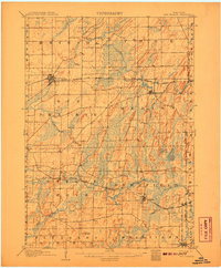
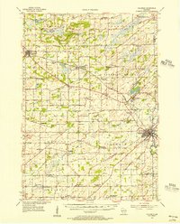
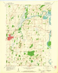
 1955 Waupun1957 Print · USGSIn the mid-1950s, the Dodge and Fond du Lac county border was defined by the massive wetland expanse of the Horicon Marsh. Genealogists and local historians can trace rural school locations like Cattaraugus Sch and the institutional grounds of the State Prison in Waupun.2 unique versions available
 - 1955 Map of Campbellsport, 1957 Print
 1955 Campbellsport1957 Print · USGSThe Fond du Lac countryside in the mid-fifties shows a landscape of limestone quarries and rail-fed village centers. Genealogists can locate family landmarks like Silver Leaf Sch, Marblehead Quarries, and the Empire Cem.2 unique versions available
 - 1955 Map of Fox Lake, 1957 Print
 1955 Fox Lake1957 Print · USGSIn the mid-1950s, the Dodge and Green Lake County borderlands were defined by a high density of one-room schoolhouses and rail-dependent towns. Trace family roots at Tichora Cem or follow the old Milwaukee Road tracks through Markesan and Fox Lake Junction.
 - 1955 Map of Horicon, 1971 Print
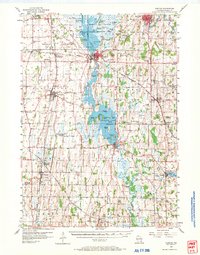 1955 Horicon1971 Print · USGSDodge County's river-and-rail landscape is captured here in the mid-fifties, centered on the wetlands of the Horicon Marsh. Genealogists and local historians can trace rural roots through numerous country schools and cemeteries, from Minnesota Junction to the Holy Assumption Cem and Woodland Road Sch.
 - 1957 Map of Madison, 1967 Print
 1957 Madison1967 Print · USGSSouth-central Wisconsin in the mid-fifties reveals a landscape of industrial hubs and glacial lakes linked by a dense rail and highway network. Genealogists and historians can trace the development of lakeside communities and find notable sites like Badger Ordnance Works and the Horicon National Wildlife Refuge.3 unique versions available
 - 1959 Map of Richwood, 1960 Print
 1959 Richwood1960 Print · USGSDodge and Jefferson Counties come alive in the late fifties, showcasing a rural landscape defined by river confluences and the railroad. Researchers can locate many local landmarks, including Mamre Ch Cem, St Marks Sch, and the rail siding at Richwood.2 unique versions available
 - 1959 Map of Waterloo, 1960 Print
 1959 Waterloo1960 Print · USGSWaterloo and its river-carved surroundings are captured here in the late fifties, showing a landscape shaped by glacial deposits and rail travel. Researchers can trace rural lineages through local landmarks like St Wenceslaus Ch, Oak Hill Cem, and the small river community of Hubbleton.3 unique versions available
 - 1959 Map of Ixonia, 1961 Print
 1959 Ixonia1961 Print · USGSIxonia and the surrounding dairy country are captured in the late fifties as the local economy balanced rail transport with emerging mid-century developments. Genealogists can trace family roots through sites like New Ashippun, the Monastery on Lac La Belle, and several rural schoolhouses.2 unique versions available
 - 1959 Map of Waterloo, 1961 Print
 1959 Waterloo1961 Print · USGSJefferson County in the late fifties remains a landscape defined by its river bends and the crossing of major rail lines. Genealogists can locate family landmarks like Moravian Cem and Hoopers Mill, or trace the many rural school districts from Badger Sch to Hilltop Sch.
 - 1959 Map of Stonebank, 1961 Print
 1959 Stonebank1961 Print · USGSWaukesha County's lake country is captured here during a transition from quiet rural townships to popular lakeside retreats in the late fifties. Genealogists and historians can trace community roots through numerous country schools and cemeteries, including Mapleton Sch, Mt Hope Cem, and St Paul Ch.4 unique versions available
Showing maps 1-25 of 219
Top cities of Dodge County
- Beaver Dam historical maps
- Mayville historical maps
- Horicon historical maps
- Juneau historical maps
- Lomira historical maps
- Lebanon historical maps
See more
Frequently asked questions
- What are the different types of historical maps available for Dodge County?
- What is the oldest map of Dodge County?
- Where can I purchase historical maps of Dodge County for my home or office?
- Where can I download high-res historical maps of Dodge County?
- Are there historical topographic maps available for Dodge County?
- Is there historical aerial imagery available for Dodge County?
- Where are historical maps of Dodge County sourced from?