Old Maps of Solon Springs, Wisconsin
Explore 12 old maps of Solon Springs, spanning from 1945 to today. These high-resolution historic maps reveal how streets, neighborhoods, landmarks, and natural features evolved over time — perfect for genealogy, metal detecting, research, and local history exploration.
What you can do with these maps:
- See how Solon Springs changed over time: Compare historical maps to modern-day views to trace roads, homesites, rail lines & more.
- View detailed metadata: Each map includes creators, publishers, year, scale, and archive source.
- Overlay maps with satellite & LiDAR: Visualize the past alongside modern tools to explore terrain & human change.
- Trusted historical sources: Maps sourced from the USGS, Library of Congress, and other archives.
- Access maps your way: View online, download high-res files, or order prints for personal or research use.
Start exploring old maps of Solon Springs to uncover forgotten places, hidden landmarks, and the deep history beneath your feet.
Solon Springs, WI maps
(12)- 1945 Map of Solon Springs, 1957 Print
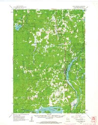
 1945 Solon Springs1957 Print · USGSWisconsin's headwaters region comes to life in the 1940s, showing the early infrastructure and wilderness of Douglas County. Researchers can trace the Old Portage Tr, locate the Sieur du Lhut Monument, and find vanished schoolhouses like Ibsen Sch.
 - 1949 Map of Solon Springs
 1949 Solon Springs1949 Print · USGSNorthwestern Wisconsin at the end of the 1940s reveals a landscape of timber, rail, and water centered on the St. Croix headwaters. Genealogists and historians can locate rural landmarks like New Hawthorne Cem, Roosevelt Sch, and the Sieur du Lhut Monument near the rail lines at Sauntry.
 - 1953 Map of Ashland, 1964 Print
 1953 Ashland1964 Print · USGSNorthern Wisconsin's lakefront and timberlands are seen here in the mid-1950s, showing the intersection of industrial rail lines and vast wilderness. Genealogists and historians can trace the Soo Line through rail towns like Mellen or locate family roots in the Apostle Islands and Bad River Indian Reservation.3 unique versions available
 - 1958 Map of Ashland
 1958 Ashland1958 Print · USGSCoastal Wisconsin and the Michigan borderlands meet here in the late fifties, dominated by the timbered expanses and iron-rich ranges. Genealogists can trace family footprints in settlements like Odanah and Montreal, or locate landmarks such as the Coast Guard Station and Agricultural Experiment Station.
 - 1961 Map of Solon Springs, 1963 Print
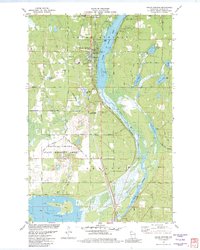
 1961 Solon Springs1963 Print · USGSNorthern Wisconsin lake country is captured in the early sixties, centered on the community of Solon Springs and the headwaters of the St. Croix. Genealogists can locate Evergreen Cem and Bennett Cem while tracing the Chicago and North Western rail line.2 unique versions available
 - 1980 Map of Solon Springs
 1980 Solon Springs1980 Print · USGSNorthern Wisconsin in the early eighties was a landscape of dense timber and sprawling glacial waters. Trace the legacy of the Chicago and North Western rail line through Solon Springs, Hayward, and Minong at this pivotal moment.
 - 1982 Map of Solon Springs
 1982 Solon Springs1982 Print · USGSThe Douglas County lakeshore comes to life in the early eighties as Solon Springs thrives along the Upper St Croix Lake. Genealogists and locals can trace family-named routes like Bakken Road and Phelps Road or locate the historic Evergreen Cem.
 - 2010 Map of Solon Springs, 2010 Print
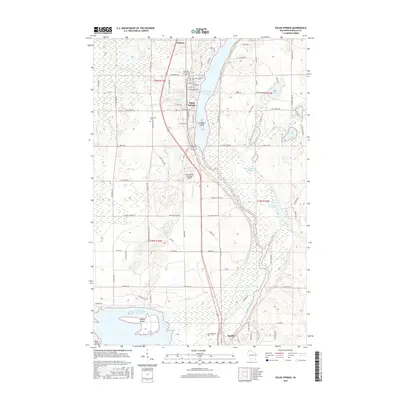
 2010 Solon Springs2010 Print · USGSCovers Solon Springs, including Gordon, Sauntry, and other nearby areas
 - 2013 Map of Solon Springs, 2013 Print
 2013 Solon Springs2013 Print · USGSCovers Solon Springs, including Gordon, Sauntry, and other nearby areas
 - 2015 Map of Solon Springs, 2015 Print
 2015 Solon Springs2015 Print · USGSCovers Solon Springs, including Gordon, Sauntry, and other nearby areas
 - 2018 Map of Solon Springs, 2018 Print
 2018 Solon Springs2018 Print · USGSCovers Solon Springs, including Gordon, Sauntry, and other nearby areas
 - 2022 Map of Solon Springs, 2022 Print
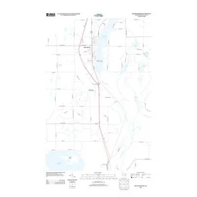
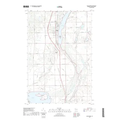
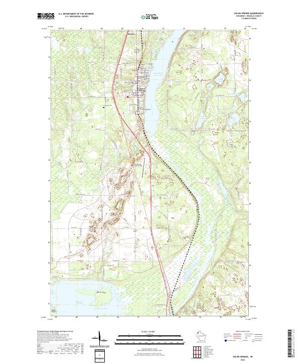 2022 Solon Springs2022 Print · USGSSolon Springs and the Upper Saint Croix headwaters are documented here in the early twenty-first century as a hub of northern Wisconsin recreation and transit. Researchers can trace family sites near Evergreen Cem, explore the Wild Rivers State Trail, and locate landmarks like Crownhart Island.
End of results
Showing maps 1-12 of 12
Top cities near Solon Springs
- Hawthorne historical maps
- Lake Nebagamon historical maps
- Gordon historical maps
- Wascott historical maps
- Maple historical maps
- Brule historical maps
See more
Frequently asked questions
- What are the different types of historical maps available for Solon Springs?
- What is the oldest map of Solon Springs?
- Where can I purchase historical maps of Solon Springs for my home or office?
- Where can I download high-res historical maps of Solon Springs?
- Are there historical topographic maps available for Solon Springs?
- Is there historical aerial imagery available for Solon Springs?
- Where are historical maps of Solon Springs sourced from?