1960s Maps of Harrison, Wisconsin
Explore 5 historic maps of Harrison from the 1960s. These maps offer a rare glimpse into what life looked like during the 1960s — showing old roads, neighborhoods, homes, and landmarks that have changed or disappeared over time.
Whether you're researching your family's past, planning a metal detecting trip, or studying how Harrison's landscape evolved across the 1960s, these high-resolution maps are a powerful tool for exploring the history of this region.
- Focus on a specific era: All maps on this page are from the 1960s, giving you a focused view of this time period.
- See what’s changed: Compare century-old streets, trails, and buildings to today's modern landscape using overlays and satellite layers.
- Research with precision: Use these maps for genealogy, historical research, land use analysis, or educational projects.
- View, download, or print: Maps are fully viewable online in high resolution, and can be downloaded or printed for your own records.
Start exploring Harrison's history through authentic maps from the 1960s. This is your window into the past.
Harrison, WI maps
(5)- 1961 Map of Dubuque
 1961 Dubuque1961 Print · USGSThe Tri-State region's river-and-rail landscape is captured here during the early sixties, showing the convergence of Iowa, Illinois, and Wisconsin. Trace mid-century rail lines like the Chicago Great Western Ry and explore sites like the Savanna Ordnance Depot and Backbone State Park.
 - 1961 Map of Dickeyville, 1962 Print
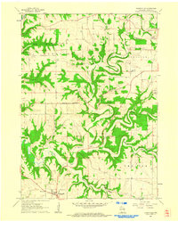 1961 Dickeyville1962 Print · USGSGrant County's rolling farmland and deep river valleys are captured here in the early sixties. Researchers can trace rural life through landmarks like the Little Grant Mine, family-named cemeteries such as Kaump Cem, and local schoolhouses like Maple Glen Sch.3 unique versions available
 - 1962 Map of Dubuque
 1962 Dubuque1962 Print · USGSThe Tri-State region's river-and-rail economy is captured here in the early sixties, centered on the Mississippi River bluffs. Genealogists and historians can locate Numerous lead and zinc mines, the New Melleray Abbey Monastery, and rural hubs like Saint Olaf.2 unique versions available
 - 1962 Map of Lancaster, 1964 Print
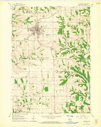 1962 Lancaster1964 Print · USGSGrant County is captured in the early sixties as a thriving agricultural and rail hub centered on the city of Lancaster. Genealogists and historians can trace numerous rural landmarks, from the Chicago and North Western line to old schoolhouses like Cement Sch and Fairview Sch.
 - 1962 Map of Ellenboro, 1964 Print
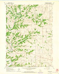 1962 Ellenboro1964 Print · USGSGrant County's rural landscape is captured here in the early sixties, showing the intricate network of ridge-top farms and valley settlements. Genealogists can trace family footprints across several burial sites and rural institutions, including Whig Cem, Union Sch, and the riverside community of Ellenboro.2 unique versions available
End of results
Showing maps 1-5 of 5
Top cities near Harrison
- Dubuque historical maps
- Platteville historical maps
- Asbury historical maps
- Lancaster historical maps
- Jamestown historical maps
- East Dubuque historical maps
See more
Top neighborhoods of Harrison
Frequently asked questions
- What are the different types of historical maps available for Harrison?
- What is the oldest map of Harrison?
- Where can I purchase historical maps of Harrison for my home or office?
- Where can I download high-res historical maps of Harrison?
- Are there historical topographic maps available for Harrison?
- Is there historical aerial imagery available for Harrison?
- Where are historical maps of Harrison sourced from?