2020s Maps of Mineral Point, Wisconsin
Explore 5 historic maps of Mineral Point from the 2020s. These maps offer a rare glimpse into what life looked like during the 2020s — showing old roads, neighborhoods, homes, and landmarks that have changed or disappeared over time.
Whether you're researching your family's past, planning a metal detecting trip, or studying how Mineral Point's landscape evolved across the 2020s, these high-resolution maps are a powerful tool for exploring the history of this region.
- Focus on a specific era: All maps on this page are from the 2020s, giving you a focused view of this time period.
- See what’s changed: Compare century-old streets, trails, and buildings to today's modern landscape using overlays and satellite layers.
- Research with precision: Use these maps for genealogy, historical research, land use analysis, or educational projects.
- View, download, or print: Maps are fully viewable online in high resolution, and can be downloaded or printed for your own records.
Start exploring Mineral Point's history through authentic maps from the 2020s. This is your window into the past.
Mineral Point, WI maps
(5)- 2022 Map of Jonesdale, 2022 Print
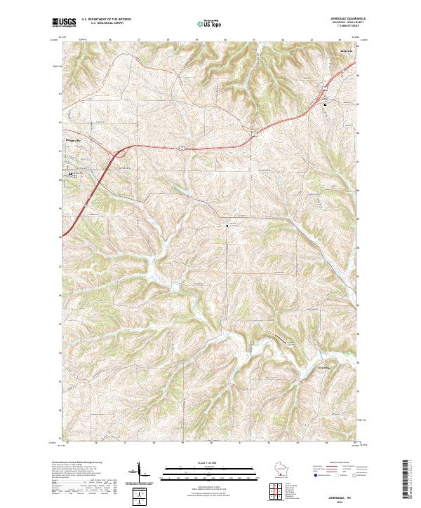 2022 Jonesdale2022 Print · USGSThe rolling hills of Iowa County are documented here in the early 2020s, showcasing the rural transition between Dodgeville and Ridgeway. Researchers can trace old family lands near Garrison Grove Cem, the path of the Military Ridge State Trl, and the small community of Jonesdale.
 - 2022 Map of Dodgeville, 2022 Print
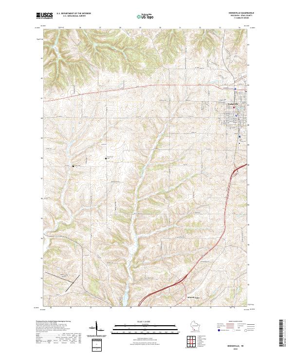 2022 Dodgeville2022 Print · USGSThe Iowa County seat and its rural surroundings are captured in this recent survey. Researchers can trace local heritage through the Iowa County Courthouse, Laxey Cem, and the path of the Military Ridge State Trl.
 - 2022 Map of Mifflin, 2022 Print
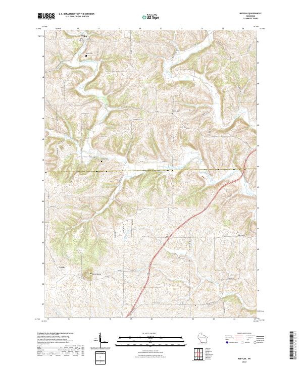 2022 Mifflin2022 Print · USGSWisconsin's driftless borderlands appear here in the early twenty-first century, spanning the rolling hills of the Iowa and Lafayette county line. Researchers can trace local genealogy and land use through sites like Salome Welsh Baptist Cem, the village of Mifflin, and the prominent Belmont Mound.
 - 2022 Map of Waldwick, 2022 Print
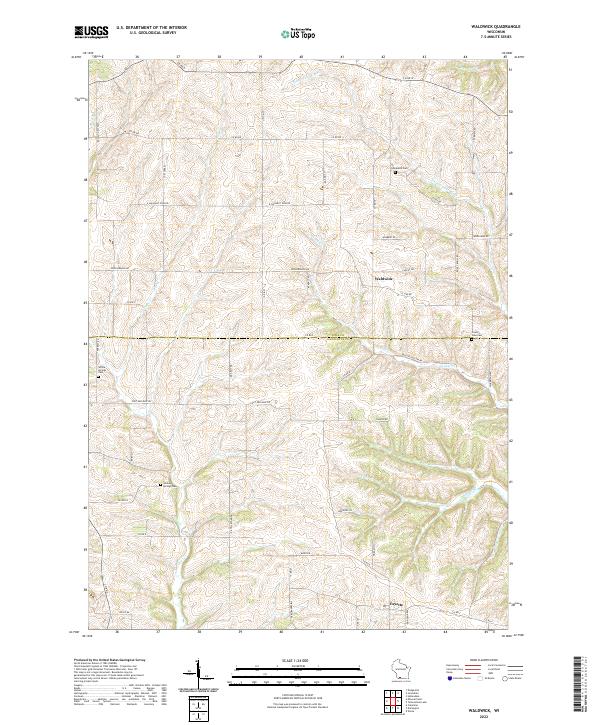 2022 Waldwick2022 Print · USGSWaldwick and Fayette appear in the twenty-first century as small rural crossroads within the complex creek systems of Iowa and Lafayette counties. Family researchers can locate Graceland Cem and Willow Springs Cem along winding roads like Fort Defiance Rd.
 - 2022 Map of Mineral Point, 2022 Print
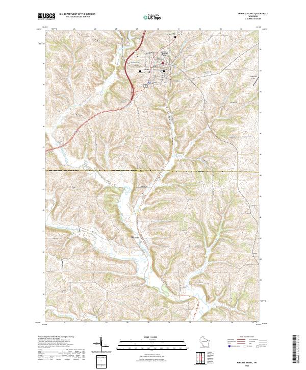 2022 Mineral Point2022 Print · USGSIn the modern era, Iowa and Lafayette counties retain the distinct settlement patterns of their mining and agricultural past. Genealogists can locate family landmarks like Old Mineral Point Cem or trace the Pecatonica River south to Slateford.
End of results
Showing maps 1-5 of 5
Top cities near Mineral Point
- Dodgeville historical maps
- Mineral Point historical maps
- Darlington historical maps
- Belmont historical maps
- Wiota historical maps
- Highland historical maps
See more
Frequently asked questions
- What are the different types of historical maps available for Mineral Point?
- What is the oldest map of Mineral Point?
- Where can I purchase historical maps of Mineral Point for my home or office?
- Where can I download high-res historical maps of Mineral Point?
- Are there historical topographic maps available for Mineral Point?
- Is there historical aerial imagery available for Mineral Point?
- Where are historical maps of Mineral Point sourced from?