2020s Maps of Ixonia, Wisconsin
Explore 4 historic maps of Ixonia from the 2020s. These maps offer a rare glimpse into what life looked like during the 2020s — showing old roads, neighborhoods, homes, and landmarks that have changed or disappeared over time.
Whether you're researching your family's past, planning a metal detecting trip, or studying how Ixonia's landscape evolved across the 2020s, these high-resolution maps are a powerful tool for exploring the history of this region.
- Focus on a specific era: All maps on this page are from the 2020s, giving you a focused view of this time period.
- See what’s changed: Compare century-old streets, trails, and buildings to today's modern landscape using overlays and satellite layers.
- Research with precision: Use these maps for genealogy, historical research, land use analysis, or educational projects.
- View, download, or print: Maps are fully viewable online in high resolution, and can be downloaded or printed for your own records.
Start exploring Ixonia's history through authentic maps from the 2020s. This is your window into the past.
Ixonia, WI maps
(4)- 2022 Map of Oconomowoc West, 2022 Print
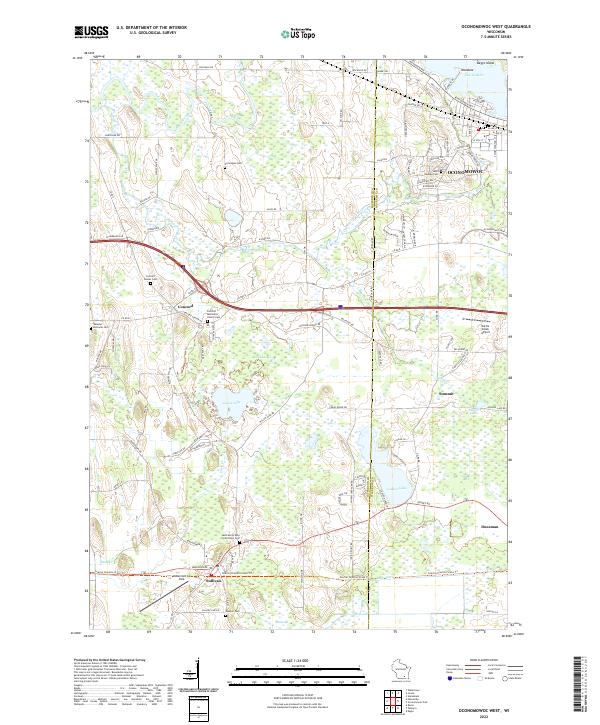 2022 Oconomowoc West2022 Print · USGSJefferson and Waukesha counties appear here in the early 2020s, showing a landscape defined by glacial lakes and river systems. Genealogists can trace several local burial sites, including Saint Jerome Cem and the Webster - Holcomb Cem.
 - 2022 Map of Helenville, 2022 Print
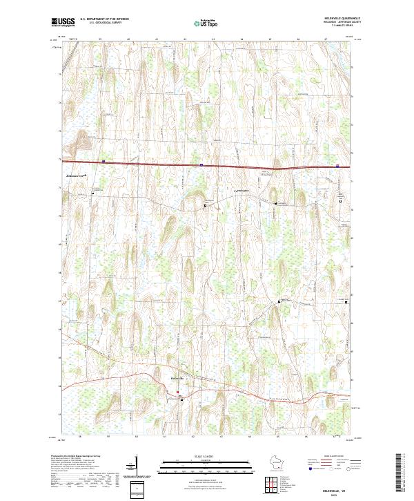 2022 Helenville2022 Print · USGSJefferson County in the early 2020s shows a landscape of persistent agricultural roots and quiet rural hamlets. Family historians can trace ancestral sites at Farmington Cem, Saint Stephens Cem, and along the Glacial Drumlin State Trail.
 - 2022 Map of Watertown, 2022 Print
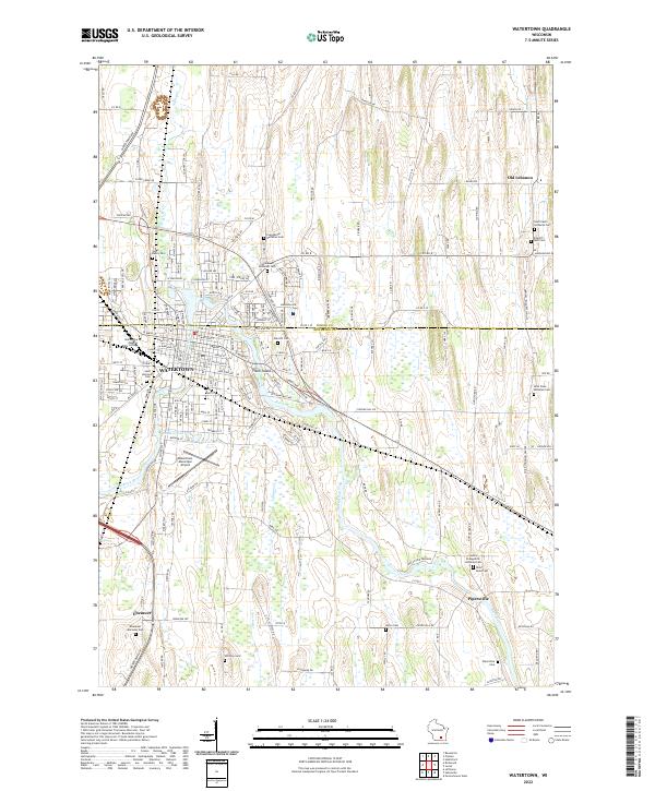 2022 Watertown2022 Print · USGSWatertown and the Rock River valley are shown in contemporary detail just as they appeared in the early 2020s. Researchers can locate family sites at Saint Paul's Lutheran Cem or trace the rural character of Ebenezer and Old Lebanon.
 - 2022 Map of Ixonia, 2022 Print
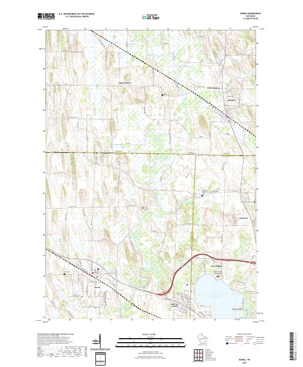 2022 Ixonia2022 Print · USGSSoutheastern Wisconsin at the confluence of the Rock River and Ashippun River reveals a landscape defined by water and early settlement. Researchers can trace family history through sites like Old Ashippun, Monterey, and the Bethel Cem.
End of results
Showing maps 1-4 of 4
Top cities near Ixonia
- Watertown historical maps
- Hartford historical maps
- Oconomowoc historical maps
- Fort Atkinson historical maps
- Merton historical maps
- Mukwonago historical maps
See more
Top neighborhoods of Ixonia
Frequently asked questions
- What are the different types of historical maps available for Ixonia?
- What is the oldest map of Ixonia?
- Where can I purchase historical maps of Ixonia for my home or office?
- Where can I download high-res historical maps of Ixonia?
- Are there historical topographic maps available for Ixonia?
- Is there historical aerial imagery available for Ixonia?
- Where are historical maps of Ixonia sourced from?