Old Maps of Tomahawk, Wisconsin
Explore 20 old maps of Tomahawk, spanning from 1950 to today. These high-resolution historic maps reveal how streets, neighborhoods, landmarks, and natural features evolved over time — perfect for genealogy, metal detecting, research, and local history exploration.
What you can do with these maps:
- See how Tomahawk changed over time: Compare historical maps to modern-day views to trace roads, homesites, rail lines & more.
- View detailed metadata: Each map includes creators, publishers, year, scale, and archive source.
- Overlay maps with satellite & LiDAR: Visualize the past alongside modern tools to explore terrain & human change.
- Trusted historical sources: Maps sourced from the USGS, Library of Congress, and other archives.
- Access maps your way: View online, download high-res files, or order prints for personal or research use.
Start exploring old maps of Tomahawk to uncover forgotten places, hidden landmarks, and the deep history beneath your feet.
Tomahawk, WI maps
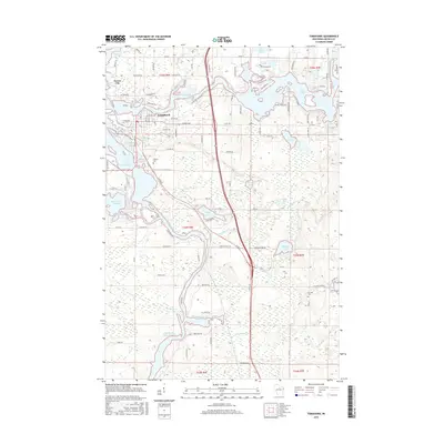
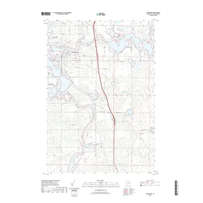
(20)- 1950 Map of Tomahawk, 1956 Print
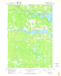
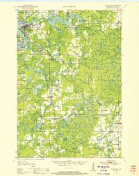 1950 Tomahawk1956 Print · USGSThe river and rail networks of Lincoln County are captured here in the early fifties, centering on the industrial activity of the Wisconsin River. Genealogists and historians can trace family roots through numerous country schools and cemeteries like Calvary Cemetery, Little Pine Creek School, and the settlement at Irma.
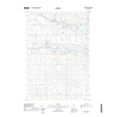
 - 1950 Map of Spirit Falls, 1957 Print
 1950 Spirit Falls1957 Print · USGSLincoln County’s river valleys and timberlands are captured here in the early 1950s, documenting the era of hydroelectric power and forest management. Genealogists and historians can trace Old Railroad Grade, remote outposts like Camp 25, and local landmarks like Grandfather Falls.2 unique versions available
 - 1952 Map of Spirit Falls
 1952 Spirit Falls1952 Print · USGSLincoln County is captured during its mid-century transition from a timber-driven frontier to an era of hydroelectric power. Genealogists and researchers can trace rural school locations like Mitchell Sch and industrial sites including Averill Junction and the Grandfather Dam.
 - 1952 Map of Tomahawk
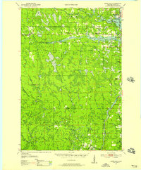
 1952 Tomahawk1952 Print · USGSWisconsin's timber country comes into focus in the early fifties as the river-driven economy of Lincoln County transitions toward modernization. Genealogists and historians can locate rural landmarks like Irma, the Dotter Sch (Abandoned), and Calvary Cem.
 - 1954 Map of Iron Mountain, 1964 Print
 1954 Iron Mountain1964 Print · USGSUpper Michigan and Northeastern Wisconsin are shown in detail during the mid-fifties, when the logging and mining economies still moved by rail. Trace the rail lines of the Soo Line to remote stops like Koepenick Station or explore the Iron Range near Iron Mountain.2 unique versions available
 - 1959 Map of Iron Mountain
 1959 Iron Mountain1959 Print · USGSThe northwoods of Wisconsin and the Michigan border are captured here in the mid-fifties, showing a landscape defined by timber, water, and rail. Researchers can trace historic junctions like Hiles Junction, the expansive Nicolet National Forest, and lakefront settlements from Rhinelander to Tomahawk.2 unique versions available
 - 1966 Map of Tomahawk, 1968 Print
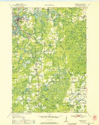
 1966 Tomahawk1968 Print · USGSLincoln County in the mid-sixties remains a landscape defined by timber, water power, and the rail lines connecting them. Genealogists and historians can trace families and industries through sites like Kings Dam, Bethany Ch, and the rural community of Irma.
 - 1978 Map of Coffee Creek, 1979 Print
 1978 Coffee Creek1979 Print · USGSLincoln County’s river-driven landscape is captured here in the late seventies, centered on the confluence of the Wisconsin and Spirit rivers. Genealogists and local historians can trace family-named roads and rural landmarks like Wilson School, the Zenith Lookout Tower, and the Cranberry Bog.2 unique versions available
 - 1982 Map of Tomahawk, 1983 Print
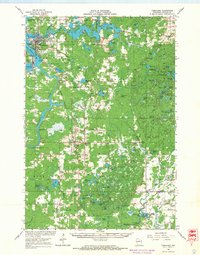
 1982 Tomahawk1983 Print · USGSThe industrial and riparian heart of Lincoln County is shown here in the early eighties, centered on the confluence of the Wisconsin and Spirit Rivers. Genealogists and local historians can trace the foundations of Tomahawk and Jersey City, alongside landmarks like Oak Hill Cem and the Kings Dam Powerplant.
 - 1990 Map of Merrill, 1991 Print
 1990 Merrill1991 Print · USGSWisconsin's Northwoods transition from timber industry to recreation in the 1990s, centered on the river corridors of Lincoln and Langlade counties. Genealogists and historians can trace rail history along the Soo Line and Old RR Grade between Merrill and Antigo.
 - 2010 Map of Tomahawk, 2010 Print
 2010 Tomahawk2010 Print · USGSCovers Tomahawk, including Bradley, King, and other nearby areas
 - 2011 Map of Coffee Creek, 2011 Print
 2011 Coffee Creek2011 Print · USGSCovers Tomahawk, including Bradley, Wilson, and other nearby areas
 - 2013 Map of Tomahawk, 2013 Print
 2013 Tomahawk2013 Print · USGSCovers Tomahawk, including Bradley, King, and other nearby areas
 - 2013 Map of Coffee Creek, 2013 Print
 2013 Coffee Creek2013 Print · USGSCovers Tomahawk, including Bradley, Wilson, and other nearby areas
 - 2015 Map of Tomahawk, 2015 Print
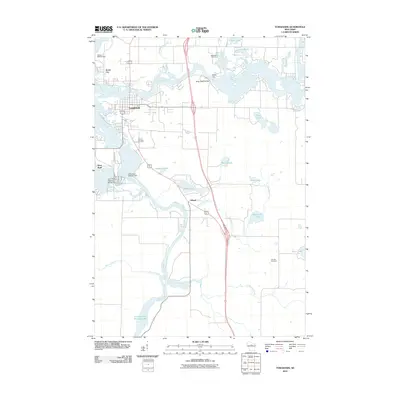
 2015 Tomahawk2015 Print · USGSCovers Tomahawk, including Bradley, King, and other nearby areas
 - 2015 Map of Coffee Creek, 2015 Print
 2015 Coffee Creek2015 Print · USGSCovers Tomahawk, including Bradley, Wilson, and other nearby areas
 - 2018 Map of Coffee Creek, 2018 Print
 2018 Coffee Creek2018 Print · USGSCovers Tomahawk, including Bradley, Wilson, and other nearby areas
 - 2018 Map of Tomahawk, 2018 Print
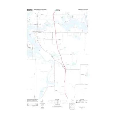
 2018 Tomahawk2018 Print · USGSCovers Tomahawk, including Bradley, King, and other nearby areas
 - 2022 Map of Coffee Creek, 2022 Print
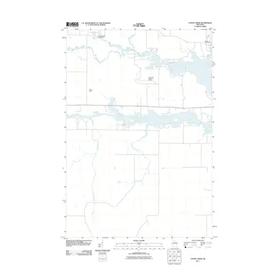
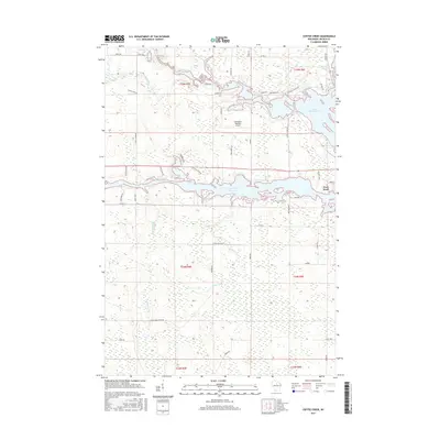
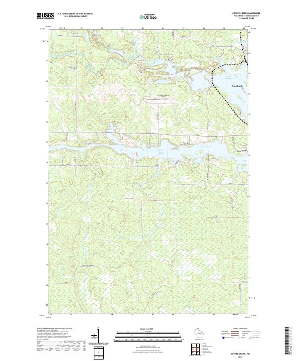 2022 Coffee Creek2022 Print · USGSThe intricate waterways around the city of Tomahawk are documented here in the early twenty-first century. Genealogists and local historians can trace family-named roads and land features around Lake Mohawksin, West Kraft, and the Spirit River Flowage.
 - 2022 Map of Tomahawk, 2022 Print
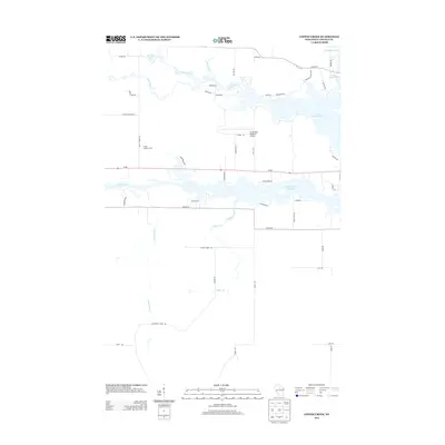
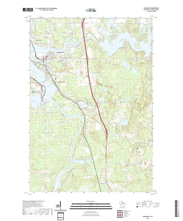 2022 Tomahawk2022 Print · USGSTomahawk and the surrounding Northwoods lakes are showcased here as they appeared in the early twenty-first century. Genealogists and local historians can trace family locations near Calvary Cem, Jersey City, and the shorelines of Lake Mohawksin or Lake Alice.
End of results
Showing maps 1-20 of 20
Top cities near Tomahawk
- Rhinelander historical maps
- Newbold historical maps
- Bradley historical maps
- Harrison historical maps
- Woodboro historical maps
Frequently asked questions
- What are the different types of historical maps available for Tomahawk?
- What is the oldest map of Tomahawk?
- Where can I purchase historical maps of Tomahawk for my home or office?
- Where can I download high-res historical maps of Tomahawk?
- Are there historical topographic maps available for Tomahawk?
- Is there historical aerial imagery available for Tomahawk?
- Where are historical maps of Tomahawk sourced from?