1950s Maps of Guenther, Wisconsin
Explore 5 historic maps of Guenther from the 1950s. These maps offer a rare glimpse into what life looked like during the 1950s — showing old roads, neighborhoods, homes, and landmarks that have changed or disappeared over time.
Whether you're researching your family's past, planning a metal detecting trip, or studying how Guenther's landscape evolved across the 1950s, these high-resolution maps are a powerful tool for exploring the history of this region.
- Focus on a specific era: All maps on this page are from the 1950s, giving you a focused view of this time period.
- See what’s changed: Compare century-old streets, trails, and buildings to today's modern landscape using overlays and satellite layers.
- Research with precision: Use these maps for genealogy, historical research, land use analysis, or educational projects.
- View, download, or print: Maps are fully viewable online in high resolution, and can be downloaded or printed for your own records.
Start exploring Guenther's history through authentic maps from the 1950s. This is your window into the past.
Guenther, WI maps
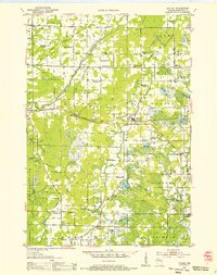
(5)- 1953 Map of Wausau, 1955 Print
 1953 Wausau1955 Print · USGSThe Wisconsin River valley comes alive in the early 1950s, showing the paper-mill towns and rugged peaks of Marathon County. Trace the development of Wausau and Mosinee or locate rural landmarks like the Mosinee Lookout Tower and St Agnes Ch.
 - 1953 Map of Hatley, 1955 Print
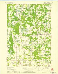
 1953 Hatley1955 Print · USGSMarathon County's eastern farming and timber lands are captured here in the early fifties as the rural school system began to consolidate. Genealogists can trace family footprints at St Francis Cem or follow the old Chicago and North Western rail line through Hatley.
 - 1955 Map of Rosholt, 1957 Print
 1955 Rosholt1957 Print · USGSPortage County’s rural landscape comes alive in the mid-fifties, showing the intersection of rail transport and small-town commerce. Researchers can trace family roots at St Marys Ch, locate vanished schoolhouses like Oakland Sch, or explore the rail corridor near Nelsonville.2 unique versions available
 - 1955 Map of Green Bay, 1968 Print
 1955 Green Bay1968 Print · USGSCentral and Eastern Wisconsin are captured here in the mid-fifties, showing the industrial growth of the Fox Valley and Wisconsin River corridors. Genealogists and historians can trace rail lines like the Green Bay and Western through settlements like Weyauwega, Clintonville, and Pulaski.2 unique versions available
 - 1956 Map of Stevens Point, 1958 Print
 1956 Stevens Point1958 Print · USGSStevens Point and the central Wisconsin River valley are captured here in the mid-fifties during a period of significant educational and infrastructure growth. Researchers can locate numerous country schools and religious landmarks, from St Francis Ch to the State Teachers College and the Cranberry Bog.2 unique versions available
End of results
Showing maps 1-5 of 5
Top cities near Guenther
- Wausau historical maps
- Stevens Point historical maps
- Weston historical maps
- Kronenwetter historical maps
- Rib Mountain historical maps
- Rothschild historical maps
See more
Top neighborhoods of Guenther
Frequently asked questions
- What are the different types of historical maps available for Guenther?
- What is the oldest map of Guenther?
- Where can I purchase historical maps of Guenther for my home or office?
- Where can I download high-res historical maps of Guenther?
- Are there historical topographic maps available for Guenther?
- Is there historical aerial imagery available for Guenther?
- Where are historical maps of Guenther sourced from?