2020s Maps of Westford, Wisconsin
Explore 4 historic maps of Westford from the 2020s. These maps offer a rare glimpse into what life looked like during the 2020s — showing old roads, neighborhoods, homes, and landmarks that have changed or disappeared over time.
Whether you're researching your family's past, planning a metal detecting trip, or studying how Westford's landscape evolved across the 2020s, these high-resolution maps are a powerful tool for exploring the history of this region.
- Focus on a specific era: All maps on this page are from the 2020s, giving you a focused view of this time period.
- See what’s changed: Compare century-old streets, trails, and buildings to today's modern landscape using overlays and satellite layers.
- Research with precision: Use these maps for genealogy, historical research, land use analysis, or educational projects.
- View, download, or print: Maps are fully viewable online in high resolution, and can be downloaded or printed for your own records.
Start exploring Westford's history through authentic maps from the 2020s. This is your window into the past.
Westford, WI maps
(4)- 2022 Map of Lime Ridge, 2022 Print
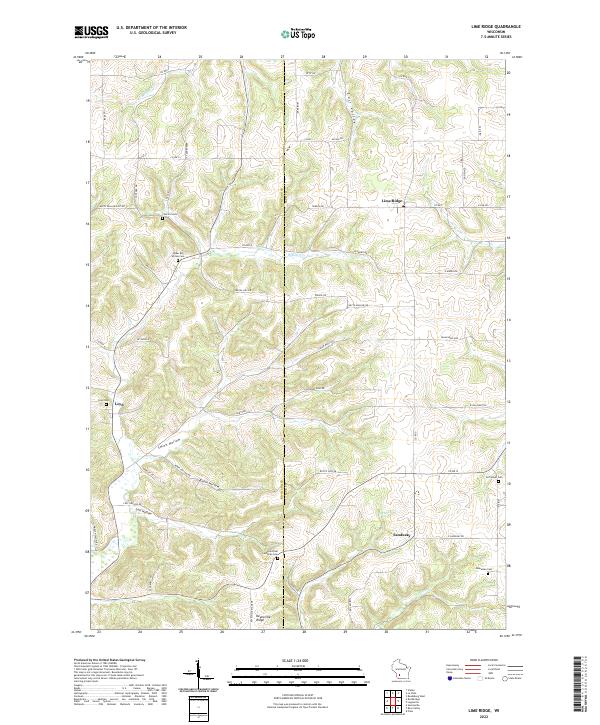 2022 Lime Ridge2022 Print · USGSThe rural border of Richland and Sauk Counties is documented here in the early twenty-first century as agricultural traditions endure. Researchers can locate family heritage sites like Saint Paul Lutheran Cemetery and the hamlets of Loyd and Sandusky.
 - 2022 Map of Valton, 2022 Print
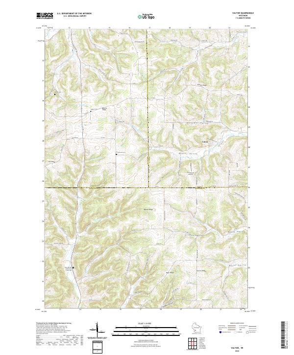 2022 Valton2022 Print · USGSRichland and Sauk County's complex ridge-and-valley landscape is documented here in the early twenty-first century. Researchers can locate secluded family burial grounds like Debello Cem and trace the paths of the Little Baraboo River and Melancthon Cr.
 - 2022 Map of Rockbridge, 2022 Print
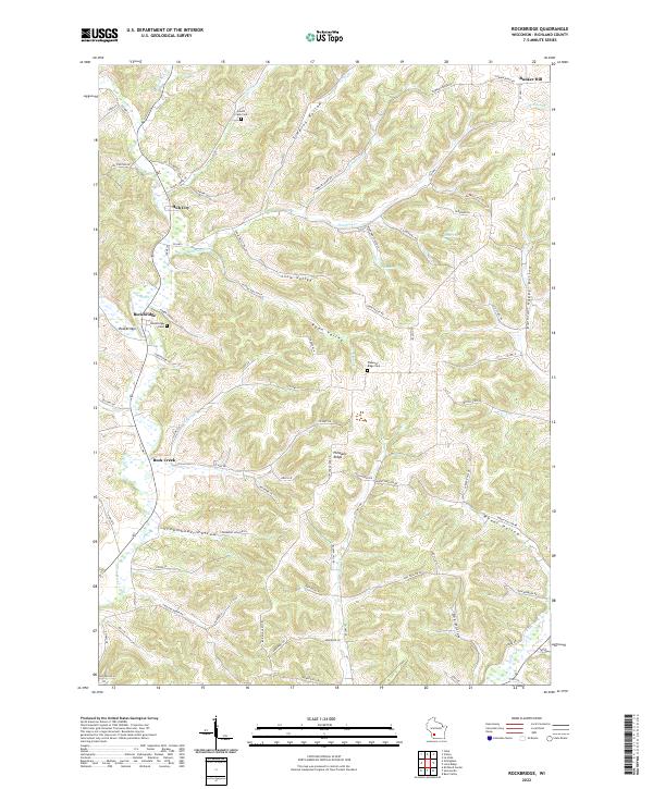 2022 Rockbridge2022 Print · USGSRichland County's driftless terrain is showcased in this modern survey of the Rockbridge and Hub City area. Researchers can trace genealogical roots at Pleasant Ridge Cem and follow the branching waters of the Pine River through Steamboat Hollow.
 - 2022 Map of La Valle, 2022 Print
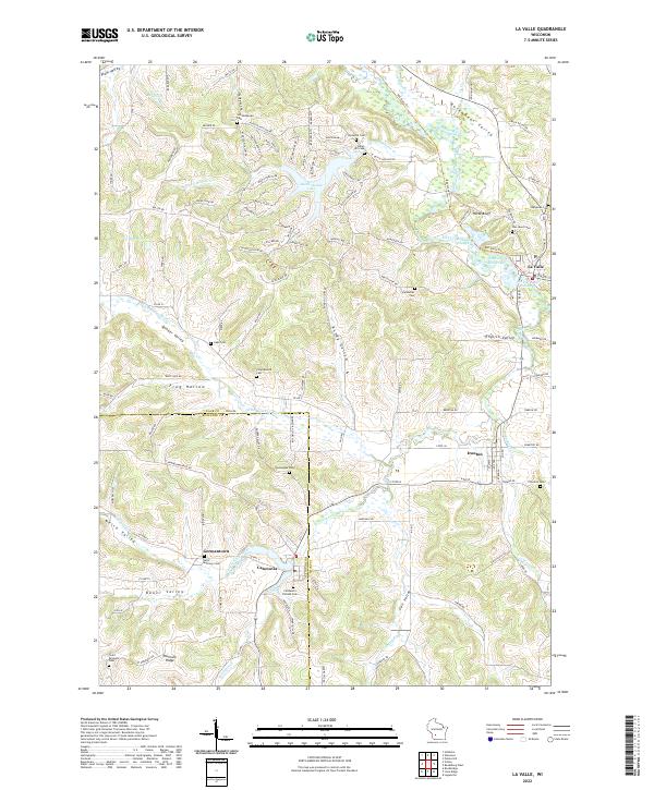 2022 La Valle2022 Print · USGSThe Baraboo River valley in Sauk and Richland counties comes alive in this detailed look at rural Wisconsin life. Genealogists can trace family footprints across La Valle, Ironton, and Cazenovia, or locate ancestral plots at Norwegian Cem and Oaks Cem.
End of results
Showing maps 1-4 of 4
Top cities near Westford
- Reedsburg historical maps
- Richland Center historical maps
- Lemonweir historical maps
- Elroy historical maps
- Hillsboro historical maps
- Greenwood historical maps
See more
Top neighborhoods of Westford
Frequently asked questions
- What are the different types of historical maps available for Westford?
- What is the oldest map of Westford?
- Where can I purchase historical maps of Westford for my home or office?
- Where can I download high-res historical maps of Westford?
- Are there historical topographic maps available for Westford?
- Is there historical aerial imagery available for Westford?
- Where are historical maps of Westford sourced from?