Old Maps of Rock County, Wisconsin for Hiking & Exploration
Hike through history with 154 historic maps of Rock County. Explore old trails, ghost towns, and forgotten backroads — perfect for outdoor adventurers and local explorers.
- Rediscover forgotten places: Map out old mining camps, roads, and footpaths that no longer exist on modern maps.
- Layer with modern tools: Combine with LiDAR or satellite views to plan hikes through historical terrain.
- Made for exploration: Popular among hikers, overlanders, and local history lovers.
Use these maps to find adventure and explore the hidden past of Rock County.
Rock County, WI maps
(154)- 1889 Map of Evansville
 1889 Evansville1889 Print · USGSSouthern Wisconsin at the end of the nineteenth century was a landscape of growing rail towns and post offices scattered across glacial drumlins. Genealogists can trace family roots through the early plats of Evansville, Oregon, and the Lake View Post Office.
 - 1890 Map of Stoughton
 1890 Stoughton1890 Print · USGSSouthern Wisconsin during the 1890s shows a landscape of thriving river towns and expanding rail networks. Researchers can trace early family homesteads near Stebbinsville, Cooksville, and Fulton Center while following the historic route of the Chicago Milwaukee and St Paul Railroad.6 unique versions available
 - 1891 Map of Koshkonong
 1891 Koshkonong1891 Print · USGSJefferson County was an evolving hub of river power and rail transit in the 1890s. Researchers can trace the early footprints of Jefferson and Fort Atkinson or locate rural landmarks like Busseyville and Cold Spring.
 - 1891 Map of Janesville, 1956 Print
 1891 Janesville1956 Print · USGSThe Rock River corridor in the 1890s appears as a burgeoning industrial landscape anchored by the rail hubs of Janesville and Beloit. Genealogists and historians can trace old property sites near Hanover, Afton, and the early settlements of Stevens and Fellows.
 - 1893 Map of Janesville
 1893 Janesville1893 Print · USGSRock County at the close of the nineteenth century is a bustling hub of rail activity and river commerce. Genealogists and local historians can trace the early city footprints of Janesville and Beloit or locate vanished rural stops like Fellows and Stevens.4 unique versions available
 - 1893 Map of Brodhead
 1893 Brodhead1893 Print · USGSSouthern Wisconsin is captured in the late nineteenth century as rail lines and river valleys shaped the landscape. Genealogists and historians can trace early village sites like Brodhead, Magnolia Station, and Orford along the Chicago Milwaukee and Saint Paul Railroad.5 unique versions available
 - 1893 Map of Shopiere
 1893 Shopiere1893 Print · USGSRock County's rural landscape is captured here in the 1890s, when steam rail dominated the local economy and travel. Genealogists and researchers can trace the early footprints of Clinton Junction, the winding path of Turtle Creek, and small rural centers like Emerald Grove.5 unique versions available
 - 1894 Map of Evansville
 1894 Evansville1894 Print · USGSSouthern Wisconsin at the end of the nineteenth century was a landscape of expanding rail lines and productive prairie farms. Genealogists and local historians can trace early settlements like Oak Hall, the lakeside community of Lakeview, and the winding course of the Sugar River.2 unique versions available
 - 1894 Map of Koshkonong
 1894 Koshkonong1894 Print · USGSSouthern Wisconsin at the end of the nineteenth century is defined by its glacial lakes and expanding rail networks. Genealogists can trace family footprints in Fort Atkinson and Milton Junction, or locate small settlements like Busseyville and Cold Spring.2 unique versions available
 - 1906 Map of Evansville
 1906 Evansville1906 Print · USGSWisconsin's southern prairie and wetlands are mapped here in the early twentieth century as the railroad transformed rural trade. Trace the iron paths of the C. and N. W. R. R. through Evansville and Oregon, or find local landmarks like Red Bridge Crossing and Liberty Pole Hill.3 unique versions available
 - 1906 Map of Koshkonong
 1906 Koshkonong1906 Print · USGSSouthern Wisconsin at the turn of the century was a landscape of expanding rail junctions and river towns. Trace the early footprints of Fort Atkinson and Jefferson, or follow the rail lines connecting Milton Junction and Lima Center.3 unique versions available
 - 1918 Map of Rockford
 1918 Rockford1918 Print · USGSWinnebago County at the end of the Great War reveals a landscape where the river-and-rail economy was in full swing. Genealogists and historians can trace family-named schools like Dickenson School and Eddy School, or locate the Winnebago County Boys Reform School.3 unique versions available
 - 1918 Map of Belvidere
 1918 Belvidere1918 Print · USGSBoone County and the Kishwaukee River valley are captured here in the final year of the Great War. Researchers can trace dozens of rural school sites like Quailtrap School or locate family roots near Argyle and the Scotch Cemetery.
 - 1932 Map of Pecatonica
 1932 Pecatonica1932 Print · USGSThe Pecatonica River valley at the start of the 1930s shows a landscape of busy rail towns and a remarkable density of rural schoolhouses. Genealogists can locate family landmarks like Woodruff Corners, Pioneer Cem, and the Twelvemile Grove Ch.3 unique versions available
 - 1936 Map of Pecatonica
 1936 Pecatonica1936 Print · USGSNorthern Illinois agriculture and river life thrive in the 1930s along the winding Pecatonica River and the Wisconsin border. Genealogists can trace hundreds of rural homes and a dense grid of schoolhouses including College Sch, Irish Grove Sch, and Twelvemile Grove Ch.2 unique versions available
 - 1938 Map of Rockford, 1954 Print
 1938 Rockford1954 Print · USGSWinnebago County at the end of the Depression shows a landscape shaped by river valleys and a dense network of country schoolhouses. You can trace early twentieth-century rural life through landmarks like Holland Spring, the Winnebago County Boys Reform School, and the Rockford and Interurban rail line.3 unique versions available
 - 1944 Map of Belvidere
 1944 Belvidere1944 Print · USGSNorthern Illinois at the height of the Second World War shows a landscape defined by rail-fed farming villages and dozens of country schoolhouses. Genealogists can trace family footprints near Scotch Church, the Fairgrounds, and settlements like Poplar Grove.2 unique versions available
 - 1954 Map of Rockford
 1954 Rockford1954 Print · USGSThe Rock River valley and the Illinois-Wisconsin borderlands are captured here in the mid-1950s during a period of robust industrial and agricultural activity. Genealogists and historians can trace rail-era corridors like the Illinois Central RR and locate landmarks from Big Foot Prairie to Lake Geneva.
 - 1955 Map of Rockford
 1955 Rockford1955 Print · USGSThe Rock River valley and southern Wisconsin dairy country are shown here in the mid-fifties as the region's manufacturing centers grew. Genealogists and historians can trace the paths of the Chicago and North Western RR and Illinois Central RR through hubs like Rockford and Beloit.
 - 1958 Map of Rockford, 1974 Print
 1958 Rockford1974 Print · USGSNorthern Illinois and southern Wisconsin are shown here in the mid-twentieth century as rail-dependent industrial towns began to interface with growing lakefront communities. Genealogists can trace family roots through settlements like Saylesville and Tess Corners or locate historical landmarks like the Rockford Ordnance Depot.4 unique versions available
 - 1959 Map of South Beloit, 1960 Print
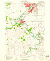 1959 South Beloit1960 Print · USGSThe Rock River valley at the Illinois-Wisconsin border shows a landscape of growing towns and industrial gravel works in the late fifties. Genealogists can trace rural school locations like Sand Prairie Sch and Lovejoy Sch or the rail lines of the Chicago and North Western.
 - 1960 Map of Lima Center, 1964 Print
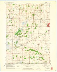 1960 Lima Center1964 Print · USGSSouthern Wisconsin farmland is captured at the dawn of the 1960s, showing the rural landscapes where Rock, Jefferson, and Walworth counties converge. Genealogists can locate Lima Center, Union Cem, and the North Lima Ch along the rail lines.3 unique versions available
 - 1961 Map of Fort Atkinson, 1963 Print
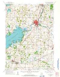 1961 Fort Atkinson1963 Print · USGSJefferson and Rock Counties come alive in the early 1960s, showing a landscape defined by the vast Lake Koshkonong and busy rail corridors. Genealogists can locate family names at Lakeview Cem or trace rural education at the Koshkonong Sch and Burr Oak Sch.2 unique versions available
 - 1961 Map of Stoughton, 1963 Print
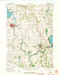 1961 Stoughton1963 Print · USGSDane and Rock Counties during the early sixties center on the tobacco-processing hubs of the Rock River valley. Genealogists and local researchers can trace family lands near Hanerville, identify remote schools like Bass Lake Sch, or locate historic burials at Jensen Cem and South Porter Cem.2 unique versions available
 - 1961 Map of Evansville, 1963 Print
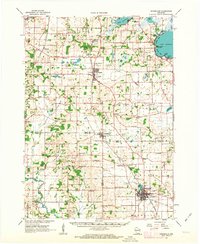 1961 Evansville1963 Print · USGSThe rural landscape between Madison and Janesville is captured here in the early sixties, showing a robust agricultural economy and well-defined town centers. Genealogists can trace family footprints at Franklin Sch, St Marys Cem, and the crossroads at Butts Corners.2 unique versions available
Showing maps 1-25 of 154
Top cities of Rock County
- Janesville historical maps
- Beloit historical maps
- Milton historical maps
- Edgerton historical maps
- Evansville historical maps
- Fulton historical maps
See more
Frequently asked questions
- What are the different types of historical maps available for Rock County?
- What is the oldest map of Rock County?
- Where can I purchase historical maps of Rock County for my home or office?
- Where can I download high-res historical maps of Rock County?
- Are there historical topographic maps available for Rock County?
- Is there historical aerial imagery available for Rock County?
- Where are historical maps of Rock County sourced from?