2020s Maps of Troy, Wisconsin
Explore 6 historic maps of Troy from the 2020s. These maps offer a rare glimpse into what life looked like during the 2020s — showing old roads, neighborhoods, homes, and landmarks that have changed or disappeared over time.
Whether you're researching your family's past, planning a metal detecting trip, or studying how Troy's landscape evolved across the 2020s, these high-resolution maps are a powerful tool for exploring the history of this region.
- Focus on a specific era: All maps on this page are from the 2020s, giving you a focused view of this time period.
- See what’s changed: Compare century-old streets, trails, and buildings to today's modern landscape using overlays and satellite layers.
- Research with precision: Use these maps for genealogy, historical research, land use analysis, or educational projects.
- View, download, or print: Maps are fully viewable online in high resolution, and can be downloaded or printed for your own records.
Start exploring Troy's history through authentic maps from the 2020s. This is your window into the past.
Troy, WI maps
(6)- 2022 Map of River Falls East, 2022 Print
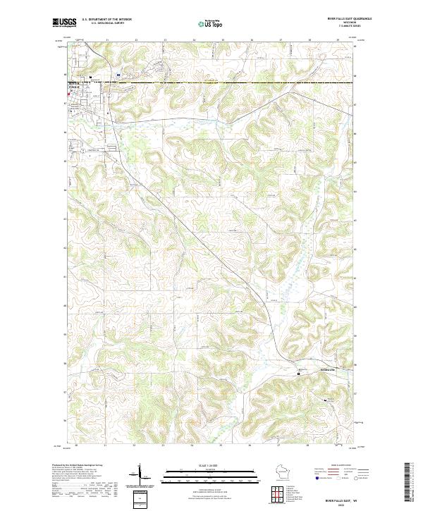 2022 River Falls East2022 Print · USGSPierce County’s eastern townships come into focus here during the early twenty-first century as the city meets the country. Genealogists can locate family sites at Thurston Hill Cem or follow the waters of the S Fork Kinnickinnic River past Beldenville.
 - 2022 Map of Northline, 2022 Print
 2022 Northline2022 Print · USGSThe St. Croix River valley in the 2020s shows a landscape of growing river towns and deep-rooted agricultural history. Genealogists and researchers can trace family plots at German Settlement Cem or Saint Patrick's Cem and locate historic points like Sono Junction.
 - 2022 Map of Roberts, 2022 Print
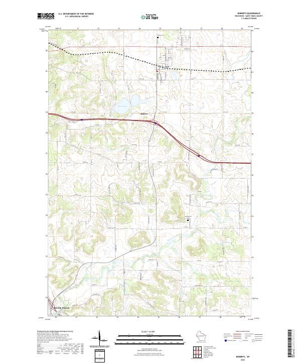 2022 Roberts2022 Print · USGSThe village of Roberts sits at the center of this recent survey, showcasing the modern landscape of St. Croix County. Local researchers can trace family landmarks like Warren Cem and the winding course of the Kinnickinnic River near River Falls.
 - 2022 Map of Prescott, 2022 Print
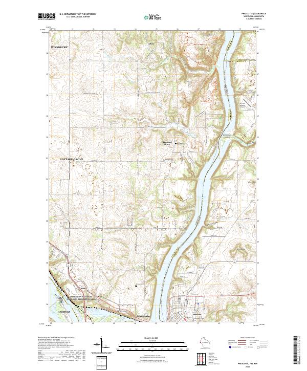 2022 Prescott2022 Print · USGSThe confluence of the Mississippi and Saint Croix rivers comes to life in this modern survey of the Wisconsin-Minnesota border. Researchers can trace land use from Afton State Park down to Prescott, pinpointing old cemeteries like Evergreen Cem and Johnson Cem.
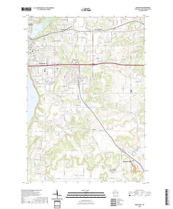
 - 2022 Map of Hudson, 2022 Print
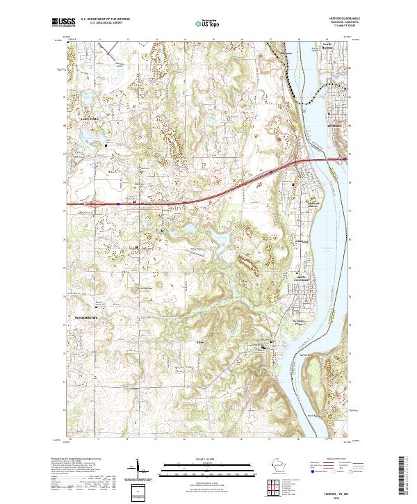 2022 Hudson2022 Print · USGSThe St. Croix River valley comes alive in this contemporary view of the Wisconsin-Minnesota border as it looked in the 2020s. Genealogists can locate several family-named burial sites including the Rentz Cem and Daniel Vollmer Cem, or trace the winding Valley Branch through Afton.
 - 2022 Map of River Falls West, 2022 Print
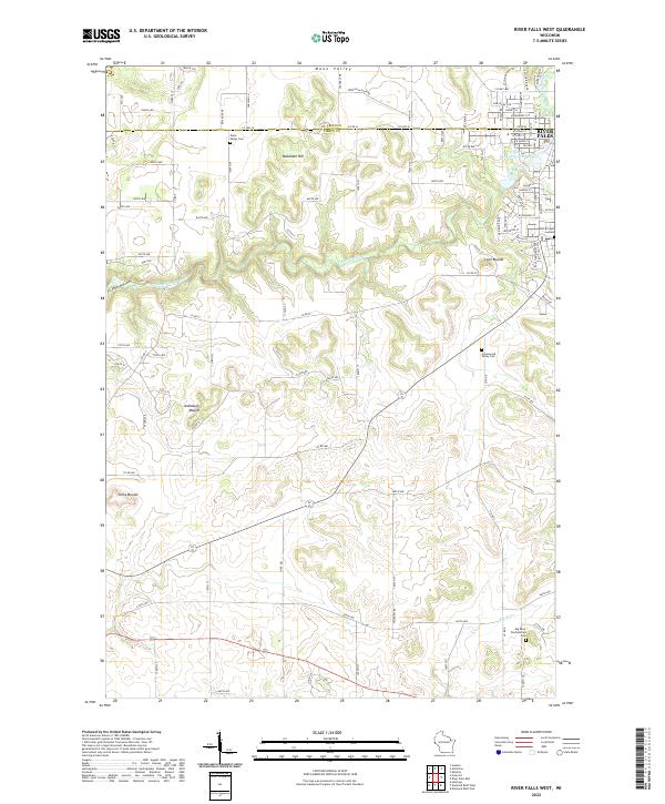 2022 River Falls West2022 Print · USGSPierce County farming and the western edge of River Falls are captured here as they appeared in the early 2020s. Genealogists can locate family burial sites at Mann Valley Cem and Big River Presbyterian Cem or trace the winding Kinnickinnic River.
End of results
Showing maps 1-6 of 6
Top cities near Troy
- Woodbury historical maps
- Cottage Grove historical maps
- Hastings historical maps
- Stillwater historical maps
- River Falls historical maps
- Hudson historical maps
See more
Top neighborhoods of Troy
Frequently asked questions
- What are the different types of historical maps available for Troy?
- What is the oldest map of Troy?
- Where can I purchase historical maps of Troy for my home or office?
- Where can I download high-res historical maps of Troy?
- Are there historical topographic maps available for Troy?
- Is there historical aerial imagery available for Troy?
- Where are historical maps of Troy sourced from?