Old Maps of Sheboygan County, Wisconsin
Explore 139 old maps of Sheboygan County, spanning from 1954 to today. These high-resolution historic maps reveal how streets, neighborhoods, landmarks, and natural features evolved over time — perfect for genealogy, metal detecting, research, and local history exploration.
What you can do with these maps:
- See how Sheboygan County changed over time: Compare historical maps to modern-day views to trace roads, homesites, rail lines & more.
- View detailed metadata: Each map includes creators, publishers, year, scale, and archive source.
- Overlay maps with satellite & LiDAR: Visualize the past alongside modern tools to explore terrain & human change.
- Trusted historical sources: Maps sourced from the USGS, Library of Congress, and other archives.
- Access maps your way: View online, download high-res files, or order prints for personal or research use.
Start exploring old maps of Sheboygan County to uncover forgotten places, hidden landmarks, and the deep history beneath your feet.
Sheboygan County, WI maps
(139)- 1954 Map of Sheboygan Falls, 1956 Print
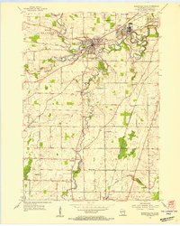
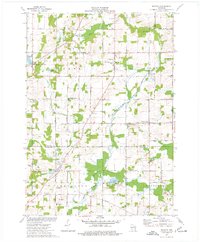
 1954 Sheboygan Falls1956 Print · USGSCoastal Sheboygan and Ozaukee counties appear here in the mid-1950s, showing a landscape of dairy farms, mill ponds, and emerging industrial centers. Genealogists can trace family names at St Patrick Ch, find rural schoolhouses like Hoard Sch, or locate the lakefront Sauk Trail Beach.2 unique versions available
 - 1954 Map of Sheboygan South, 1956 Print
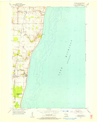
 1954 Sheboygan South1956 Print · USGSThe Sheboygan shoreline in the mid-1950s shows a balance between industrial utility and lakeside recreation. Genealogists and historians can locate Southside Cemetery, early schools like Jackson School, and the industrial footprint of Kohler.
 - 1954 Map of School Hill, 1956 Print
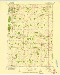
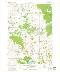
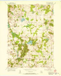 1954 School Hill1956 Print · USGSThe rolling dairy country of Manitowoc and Sheboygan counties is captured here in the mid-1950s. Genealogists and local historians can trace the many rural schools and churches of the era, from Bethlehem Ch to Pigeon River Sch and the Salvatorian Seminary.2 unique versions available
 - 1954 Map of Sheboygan Falls, 1956 Print
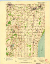
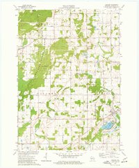
 1954 Sheboygan Falls1956 Print · USGSSheboygan County's industrial and rural heart comes into focus during the mid-fifties, centered on the confluence of three rivers. Genealogists and local historians can trace family-named sites like Jansen Cem and Madison Sch or explore the early layout of Kohler and Ourtown.3 unique versions available
 - 1954 Map of Cleveland, 1956 Print
 1954 Cleveland1956 Print · USGSMid-century life along the Lake Michigan shoreline comes into focus through this survey of the Manitowoc and Sheboygan county line. Genealogists and local historians can trace the rural landscape through family-linked sites like St John Cemetery, Hika, and the Point River School.3 unique versions available
 - 1954 Map of St. Wendel, 1956 Print
 1954 St. Wendel1956 Print · USGSThe rural townships of Manitowoc and Sheboygan counties are captured here in the mid-1950s, a landscape defined by small crossroads settlements and dairy farms. Genealogists can trace family roots through local landmarks like Meeme Center Cem, St Fidelis Sch, and the village of Osman.3 unique versions available
 - 1954 Map of Sheboygan North, 1956 Print
 1954 Sheboygan North1956 Print · USGSThe Sheboygan lakeshore and the developing townships of Manitowoc and Sheboygan counties are documented here in the mid-fifties. Researchers can trace the rail corridor of the Chicago and North Western through early settlements like Hika, Haven, and the Camp Haven Military Reservation.
 - 1954 Map of Sheboygan North, 1956 Print
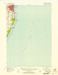
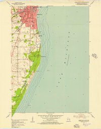
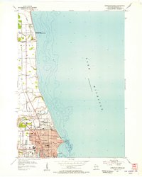 1954 Sheboygan North1956 Print · USGSSheboygan and the Lake Michigan shoreline are shown here in the mid-fifties, capturing a period of steady lakeside growth. Researchers can trace family sites at Wildwood Cemetery, locate old schoolhouses like Lyman Sch, or explore the Camp Haven Military Reservation and the tracks of the Chicago and North Western.3 unique versions available
 - 1954 Map of Sheboygan South, 1956 Print
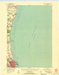
 1954 Sheboygan South1956 Print · USGSThe Lake Michigan shoreline south of Sheboygan is captured here in the mid-1950s as industry and recreation began to shape the coastal landscape. Genealogists and researchers can trace urban landmarks like Central High Sch, local burial grounds including Wildwood Cem, and lakefront features like the Sunken Caisson.3 unique versions available
 - 1954 Map of Howards Grove, 1956 Print
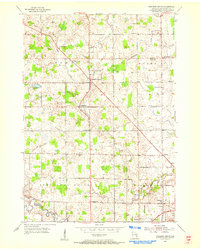
 1954 Howards Grove1956 Print · USGSSheboygan and Manitowoc counties are captured here in the mid-1950s, a period defined by tight-knit rural townships and an economy rooted in local dairy and industry. Genealogists can locate family landmarks like Rocky Knoll Sanatorium, the St Paul-Friedhof Cem, and Mission House College.
 - 1954 Map of Howards Grove, 1956 Print
 1954 Howards Grove1956 Print · USGSSheboygan County was a landscape of thriving rural school districts and crossroads hamlets in the mid-fifties. Genealogists can trace family roots through local landmarks like Union Cem, Trinity Sch, and the riverside settlement of Millersville.3 unique versions available
 - 1954 Map of Franklin, 1956 Print
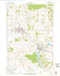
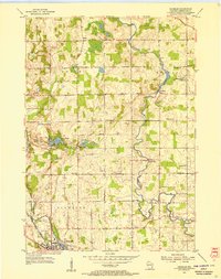 1954 Franklin1956 Print · USGSSheboygan County agriculture and industry meet in the mid-1950s as rail lines converge on the city of Plymouth. Genealogists can trace family footprints through numerous rural sites like Mission House College, Maple Grove Cem, and the Rocky Knoll Sanatorium.3 unique versions available
 - 1954 Map of Kiel, 1956 Print
 1954 Kiel1956 Print · USGSWisconsin's glacial landscape meets mid-century development in this survey of the four-county border region. Genealogists can trace family roots through numerous country churches like Holy Rosary Ch and schools including the Elder Grove Sch.2 unique versions available
 - 1954 Map of Milwaukee, 1967 Print
 1954 Milwaukee1967 Print · USGSCoastal life and maritime commerce across Lake Michigan are seen here during the mid-fifties, bridging Wisconsin's industrial hubs and Michigan's timberlands. Genealogists and historians can trace the rail lines of the Grand Trunk Western and find long-established ports like Ludington, Port Washington, and Muskegon.3 unique versions available
 - 1955 Map of Kewaskum, 1957 Print
 1955 Kewaskum1957 Print · USGSMid-century eastern Wisconsin comes alive in this survey of the glacial Kettle Moraine region. Genealogists and historians can locate rural landmarks like Conners Mill, the Parnell Lookout Tower, and old schools including Mitchell Sch and Hillside Sch.4 unique versions available
 - 1957 Map of Madison, 1967 Print
 1957 Madison1967 Print · USGSSouth-central Wisconsin in the mid-fifties reveals a landscape of industrial hubs and glacial lakes linked by a dense rail and highway network. Genealogists and historians can trace the development of lakeside communities and find notable sites like Badger Ordnance Works and the Horicon National Wildlife Refuge.3 unique versions available
 - 1958 Map of Milwaukee
 1958 Milwaukee1958 Print · USGSThe shorelines of Lake Michigan in the late fifties reveal a landscape of bustling ferry ports and growing industrial suburbs. Genealogists and historians can trace rail networks like the Chesapeake & Ohio and locate landmarks such as Little Sable Point and Holy Cross Church.
 - 1960 Map of Madison
 1960 Madison1960 Print · USGSCentral and Southern Wisconsin are captured in the late fifties, showing the region as its rail-and-river network matured. Trace the paths of the Soo Line RR or locate family roots near Lake Mendota and Horicon National Wildlife Refuge.2 unique versions available
 - 1974 Map of Random Lake, 1977 Print
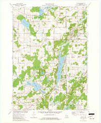
 1974 Random Lake1977 Print · USGSSheboygan and Ozaukee counties are shown here in the 1970s, as traditional rail corridors and rural townships began to accommodate new parks and utilities. You can trace family roots at Emmanuel Cem, locate the Indian Mound, or follow the Milwaukee Road rail line.
 - 1974 Map of St. Cloud, 1977 Print
 1974 St. Cloud1977 Print · USGSFond du Lac and Sheboygan counties are captured in the mid-seventies, showing a landscape defined by conservation and glacial water. Genealogists can locate family landmarks like Forest Home Cem, St Joseph Ch, and the historic St Lawrence Seminary.
 - 1974 Map of Kiel, 1977 Print
 1974 Kiel1977 Print · USGSThe manufacturing corridor between Kiel and New Holstein comes into focus in the mid-seventies, highlighting a landscape shaped by rail and river. Genealogists and local historians can trace family-named roads and landmarks like Holy Rosary Cem, the SS Peter and Paul Cem, and the old Kilns.
 - 1974 Map of Elkhart Lake, 1977 Print
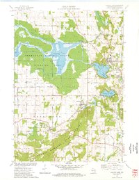 1974 Elkhart Lake1977 Print · USGSElkhart Lake and the surrounding kettle moraine country are captured here in the mid-seventies, showing a landscape defined by glacial hydrology and historic preservation. Trace the old road network around Glenbeulah and locate landmarks like the Old Wade House State Park or the Road America Raceway.
 - 1974 Map of Dundee, 1977 Print
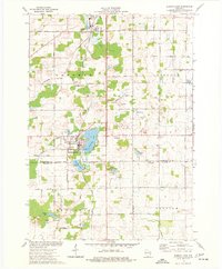
 1974 Dundee1977 Print · USGSThe glacial landscapes of Fond du Lac and Sheboygan counties are captured here in the mid-seventies, showing the intersection of conservation and rural life. Researchers can trace family sites at Union Cem and Trinity Cem or locate the old Townhall near Mud Lake.2 unique versions available
 - 1974 Map of Cascade, 1977 Print
 1974 Cascade1977 Print · USGSSheboygan County's glacial terrain is on full display in the mid-1970s, from the summits of the moraine to the village of Cascade. Genealogists and hikers can trace the Parnell Esker, locate St Michael Ch, or find family plots at Union Cem.2 unique versions available
 - 1974 Map of Batavia, 1977 Print
 1974 Batavia1977 Print · USGSThe rural borderlands of Sheboygan, Washington, and Ozaukee counties are preserved here in the mid-seventies as agriculture and gravel mining shaped the land. Researchers can locate family landmarks like the Winfield Cem, St Johns Ch, and the small settlement of Boltonville.
Showing maps 1-25 of 139
Top cities of Sheboygan County
- Sheboygan historical maps
- Plymouth historical maps
- Sheboygan Falls historical maps
- Howards Grove historical maps
- Oostburg historical maps
- Greenbush historical maps
See more
Frequently asked questions
- What are the different types of historical maps available for Sheboygan County?
- What is the oldest map of Sheboygan County?
- Where can I purchase historical maps of Sheboygan County for my home or office?
- Where can I download high-res historical maps of Sheboygan County?
- Are there historical topographic maps available for Sheboygan County?
- Is there historical aerial imagery available for Sheboygan County?
- Where are historical maps of Sheboygan County sourced from?