Old Maps of Cloverland, Wisconsin
Explore 18 old maps of Cloverland, spanning from 1930 to today. These high-resolution historic maps reveal how streets, neighborhoods, landmarks, and natural features evolved over time — perfect for genealogy, metal detecting, research, and local history exploration.
What you can do with these maps:
- See how Cloverland changed over time: Compare historical maps to modern-day views to trace roads, homesites, rail lines & more.
- View detailed metadata: Each map includes creators, publishers, year, scale, and archive source.
- Overlay maps with satellite & LiDAR: Visualize the past alongside modern tools to explore terrain & human change.
- Trusted historical sources: Maps sourced from the USGS, Library of Congress, and other archives.
- Access maps your way: View online, download high-res files, or order prints for personal or research use.
Start exploring old maps of Cloverland to uncover forgotten places, hidden landmarks, and the deep history beneath your feet.
Cloverland, WI maps
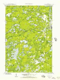
(18)- 1930 Map of Robbins
 1930 Robbins1930 Print · USGSThe Vilas and Oneida County lake country comes into focus in the early 1930s as tourism and industry overlap. Locate vanished rural schoolhouses like Evergreen Sch. and Sebastian Sch. or trace the early path of the Chicago and Northwestern RR.2 unique versions available
 - 1938 Map of Robbins, 1957 Print
 1938 Robbins1957 Print · USGSNorthern Wisconsin’s lake country was a mosaic of rural school districts and new hydroelectric power in the late 1930s. Genealogists can locate family-named landmarks like Kuehn Sch and Bohemian Sch or trace the early Rhinelander Trail.2 unique versions available
 - 1945 Map of Robbins, 1946 Print
 1945 Robbins1946 Print · USGSWisconsin's Northwoods come alive in this mid-century survey of the lake country around the Vilas and Oneida county line. Genealogists can trace family footprints through numerous rural schoolhouses like Lake Kathan Sch and forgotten sites like Wakefield and Robbins.
 - 1954 Map of Iron Mountain, 1964 Print
 1954 Iron Mountain1964 Print · USGSUpper Michigan and Northeastern Wisconsin are shown in detail during the mid-fifties, when the logging and mining economies still moved by rail. Trace the rail lines of the Soo Line to remote stops like Koepenick Station or explore the Iron Range near Iron Mountain.2 unique versions available
 - 1959 Map of Iron Mountain
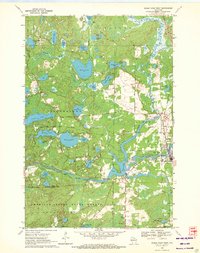
 1959 Iron Mountain1959 Print · USGSThe northwoods of Wisconsin and the Michigan border are captured here in the mid-fifties, showing a landscape defined by timber, water, and rail. Researchers can trace historic junctions like Hiles Junction, the expansive Nicolet National Forest, and lakefront settlements from Rhinelander to Tomahawk.2 unique versions available
 - 1970 Map of Eagle River West, 1972 Print
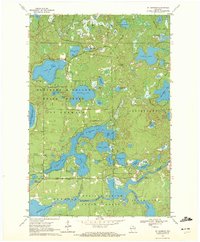
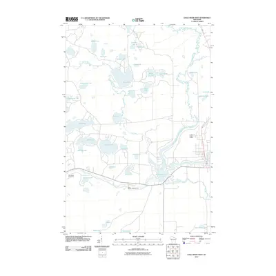
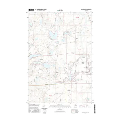
 1970 Eagle River West1972 Print · USGSVilas and Oneida Counties appear here as a interconnected network of Northwoods lakes and timberlands during the early 1970s. Trace the industrial and civic landscape through the Chicago and North Western rail line, the Otter Rapids Dam, and the Fairground.2 unique versions available
 - 1970 Map of St. Germain, 1972 Print
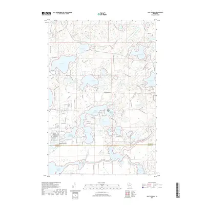
 1970 St. Germain1972 Print · USGSVilas and Oneida counties are captured here in the 1970s, a landscape defined by its glacial lakes and the expansive timberlands of the state forest. Genealogists and local historians can locate the St Germain Cem and trace the original paths of Birchwood Drive and Juve Road.3 unique versions available
 - 1989 Map of Rhinelander, 1990 Print
 1989 Rhinelander1990 Print · USGSThe Wisconsin Northwoods are captured here in the late eighties, showing a landscape defined by water and timber management. Researchers can trace the Soo Line rail corridors and find local landmarks like Rainbow Flowage, Pelican Lake, and the Rhinelander-Oneida Co Airport.
 - 2010 Map of Saint Germain, 2010 Print
 2010 Saint Germain2010 Print · USGSCovers Cloverland, including Newbold, Sugar Camp, and other nearby areas
 - 2010 Map of Eagle River West, 2010 Print
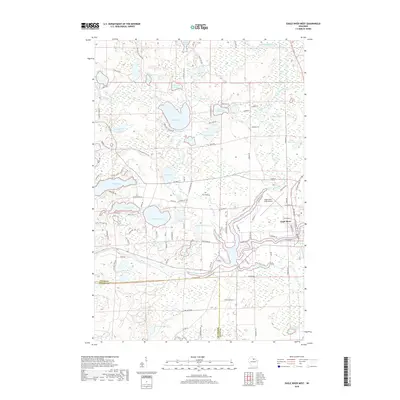
 2010 Eagle River West2010 Print · USGSCovers Cloverland, including Sugar Camp, Eagle River, and other nearby areas
 - 2013 Map of Eagle River West, 2013 Print
 2013 Eagle River West2013 Print · USGSCovers Cloverland, including Sugar Camp, Eagle River, and other nearby areas
 - 2013 Map of Saint Germain, 2013 Print
 2013 Saint Germain2013 Print · USGSCovers Cloverland, including Newbold, Sugar Camp, and other nearby areas
 - 2015 Map of Eagle River West, 2015 Print
 2015 Eagle River West2015 Print · USGSCovers Cloverland, including Sugar Camp, Eagle River, and other nearby areas
 - 2015 Map of Saint Germain, 2015 Print
 2015 Saint Germain2015 Print · USGSCovers Cloverland, including Newbold, Sugar Camp, and other nearby areas
 - 2018 Map of Saint Germain, 2018 Print
 2018 Saint Germain2018 Print · USGSCovers Cloverland, including Newbold, Sugar Camp, and other nearby areas
 - 2018 Map of Eagle River West, 2018 Print
 2018 Eagle River West2018 Print · USGSCovers Cloverland, including Sugar Camp, Eagle River, and other nearby areas
 - 2022 Map of Eagle River West, 2022 Print
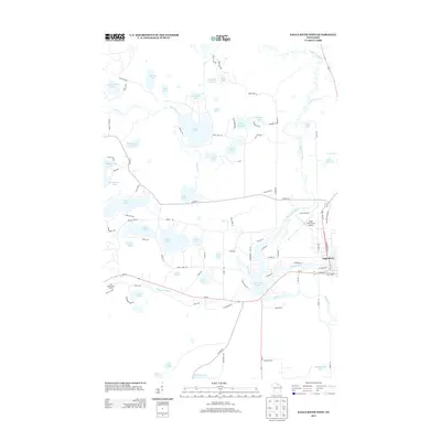
 2022 Eagle River West2022 Print · USGSVilas County's lake-rich landscape is captured here in the early twenty-first century as Eagle River remains the region's focal point. Researchers can trace the development of the Wisconsin River corridor and identify family landmarks near Hunter Lake, Boot Lake, and the Eagle River Union Airport.
 - 2022 Map of Saint Germain, 2022 Print
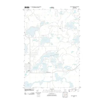
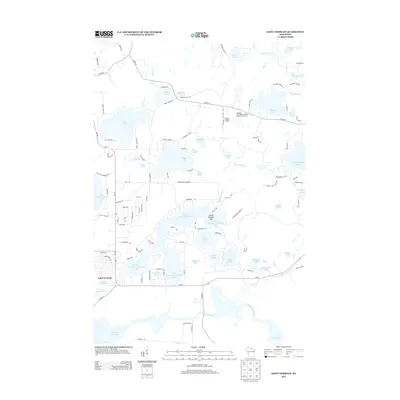
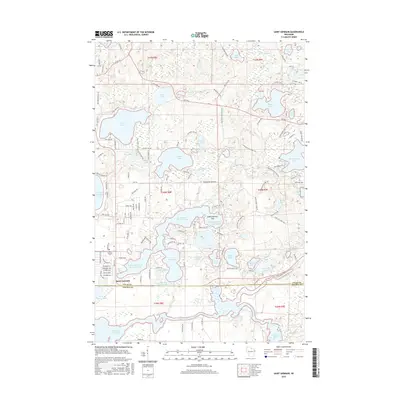
 2022 Saint Germain2022 Print · USGSSaint Germain and the surrounding Northwoods lake country appear here in the early twenty-first century, showcasing a landscape defined by glacial waters. Researchers can trace the town's layout near Saint Germain Cemetery or explore the complex shores of Big Saint Germain and Little Saint Germain Lake.
End of results
Showing maps 1-18 of 18
Top cities near Cloverland
- Newbold historical maps
- Three Lakes historical maps
- Sugar Camp historical maps
- Washington historical maps
- Eagle River historical maps
- Phelps historical maps
See more
Frequently asked questions
- What are the different types of historical maps available for Cloverland?
- What is the oldest map of Cloverland?
- Where can I purchase historical maps of Cloverland for my home or office?
- Where can I download high-res historical maps of Cloverland?
- Are there historical topographic maps available for Cloverland?
- Is there historical aerial imagery available for Cloverland?
- Where are historical maps of Cloverland sourced from?