2020s Maps of Presque Isle, Wisconsin
Explore 5 historic maps of Presque Isle from the 2020s. These maps offer a rare glimpse into what life looked like during the 2020s — showing old roads, neighborhoods, homes, and landmarks that have changed or disappeared over time.
Whether you're researching your family's past, planning a metal detecting trip, or studying how Presque Isle's landscape evolved across the 2020s, these high-resolution maps are a powerful tool for exploring the history of this region.
- Focus on a specific era: All maps on this page are from the 2020s, giving you a focused view of this time period.
- See what’s changed: Compare century-old streets, trails, and buildings to today's modern landscape using overlays and satellite layers.
- Research with precision: Use these maps for genealogy, historical research, land use analysis, or educational projects.
- View, download, or print: Maps are fully viewable online in high resolution, and can be downloaded or printed for your own records.
Start exploring Presque Isle's history through authentic maps from the 2020s. This is your window into the past.
Presque Isle, WI maps
(5)- 2022 Map of Tenderfoot Lake, 2022 Print
 2022 Tenderfoot Lake2022 Print · USGSThe Wisconsin-Michigan border country near the turn of the 2020s is a landscape of glacial waters and protected timberlands. Genealogists and historians can trace shoreline developments and forest access roads around Tenderfoot Lake, Plum Lake, and High Lake.
 - 2022 Map of Presque Isle, 2022 Print
 2022 Presque Isle2022 Print · USGSWisconsin's lake country along the Michigan border is seen here in recent years, showing a landscape saturated with water and forest. Genealogists and historians can trace shoreline developments around Annabelle Lake, Armour Lake, and the local Presque Isle community.
 - 2022 Map of Harris Lake, 2022 Print
 2022 Harris Lake2022 Print · USGSThe Northwoods along the Wisconsin-Michigan border are documented here in their modern state, centered on the protected wilderness of the Ottawa National Forest. Researchers and outdoorsmen can trace remote access points along Fisher Rd and identify the numerous glacial basins like Harris Lake and Twin Pups Lakes.
 - 2022 Map of Papoose Lake, 2022 Print
 2022 Papoose Lake2022 Print · USGSThe lake country of Vilas County comes into sharp focus here, showing the dense network of waterways and early twentieth-century road systems. Researchers can locate the Winchester Memorial Cem, trace the banks of Papoose Lake, or follow the Presque Isle River as it winds north.
 - 2023 Map of Stateline Lake, 2023 Print
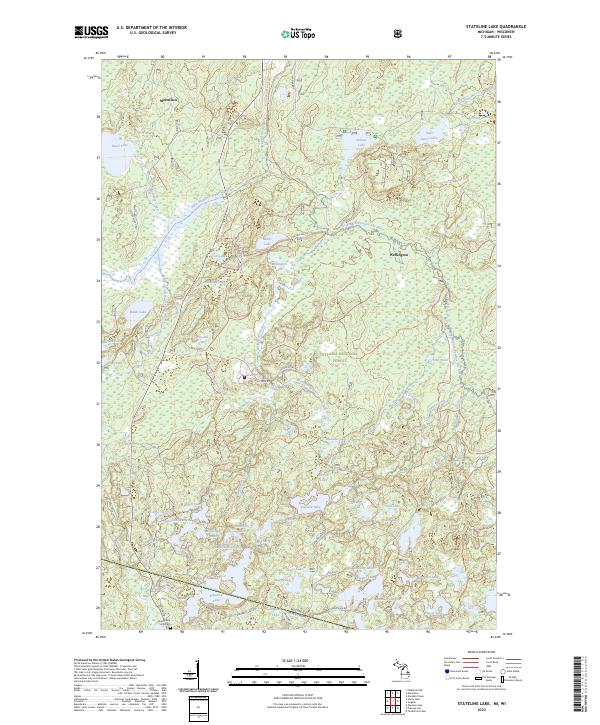 2023 Stateline Lake2023 Print · USGSThe Michigan-Wisconsin borderlands come alive in this survey of the Ottawa National Forest and Stateline Lake. Local historians can trace the roads around Marenisco or find the Shanty Boy Hill Cem near the state line.
End of results
Showing maps 1-5 of 5
Top cities near Presque Isle
- Lac du Flambeau historical maps
- Marenisco historical maps
- Boulder Junction historical maps
- Manitowish Waters historical maps
- Winchester historical maps
Top neighborhoods of Presque Isle
Frequently asked questions
- What are the different types of historical maps available for Presque Isle?
- What is the oldest map of Presque Isle?
- Where can I purchase historical maps of Presque Isle for my home or office?
- Where can I download high-res historical maps of Presque Isle?
- Are there historical topographic maps available for Presque Isle?
- Is there historical aerial imagery available for Presque Isle?
- Where are historical maps of Presque Isle sourced from?