2020s Maps of Birchwood, Wisconsin
Explore 4 historic maps of Birchwood from the 2020s. These maps offer a rare glimpse into what life looked like during the 2020s — showing old roads, neighborhoods, homes, and landmarks that have changed or disappeared over time.
Whether you're researching your family's past, planning a metal detecting trip, or studying how Birchwood's landscape evolved across the 2020s, these high-resolution maps are a powerful tool for exploring the history of this region.
- Focus on a specific era: All maps on this page are from the 2020s, giving you a focused view of this time period.
- See what’s changed: Compare century-old streets, trails, and buildings to today's modern landscape using overlays and satellite layers.
- Research with precision: Use these maps for genealogy, historical research, land use analysis, or educational projects.
- View, download, or print: Maps are fully viewable online in high resolution, and can be downloaded or printed for your own records.
Start exploring Birchwood's history through authentic maps from the 2020s. This is your window into the past.
Birchwood, WI maps
(4)- 2022 Map of Birchwood, 2022 Print
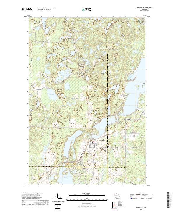 2022 Birchwood2022 Print · USGSThe village of Birchwood and its surrounding lake country are shown at the intersection of four counties in the 2020s. Researchers can locate Woodlawn Cem, trace the Tuscobia State Trl, and explore the shorelines of Lake Chetac and Red Cedar Lake.
 - 2022 Map of Nobleton, 2022 Print
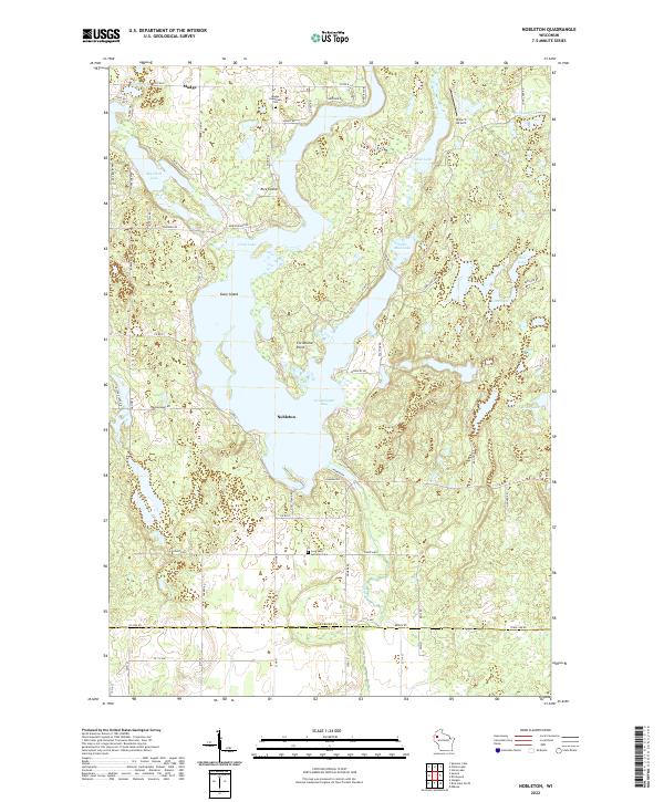 2022 Nobleton2022 Print · USGSWashburn County's lake district is shown here in the 2020s, centered on the intricate shoreline of Long Lake. Researchers can trace local heritage through the Madge Evergreen Cem, the Abandoned RR, and landmarks like Christiana Point.
 - 2022 Map of Potato Lake, 2022 Print
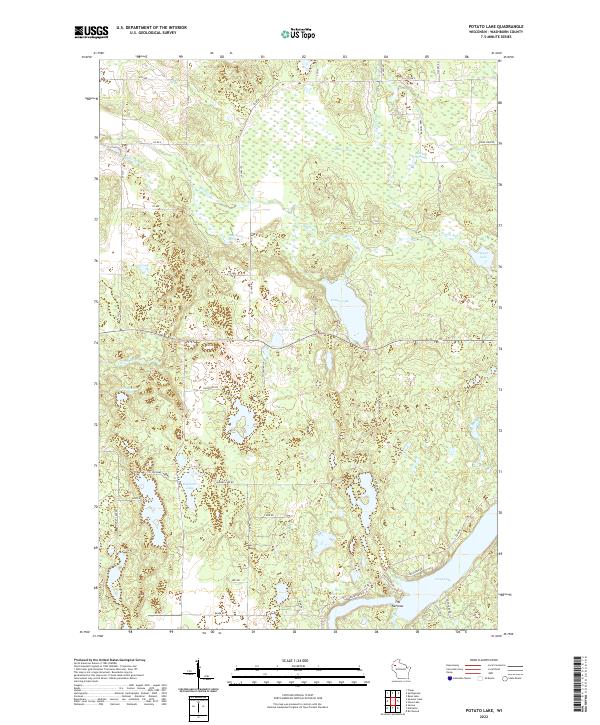 2022 Potato Lake2022 Print · USGSWashburn County's lake country is captured here in the early twenty-first century, showing a landscape defined by water and woods. Genealogists and local historians can trace lakeside properties and family landmarks like Mackay Springs, Westenberg Spring, and The Narrows.
 - 2022 Map of Stone Lake, 2022 Print
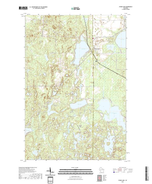 2022 Stone Lake2022 Print · USGSWashburn and Sawyer counties meet at the village of Stone Lake in this recent survey of the Wisconsin lake country. Researchers can trace family-named roads and remote landmarks like Evergreen Cem and Lakewood Lodge Airport.
End of results
Showing maps 1-4 of 4
Top cities near Birchwood
- Rice Lake historical maps
- Trego historical maps
- Beaver Brook historical maps
- Edgewater historical maps
- Springbrook historical maps
- Birchwood historical maps
See more
Top neighborhoods of Birchwood
Frequently asked questions
- What are the different types of historical maps available for Birchwood?
- What is the oldest map of Birchwood?
- Where can I purchase historical maps of Birchwood for my home or office?
- Where can I download high-res historical maps of Birchwood?
- Are there historical topographic maps available for Birchwood?
- Is there historical aerial imagery available for Birchwood?
- Where are historical maps of Birchwood sourced from?