1910s Maps of Aurora, Wisconsin
Explore 4 historic maps of Aurora from the 1910s. These maps offer a rare glimpse into what life looked like during the 1910s — showing old roads, neighborhoods, homes, and landmarks that have changed or disappeared over time.
Whether you're researching your family's past, planning a metal detecting trip, or studying how Aurora's landscape evolved across the 1910s, these high-resolution maps are a powerful tool for exploring the history of this region.
- Focus on a specific era: All maps on this page are from the 1910s, giving you a focused view of this time period.
- See what’s changed: Compare century-old streets, trails, and buildings to today's modern landscape using overlays and satellite layers.
- Research with precision: Use these maps for genealogy, historical research, land use analysis, or educational projects.
- View, download, or print: Maps are fully viewable online in high resolution, and can be downloaded or printed for your own records.
Start exploring Aurora's history through authentic maps from the 1910s. This is your window into the past.
Aurora, WI maps
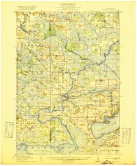
(4)- 1915 Map of Neshkoro
 1915 Neshkoro1915 Print · USGSCentral Wisconsin at the height of the river-and-rail era shows a network of locks and rural schoolhouses. Trace the early layouts of Princeton and Neshkoro, or locate landmarks like White River Lock and Puckaway Lake.
 - 1916 Map of Ripon
 1916 Ripon1916 Print · USGSWisconsin’s Fox River Valley and the lakelands of Fond du Lac and Winnebago counties are captured here just before the close of the Great War. Genealogists can trace family roots through dozens of rural landmarks, from Center House to Fera School and the Eureka Lock.
 - 1918 Map of Neshkoro
 1918 Neshkoro1918 Print · USGSThe Fox River valley and its complex lock system are recorded here during a period of active river and rail commerce. Genealogists can locate numerous rural schoolhouses and vanished rail stops near Princeton, Neshkoro, and the White River Lock.3 unique versions available
 - 1918 Map of Ripon
 1918 Ripon1918 Print · USGSFond du Lac and Green Lake counties are shown here at the end of the Great War, when the rail lines still dictated the pace of commerce. Researchers can trace the early boundaries of Berlin and Ripon or locate rural landmarks like the Arcade School and Koro.
End of results
Showing maps 1-4 of 4
Top cities near Aurora
- Ripon historical maps
- City of Berlin historical maps
- Berlin historical maps
- Omro historical maps
- Dale historical maps
- Winneconne historical maps
See more
Top neighborhoods of Aurora
Frequently asked questions
- What are the different types of historical maps available for Aurora?
- What is the oldest map of Aurora?
- Where can I purchase historical maps of Aurora for my home or office?
- Where can I download high-res historical maps of Aurora?
- Are there historical topographic maps available for Aurora?
- Is there historical aerial imagery available for Aurora?
- Where are historical maps of Aurora sourced from?