1900s (20th Century) Maps of Frannie, Wyoming
Explore 6 historic maps of Frannie from the 1900s (20th Century). These maps offer a rare glimpse into what life looked like during the 1900s — showing old roads, neighborhoods, homes, and landmarks that have changed or disappeared over time.
Whether you're researching your family's past, planning a metal detecting trip, or studying how Frannie's landscape evolved across the 1900s, these high-resolution maps are a powerful tool for exploring the history of this region.
- Focus on a specific era: All maps on this page are from the 1900s, giving you a focused view of this time period.
- See what’s changed: Compare century-old streets, trails, and buildings to today's modern landscape using overlays and satellite layers.
- Research with precision: Use these maps for genealogy, historical research, land use analysis, or educational projects.
- View, download, or print: Maps are fully viewable online in high resolution, and can be downloaded or printed for your own records.
Start exploring Frannie's history through authentic maps from the 1900s. This is your window into the past.
Frannie, WY maps
(6)- 1955 Map of Cody, 1969 Print
 1955 Cody1969 Print · USGSThe Bighorn Basin and Absaroka Range meet in the mid-fifties, capturing a landscape defined by mountain wilderness and burgeoning oil fields. Trace family roots in Cody or Meeteetse, and locate industrial landmarks like the Elk Basin Oil and Gas Field and the Chicago Burlington and Quincy RR.2 unique versions available
 - 1958 Map of Cody
 1958 Cody1958 Print · USGSNorthwestern Wyoming at the peak of the mid-century energy and ranching boom shows a land of high peaks and oil basins. Researchers can trace the Chicago Burlington and Quincy rail lines through Greybull or locate the sprawling Elk Basin Oil and Gas Field.
 - 1962 Map of Cody
 1962 Cody1962 Print · USGSBig Horn Basin energy and agriculture define this mid-century look at Wyoming’s northern frontier. Local historians can trace the irrigation and rail networks connecting Cody and Powell to major energy sites like the Oregon Basin Oil Field.
 - 1966 Map of Frannie, 1969 Print
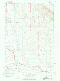 1966 Frannie1969 Print · USGSThe northern Bighorn Basin comes into sharp focus in the 1960s as a hub of irrigation and rail transport. Genealogists and local historians can trace the development of Deaver and Frannie along the Chicago Burlington and Quincy railroad line.
 - 1966 Map of Deaver Reservoir, 1969 Print
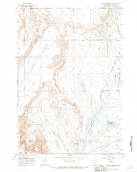 1966 Deaver Reservoir1969 Print · USGSThe Montana-Wyoming border was a hub of energy and irrigation in the mid-sixties, dominated by the rise of Polecat Bench. Researchers can trace the industrial footprint of the Frannie Oil Field, the rail lines of the Chicago Burlington and Quincy, and the waters of Deaver Reservoir.2 unique versions available
 - 1980 Map of Powell, 1982 Print
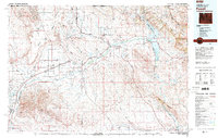 1980 Powell1982 Print · USGSThe Bighorn Basin in the 1980s shows a landscape where irrigation and rail transformed the high desert near the Montana border. Researchers can trace the path of the Burlington Northern line through historic stops like Garland, Frannie, and Deaver.
End of results
Showing maps 1-6 of 6
Top cities near Frannie
- Powell historical maps
- Lovell historical maps
- Cowley historical maps
- Byron historical maps
- Deaver historical maps
Frequently asked questions
- What are the different types of historical maps available for Frannie?
- What is the oldest map of Frannie?
- Where can I purchase historical maps of Frannie for my home or office?
- Where can I download high-res historical maps of Frannie?
- Are there historical topographic maps available for Frannie?
- Is there historical aerial imagery available for Frannie?
- Where are historical maps of Frannie sourced from?