Old Maps of South Flat, Wyoming
Explore 11 old maps of South Flat, spanning from 1945 to today. These high-resolution historic maps reveal how streets, neighborhoods, landmarks, and natural features evolved over time — perfect for genealogy, metal detecting, research, and local history exploration.
What you can do with these maps:
- See how South Flat changed over time: Compare historical maps to modern-day views to trace roads, homesites, rail lines & more.
- View detailed metadata: Each map includes creators, publishers, year, scale, and archive source.
- Overlay maps with satellite & LiDAR: Visualize the past alongside modern tools to explore terrain & human change.
- Trusted historical sources: Maps sourced from the USGS, Library of Congress, and other archives.
- Access maps your way: View online, download high-res files, or order prints for personal or research use.
Start exploring old maps of South Flat to uncover forgotten places, hidden landmarks, and the deep history beneath your feet.
South Flat, WY maps
(11)- 1945 Map of Kirby, 1958 Print
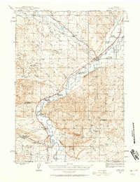 1945 Kirby1958 Print · USGSThe Bighorn River valley in the mid-1940s shows a region transitioning from its peak coal-mining years. Genealogists and historians can trace defunct operations like Crosby Mine, rail stops at Chatham Sta, and old frontier landmarks like The Willows (Old Stage Sta).2 unique versions available
 - 1946 Map of Kirby
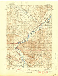 1946 Kirby1946 Print · USGSThe Bighorn River valley in the mid-1940s reveals a transition from active coal extraction to a rail-and-ranching economy. Researchers can locate the remnants of the Crosby Mine, the site of The Willows (Old Stage Sta), and the settlement of Gebo.
 - 1955 Map of Thermopolis, 1969 Print
 1955 Thermopolis1969 Print · USGSMid-century Wyoming comes alive in this survey of the Wind River basin and the high Absaroka peaks. Trace the roots of oil and water development through the Hamilton Dome Oil Field and the Boysen Reservoir, or locate local landmarks like the Wyoming Industrial Institute and St. Stephens.2 unique versions available
 - 1958 Map of Thermopolis
 1958 Thermopolis1958 Print · USGSThe Bighorn Basin and Wind River Reservation are shown here in the late fifties, during a period of significant petroleum and agricultural growth. Genealogists and historians can trace rail-towns like Gebo, energy hubs like the Hamilton Dome Oil Field, and the layout of Fort Washakie.2 unique versions available
 - 1962 Map of Thermopolis
 1962 Thermopolis1962 Print · USGSThe Wind River and Bighorn basins are meticulously mapped in the early sixties, showing the vital irrigation and rail networks of the era. Genealogists and historians can locate specific landmarks like the Duncan Ranch School, the Wyoming Industrial Institute, and the Hamilton Dome oil field.
 - 1981 Map of Thermopolis, 1982 Print
 1981 Thermopolis1982 Print · USGSCentral Wyoming in the early eighties shows a landscape of geothermal wonders and energy extraction. Trace the legacy of early settlements and industry near Hot Springs State Park, the rail lines of the Burlington Northern, and outposts like Gebo and Hamilton Dome.
 - 1985 Map of Neiber
 1985 Neiber1985 Print · USGSWashakie County agriculture and irrigation are central to this mid-eighties survey of the Bighorn basin. Researchers can trace the water systems of the Hanover Canal and South Flat Ditch alongside settlements like Neiber and Mc Nuttville.
 - 2012 Map of Neiber, 2012 Print
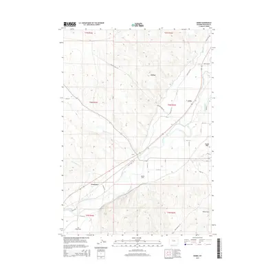
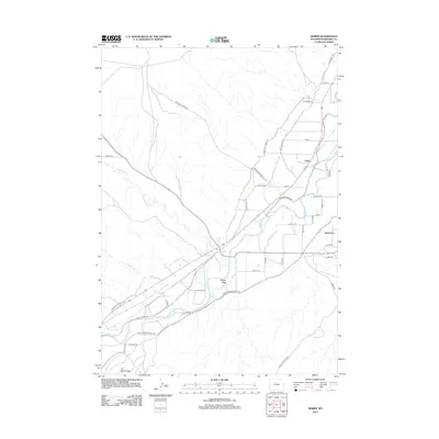 2012 Neiber2012 Print · USGSCovers South Flat, including Colter, Washakie County, and other nearby areas
 - 2015 Map of Neiber, 2015 Print
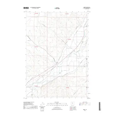
 2015 Neiber2015 Print · USGSCovers South Flat, including Colter, Washakie County, and other nearby areas
 - 2018 Map of Neiber, 2018 Print
 2018 Neiber2018 Print · USGSCovers South Flat, including Colter, Washakie County, and other nearby areas
 - 2021 Map of Neiber, 2021 Print
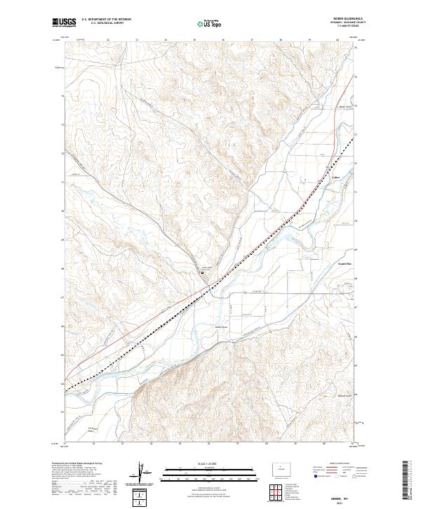 2021 Neiber2021 Print · USGSThe Bighorn River valley reveals its irrigation history in this recent survey of Washakie County. Researchers can trace the legacy of early settlements near the Neiber Ghost Town Cem and follow the paths of the Big Horn Canal and Upper Hanover Canal.
End of results
Showing maps 1-11 of 11
Top cities near South Flat
Frequently asked questions
- What are the different types of historical maps available for South Flat?
- What is the oldest map of South Flat?
- Where can I purchase historical maps of South Flat for my home or office?
- Where can I download high-res historical maps of South Flat?
- Are there historical topographic maps available for South Flat?
- Is there historical aerial imagery available for South Flat?
- Where are historical maps of South Flat sourced from?