Old Maps of Washakie County, Wyoming
Explore 155 old maps of Washakie County, spanning from 1899 to today. These high-resolution historic maps reveal how streets, neighborhoods, landmarks, and natural features evolved over time — perfect for genealogy, metal detecting, research, and local history exploration.
What you can do with these maps:
- See how Washakie County changed over time: Compare historical maps to modern-day views to trace roads, homesites, rail lines & more.
- View detailed metadata: Each map includes creators, publishers, year, scale, and archive source.
- Overlay maps with satellite & LiDAR: Visualize the past alongside modern tools to explore terrain & human change.
- Trusted historical sources: Maps sourced from the USGS, Library of Congress, and other archives.
- Access maps your way: View online, download high-res files, or order prints for personal or research use.
Start exploring old maps of Washakie County to uncover forgotten places, hidden landmarks, and the deep history beneath your feet.
Washakie County, WY maps
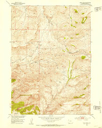
(155)- 1899 Map of Cloud peak, 1960 Print
 1899 Cloud peak1960 Print · USGSThe high wilderness of the Big Horn Mountains is captured here at the end of the century, showing the remote crest and early county boundaries. Hikers and historians can trace the paths to Lake Helen, the outposts at Soldier Park, and the heights of Cloud Pk.
 - 1901 Map of Cloud Peak
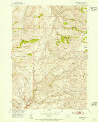
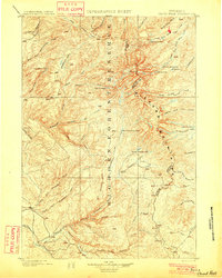 1901 Cloud Peak1901 Print · USGSThe high alpine country of the Big Horn range is captured here at the turn of the century just after its designation as a Forest Reserve. Researchers can trace the rugged headwaters of the Powder River and find remote landmarks like Lake Solitude, Black Butte, and Cloud Peak Lake.7 unique versions available
 - 1914 Map of Blue Mesa, 1975 Print
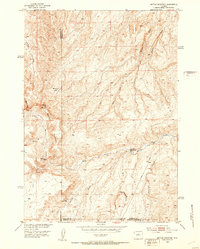
 1914 Blue Mesa1975 Print · USGSHot Springs and Washakie Counties are documented here shortly after the turn of the century, showing a remote landscape defined by its vital water sources. Researchers can trace the paths of Cottonwood Creek and Grass Creek, or locate Keg Spring and Harris Spring among the draws of Blue Mesa.
 - 1916 Map of Blue Mesa
 1916 Blue Mesa1916 Print · USGSHot Springs and Washakie counties are captured here just before the Great War, showing a network of high-desert drainages and cattle country. Trace early water sources like Harris Spring, Ivy Spring, and the winding Grass Creek through the Blue Mesa landscape.2 unique versions available
 - 1945 Map of Kirby, 1958 Print
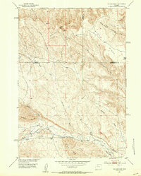
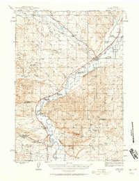 1945 Kirby1958 Print · USGSThe Bighorn River valley in the mid-1940s shows a region transitioning from its peak coal-mining years. Genealogists and historians can trace defunct operations like Crosby Mine, rail stops at Chatham Sta, and old frontier landmarks like The Willows (Old Stage Sta).2 unique versions available
 - 1946 Map of Kirby
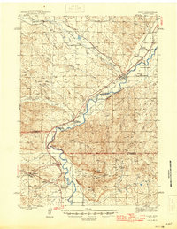 1946 Kirby1946 Print · USGSThe Bighorn River valley in the mid-1940s reveals a transition from active coal extraction to a rail-and-ranching economy. Researchers can locate the remnants of the Crosby Mine, the site of The Willows (Old Stage Sta), and the settlement of Gebo.
 - 1951 Map of Sucker Dam, 1952 Print
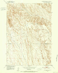
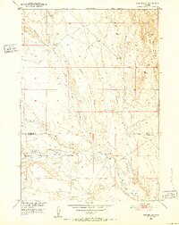 1951 Sucker Dam1952 Print · USGSBig Horn and Washakie counties are shown in the early fifties during a period of Missouri River Basin development. Researchers can locate family-named landmarks like the Rex Mueller Cabin (Aban'd) and the namesake Sucker Dam.2 unique versions available
 - 1951 Map of Schuster Flats NE, 1952 Print
 1951 Schuster Flats NE1952 Print · USGSBig Horn and Washakie counties meet in this drainage basin during the early fifties energy boom. Genealogists and historians can trace old trails and resource development through labeled Oil Well sites and local landmarks like Dobie Butte and Alamo Creek.3 unique versions available
 - 1951 Map of Dutch Nick Flat, 1952 Print
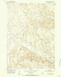
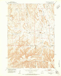
 1951 Dutch Nick Flat1952 Print · USGSThe high desert ranching country of Washakie County is captured here in the early fifties, centering on the vital irrigation network of Dutch Nick Flat. Genealogists and local historians can locate the Shryack School and trace historic water rights through the Holder Ditch and Peterson Ditch.2 unique versions available
 - 1951 Map of Schuster Flats, 1952 Print
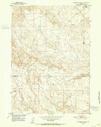
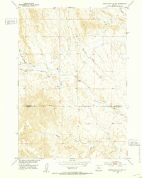
 1951 Schuster Flats1952 Print · USGSWashakie County at the start of the 1950s reveals a high-desert landscape being shaped by early irrigation and utility corridors. Researchers can trace historic water management at Holland Ditch or locate remote landmarks like Murdoch Cabin and Red Hill.2 unique versions available
 - 1951 Map of Schuster Flats NW, 1952 Print
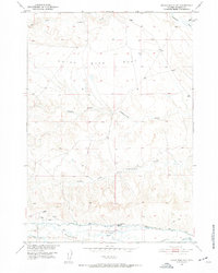
 1951 Schuster Flats NW1952 Print · USGSThe arid lands of the Bighorn Basin are captured here in the early fifties, straddling the Big Horn Co and Washakie Co line. Researchers can trace the intricate drainages of Fivemile Creek and the landmark Red Butte.2 unique versions available
 - 1951 Map of Dutch Nick Flat SW, 1953 Print
 1951 Dutch Nick Flat SW1953 Print · USGSThe Bighorn Basin badlands come into focus in the early fifties, documenting a landscape of isolated ranching and water management. Researchers can trace the development of irrigation at Steele Ditch and Perkins Ditch near the old Steele School.2 unique versions available
 - 1951 Map of Gillies Draw, 1953 Print
 1951 Gillies Draw1953 Print · USGSHot Springs and Washakie Counties are mapped here in the early fifties, documenting a landscape shaped by water rights and high-desert terrain. Researchers can trace historical irrigation systems like the Quartz Pipe Line Ditch and the Murphy Ditch (Abandoned).2 unique versions available
 - 1951 Map of Schuster Flats SE, 1953 Print
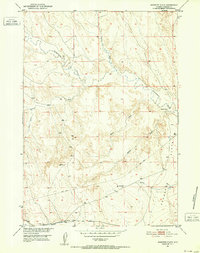
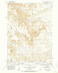
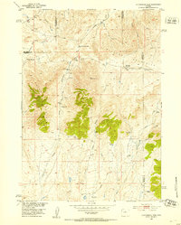
 1951 Schuster Flats SE1953 Print · USGSThe high basin of Washakie County comes into focus in the early 1950s, showing a landscape defined by critical water infrastructure and grazing lands. Genealogists and historians can trace the paths of Big Horn Canal and find landmarks like Schuster Flats and the Fifteenmile Siphon.3 unique versions available
 - 1951 Map of Dead Indian Hill, 1953 Print
 1951 Dead Indian Hill1953 Print · USGSThe high grazing lands of Park and Big Horn Counties are captured here in the early fifties, showing a remote landscape of canyons and livestock bedgrounds. Researchers can locate specific family landmarks and homesteads like the Mc Donald Cabins, Johnson Cabin, and the Sales Place.2 unique versions available
 - 1951 Map of Dutch Nick Flat NW, 1953 Print
 1951 Dutch Nick Flat NW1953 Print · USGSThe Big Horn Basin rangeland is captured here in the early fifties, showing a landscape defined by seasonal watercourses and remote ranching outposts. Researchers can trace the path of Fenton Pass Road and locate landmarks like Mueller Cabin or Rock Waterhole Creek.2 unique versions available
 - 1952 Map of Cottonwood Pass, 1953 Print
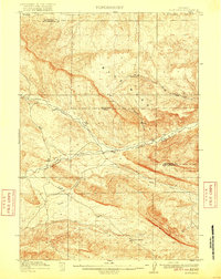
 1952 Cottonwood Pass1953 Print · USGSHigh Wyoming rangeland at the junction of Fremont, Hot Springs, and Natrona counties shows a landscape of remote homesteading in the early fifties. Researchers can trace family sites like Nichols Ranch and Britain Ranch or locate the deserted McWilliams Homestead near Cottonwood Pass.3 unique versions available
 - 1952 Map of Grave Spring, 1953 Print
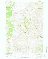 1952 Grave Spring1953 Print · USGSThe Bighorn Mountains meet the headwaters of the Powder River during the early fifties, documenting a landscape defined by livestock trails and mountain springs. Researchers can trace the forks of the North Fork Powder River and find landmarks like Grave Spring and Pearce.
 - 1952 Map of Sioux Pass, 1953 Print
 1952 Sioux Pass1953 Print · USGSHigh in the Wyoming backcountry during the early fifties, this area shows the livestock and transit routes of the eastern Big Horns. Genealogists and historians can trace the Bighorn Trail, locate the Welby Ranch, and identify landmarks like Sioux Pass.2 unique versions available
 - 1952 Map of Badwater NE, 1954 Print
 1952 Badwater NE1954 Print · USGSThe Bighorn Mountains of Natrona County are shown here in the early fifties, capturing a landscape defined by high-altitude ranching and livestock trails. Researchers can trace remote mountain life through named outposts like Balkett Cabin and Bishop Cabin or follow the historic Bighorn Trail.2 unique versions available
 - 1952 Map of Battle Mountain, 1954 Print
 1952 Battle Mountain1954 Print · USGSThe high plains of the Bighorn Basin are captured here in the early fifties, documenting a landscape of isolated ranching outposts and historic sites. Genealogists and historians can trace family-named locations such as Rate Homestead and the Orchard Bates Creek Ranch, or locate the historic Bates Battlefield.2 unique versions available
 - 1955 Map of Cody, 1969 Print
 1955 Cody1969 Print · USGSThe Bighorn Basin and Absaroka Range meet in the mid-fifties, capturing a landscape defined by mountain wilderness and burgeoning oil fields. Trace family roots in Cody or Meeteetse, and locate industrial landmarks like the Elk Basin Oil and Gas Field and the Chicago Burlington and Quincy RR.2 unique versions available
 - 1955 Map of Thermopolis, 1969 Print
 1955 Thermopolis1969 Print · USGSMid-century Wyoming comes alive in this survey of the Wind River basin and the high Absaroka peaks. Trace the roots of oil and water development through the Hamilton Dome Oil Field and the Boysen Reservoir, or locate local landmarks like the Wyoming Industrial Institute and St. Stephens.2 unique versions available
 - 1955 Map of Sheridan, 1973 Print
 1955 Sheridan1973 Print · USGSThe Bighorn Mountains meet the Powder River Basin in the 1950s, a period when cattle ranching and coal mining defined the regional economy. Genealogists and historians can trace local landmarks like the Fort Mackenzie Veteran Hospital, the Monarch Coal Mine, and legacy operations such as the Beckton Stock Farm.2 unique versions available
 - 1955 Map of Arminto, 1976 Print
 1955 Arminto1976 Print · USGSCentral Wyoming at the mid-century shows a landscape of energy reserves and high-plains ranching. Genealogists and historians can trace the Burlington Northern line through Lost Cabin and the famed Teapot Dome Naval Petroleum Reserve No 3.2 unique versions available
Showing maps 1-25 of 155
Top cities of Washakie County
Frequently asked questions
- What are the different types of historical maps available for Washakie County?
- What is the oldest map of Washakie County?
- Where can I purchase historical maps of Washakie County for my home or office?
- Where can I download high-res historical maps of Washakie County?
- Are there historical topographic maps available for Washakie County?
- Is there historical aerial imagery available for Washakie County?
- Where are historical maps of Washakie County sourced from?