
1951 Map of Sucker Dam
USGS Topo · Published 1952About this map
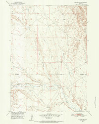
Fifteenmile Creek meanders across this High Plains landscape, marking the boundary between Big Horn Co and Washakie Co in north-central Wyoming. The 1951 field check reveals a network of intermittent drainages like Dry Cottonwood Creek and Reservoir Creek that define the local topography. Human presence is sparse, centered on the Sucker Dam and evidence of previous ranching or homesteading efforts. The notation of the Rex Mueller Cabin (Aban'd) near Timber Creek provides a specific point of interest for local historians, indicating a transition in land use or occupancy at the time of the survey. To the south, Crooked Creek and a simple Corral highlight the area's primary connection to livestock grazing within the Missouri River Basin development program.
Find a feature on this map
11 named features on this map. Tap any name to fly to it.
Don’t see what you’re looking for? This feature index may not catch every label — zoom into the map to look around manually.
Map Details
Editions of this 1951 Sucker Dam Map
2 editions found
Other maps of this area

1951 · Dutch Nick Flat
USGS Topo · 1:24,000

1951 · Schuster Flats
USGS Topo · 1:24,000

1951 · Schuster Flats NW
USGS Topo · 1:24,000

1951 · Dutch Nick Flat SW
USGS Topo · 1:24,000

1951 · Sheep Mountain
USGS Topo · 1:24,000

1951 · Wardel Reservoir
USGS Topo · 1:24,000

1951 · Dutch Nick Flat NW
USGS Topo · 1:24,000

1955 · Cody
USGS Topo · 1:250,000

1958 · Cody
USGS Topo · 1:250,000

1962 · Cody
USGS Topo · 1:250,000