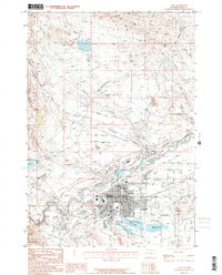
1958 Map of Cody
USGS Topo · Published 1958About this map
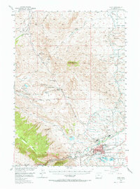
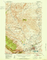
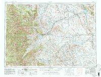
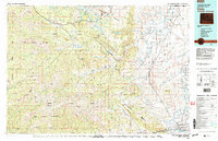
Cody serves as the gateway to the massive wilderness of the Absaroka Range and Shoshone National Forest in this mid-century portrait of northwestern Wyoming. The landscape is defined by the sharp contrast between the high peaks of the Beartooth Mountains and the developed irrigation and energy basins to the east. The Shoshone River flows from the Buffalo Bill Reservoir, supporting agricultural settlements like Powell and Ralston. This era was marked by significant energy production, visible in the extensive footprints of the Elk Basin Oil and Gas Field and Oregon Basin Oil and Gas Field, which drove the local economy alongside the Chicago Burlington and Quincy railroad. To the south, smaller ranching communities such as Meeteetse and Sunshine sit along the Greybull River, illustrating the distribution of cattle and sheep operations across the Tatman Mountain and Yu Bench terrain.
Find a feature on this map
66 named features on this map. Tap any name to fly to it.
Don’t see what you’re looking for? This feature index may not catch every label — zoom into the map to look around manually.
Map Details
Editions of this 1958 Cody Map
This is the sole edition of this map. No revisions or reprints were ever made.
Historical Maps of Cody Through Time
8 maps found