Old Maps of Park County, Wyoming
Explore 1,089 old maps of Park County, spanning from 1885 to today. These high-resolution historic maps reveal how streets, neighborhoods, landmarks, and natural features evolved over time — perfect for genealogy, metal detecting, research, and local history exploration.
What you can do with these maps:
- See how Park County changed over time: Compare historical maps to modern-day views to trace roads, homesites, rail lines & more.
- View detailed metadata: Each map includes creators, publishers, year, scale, and archive source.
- Overlay maps with satellite & LiDAR: Visualize the past alongside modern tools to explore terrain & human change.
- Trusted historical sources: Maps sourced from the USGS, Library of Congress, and other archives.
- Access maps your way: View online, download high-res files, or order prints for personal or research use.
Start exploring old maps of Park County to uncover forgotten places, hidden landmarks, and the deep history beneath your feet.
Park County, WY maps
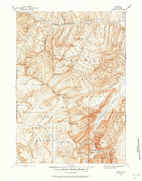
(1,089)- 1885 Map of Lake
 1885 Lake1885 Print · USGSThe high wilderness south of Yellowstone Lake is captured here in the mid-1880s, showcasing the intricate hydrology of the Continental Divide. Researchers can trace the unique split of Pacific Creek and Atlantic Creek at Two Ocean Pass or locate early landmark peaks like The Trident and Mt Stevenson.2 unique versions available
 - 1885 Map of Gallatin
 1885 Gallatin1885 Print · USGSNorthwestern Yellowstone in the 1880s remains a wild expanse of thermal basins and high peaks just as early visitors were beginning to arrive. Geologists and historians can trace the early footprint of Mammoth Hot Springs, the Norris Geyser Basin, and landmarks like Obsidian Cliff.
 - 1885 Map of Gallatin, 1886 Print
 1885 Gallatin1886 Print · USGSEarly park visitors and naturalists can trace the frontier-era geothermal landscape as it was first recorded in the mid-1880s. Identify original landmarks like the Hotel at Mammoth Hot Springs and the early topography of Norris Geyser Basin or Obsidian Cliff.2 unique versions available
 - 1886 Map of Canyon
 1886 Canyon1886 Print · USGSThe Grand Canyon of the Yellowstone area appears here in the late nineteenth century, just over a decade after the park's founding. Modern researchers can locate early landmarks like Yanceys, the Baronette Bridge, and the site of the Fossil Forest.
 - 1888 Map of Three Forks
 1888 Three Forks1888 Print · USGSSouthwestern Montana was a land of mining camps and river junctions in the late nineteenth century, as the railroad began to connect established valleys. Genealogists can trace family roots through pioneer settlements like Virginia City, Salesville, and Spring Hill, or locate early crossings at Barton's Bridge.
 - 1891 Map of Livingston
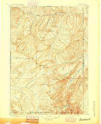
 1891 Livingston1891 Print · USGSUpper Yellowstone River country is documented here in the late nineteenth century as the railroad transformed the valley. Genealogists and historians can trace rail-stop towns like Cokedale, the military grounds at Ft. Ellis, and the Old Crow Agency.
 - 1893 Map of Livingston
 1893 Livingston1893 Print · USGSThe Montana mountain country and the gateway to the national park are captured here in the late nineteenth century. Trace the industrial rail corridor through Livingston to mining sites like Coke and the historic Old Crow Agency.5 unique versions available
 - 1893 Map of Ishawooa, 1962 Print
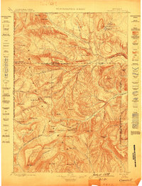
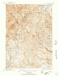
 1893 Ishawooa1962 Print · USGSPark County at the end of the nineteenth century remains a wilderness of mining camps and alpine plateaus along the boundary of the nation’s first park. Trace early exploration through the Stinkingwater Mining Region and over high points like Ishawooa Pass and the Thorofare Plateau.
 - 1894 Map of Three Forks
 1894 Three Forks1894 Print · USGSSouthwestern Montana thrives along the river forks and rail lines during the mid-1880s. Genealogists and historians can trace early town sites like Pony, Logan, and Salesville while locating river crossings such as Fly's Bridge and Shedds Bridge.
 - 1895 Map of Three Forks
 1895 Three Forks1895 Print · USGSSouthern Montana was a landscape of emerging rail towns and gold-country gulches during the mid-1890s. Genealogists and historians can trace the early footprints of Bozeman, locate Guns Ranch, and follow the Northern Pacific Railroad through Three Forks.5 unique versions available
 - 1895 Map of Ishawooa
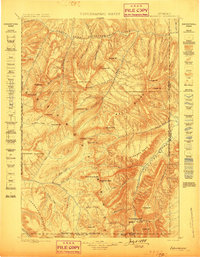
 1895 Ishawooa1895 Print · USGSThe Yellowstone backcountry of the 1890s appears as a rugged high-mountain frontier in this early survey of the Shoshone and Stinkingwater drainages. Researchers can trace early high-altitude routes through Ishawooa Pass and explore the historic Stinkingwater Mining Region.
 - 1895 Map of Canyon
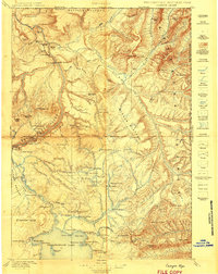
 1895 Canyon1895 Print · USGSYellowstone's early park architecture and geothermal wonders are captured here in the late nineteenth century. Trace early routes past the Baronett Bridge, the Hotel on the lake, and the storied settlement at Yanceys.
 - 1895 Map of Lake
 1895 Lake1895 Print · USGSSoutheastern Yellowstone was a wild frontier of high passes and glacial lakes in the 1890s. Trace the complex alpine terrain around Yellowstone Lake, the waters of Heart Lake, and notable peaks like Mt Stevenson or Eagle Peak.
 - 1896 Map of Lake
 1896 Lake1896 Print · USGSThe high wilderness of the Wyoming Rockies is captured here in the late nineteenth century, just years after the park's establishment. Researchers can trace the wild southern reaches of Yellowstone Lake and find remote landmarks like Hawks Rest, Bridger Lake, and Brimstone Basin.
 - 1896 Map of Canyon
 1896 Canyon1896 Print · USGSYellowstone National Park is documented in the mid-1890s, capturing the early landmarks and hydrothermal features of the canyon country. Trace the early outposts at Yanceys or the Hotel and locate thermal sites like Calcite Springs and the Fossil Forest.2 unique versions available
 - 1896 Map of Crandall Creek
 1896 Crandall Creek1896 Print · USGSThe high peaks of the Absaroka Range and the early Yellowstone frontier are captured in the 1890s. Trace the beginnings of the Sunlight Mining Region and identify landmarks like Beartooth Butte and Pilot Peak.
 - 1898 Map of Granite Mountain District
 1898 Granite Mountain District1898 Print · USGSThe Beartooth Range appears here in the late nineteenth century during a specialized survey for regional coal and electric companies. Researchers can trace early mountain pathways through Goose Lake Pass and locate major summits like Granite Peak and Mt Dewey.
 - 1899 Map of Crandall
 1899 Crandall1899 Print · USGSThe Absaroka mountains and northern park lands are captured here during the frontier mining era of the 1890s. Researchers can trace early claims in the Sunlight Mining Region and identify landmarks like Pilot Peak and Beartooth Butte.4 unique versions available
 - 1899 Map of Ishawooa
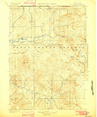
 1899 Ishawooa1899 Print · USGSThe Absaroka wilderness comes into sharp focus in the 1890s, revealing the high-mountain terrain bordering the eastern edge of Yellowstone. Researchers can trace early prospecting sites in the Stinkingwater Mining Region or locate landmarks like Ishawooa Pass and Sheep Mesa.4 unique versions available
 - 1901 Map of Canyon
 1901 Canyon1901 Print · USGSYellowstone's northeast wilderness appears at the dawn of the twentieth century, detailing the park's early infrastructure and raw geothermal wonders. Researchers can trace the original locations of Yanceys, Baronett Bridge, and unique curiosities like the Fossil Forest.
 - 1901 Map of Gallatin
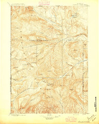
 1901 Gallatin1901 Print · USGSThe high plateau of the Yellowstone country appears here in the late nineteenth century, just as its hydrothermal wonders were becoming globally known. Researchers can locate early campsites and lodges near the Norris Geyser Basin, Obsidian Cliff, and Mammoth Hot Springs.
 - 1901 Map of Lake
 1901 Lake1901 Print · USGSYellowstone's wilderness at the dawn of the twentieth century is charted here through its complex alpine hydrography and high-altitude peaks. Researchers can trace early park boundaries and remote landmarks like Hawks Rest, Brimstone Basin, and Frank Island.
 - 1902 Map of Mt Leidy
 1902 Mt Leidy1902 Print · USGSTeton and Uinta counties are shown here at the turn of the century as a wilderness of forest reserves and high mountain passes. Researchers can trace early routes over the Continental Divide at Twogwotee Pass or locate the remote Dick Turpin Meadow.5 unique versions available
 - 1904 Map of Kirwin, 1957 Print
 1904 Kirwin1957 Print · USGSHigh-country mining and ranching define this region of the Absaroka Range at the turn of the century. Genealogists can trace family holdings like Double Diamond Ranch and Antler Ranch, or the high-altitude mining outpost at Kirwin.
 - 1905 Map of Younts Peak, 1955 Print
 1905 Younts Peak1955 Print · USGSThe upper Wind River valley and the Absaroka wilderness are captured here during the early ranching era. Local historians can trace the foundations of Dubois and locate early family homesteads like Rocking Chair Ranch, Nipper's Ranch, and the Clarks Placer Mines.2 unique versions available
Showing maps 1-25 of 1,089
Top cities of Park County
Frequently asked questions
- What are the different types of historical maps available for Park County?
- What is the oldest map of Park County?
- Where can I purchase historical maps of Park County for my home or office?
- Where can I download high-res historical maps of Park County?
- Are there historical topographic maps available for Park County?
- Is there historical aerial imagery available for Park County?
- Where are historical maps of Park County sourced from?