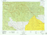
1970s Maps of Park County, Wyoming
Explore 20 historic maps of Park County from the 1970s. These maps offer a rare glimpse into what life looked like during the 1970s — showing old roads, neighborhoods, homes, and landmarks that have changed or disappeared over time.
Whether you're researching your family's past, planning a metal detecting trip, or studying how Park County's landscape evolved across the 1970s, these high-resolution maps are a powerful tool for exploring the history of this region.
- Focus on a specific era: All maps on this page are from the 1970s, giving you a focused view of this time period.
- See what’s changed: Compare century-old streets, trails, and buildings to today's modern landscape using overlays and satellite layers.
- Research with precision: Use these maps for genealogy, historical research, land use analysis, or educational projects.
- View, download, or print: Maps are fully viewable online in high resolution, and can be downloaded or printed for your own records.
Start exploring Park County's history through authentic maps from the 1970s. This is your window into the past.
Park County, WY maps
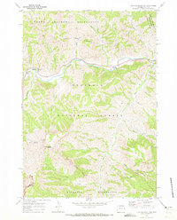
(20)- 1970 Map of Younts Peak, 1973 Print
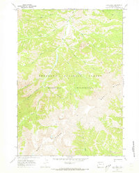
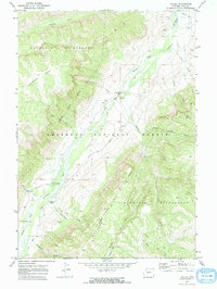
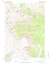 1970 Younts Peak1973 Print · USGSThe Absaroka Range in the early 1970s reveals a wilderness of high peaks and river headwaters where the Continental Divide splits the county lines. Trace historic travel routes over Marston Pass or follow the Pack Trail along the South Fork Yellowstone River.2 unique versions available
 - 1970 Map of Sheep Mesa, 1973 Print
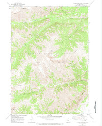
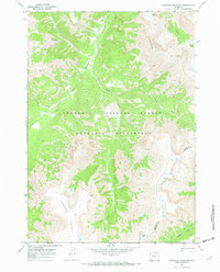
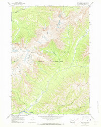
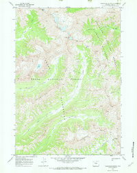
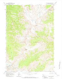 1970 Sheep Mesa1973 Print · USGSPark County, Wyoming, is captured in the early 1970s as a high-country wilderness before modern trail modifications. Researchers can trace historical routes like the FISHHAWK TRAIL and identify landmarks including Blackwater Natural Bridge and Battlement Mountain.
 - 1970 Map of Fall Creek, 1973 Print
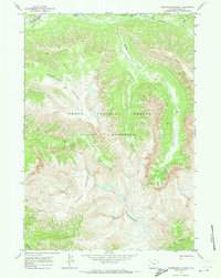
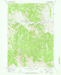
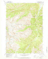 1970 Fall Creek1973 Print · USGSPark County at the start of the 1970s shows a high-country wilderness shaped by mining history and the South Fork Shoshone River. Researchers can trace the Stinkingwater Mining Region, the remote Majo Ranch, and miles of high-altitude pack trails.2 unique versions available
 - 1970 Map of Ptarmigan Mountain, 1973 Print
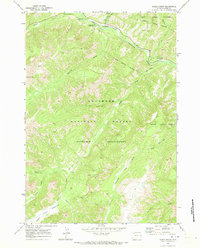
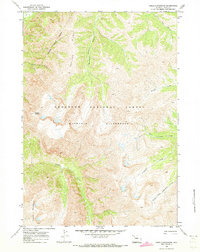
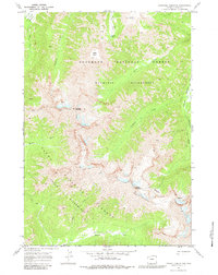
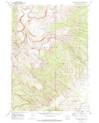 1970 Ptarmigan Mountain1973 Print · USGSThe high Absaroka backcountry of Park County is detailed here just as the wilderness protections were being formalized. Researchers and hikers can trace primitive routes like the Ishawooa Trail past Hardpan Lake and the towering peak of Ptarmigan Mountain.
 - 1970 Map of Chimney Rock, 1973 Print
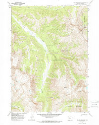
 1970 Chimney Rock1973 Print · USGSThe North Fork Shoshone River corridor is captured here in the early 1970s, showcasing the intersection of canyon travel and wilderness preservation. Map collectors and historians can trace routes along the Fire Memorial Trail (Pack) or locate landmarks like Buffalo Bill Camp and the Wayfarers Chapel.2 unique versions available
 - 1970 Map of Ferry Lake, 1973 Print
 1970 Ferry Lake1973 Print · USGSThe Continental Divide crosses the high Teton Wilderness in the early seventies, marking the rugged boundary between Park and Fremont counties. Backcountry travelers can trace the historic Lake Fork Trail past Lake Fork Falls to Ferry Lake 9930.
 - 1970 Map of Yellow Mountain, 1973 Print
 1970 Yellow Mountain1973 Print · USGSThe Wyoming backcountry in the early seventies remained a roadless frontier of high peaks and river forks. Trace the remote Thorofare Trail (Pack) past Yellow Mountain and the headwaters of the North Fork Yellowstone River.2 unique versions available
 - 1970 Map of Clouds Home Peak, 1973 Print
 1970 Clouds Home Peak1973 Print · USGSThe high Absaroka backcountry of Park County is captured in the early 1970s, showcasing a landscape of high summits and deep drainages. Follow the Pack Trail systems past Clouds Home Peak to remote landmarks like Gobblers Knob and the headwaters of Ishawooa Creek.2 unique versions available
 - 1970 Map of Clayton Mountain, 1973 Print
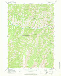
 1970 Clayton Mountain1973 Print · USGSPark County, Wyoming, during the early 1970s reveals a landscape of high wilderness peaks and managed forest lands along the river. Researchers can trace the routes of a Pack Trail or locate historical sites like Mummy Cave and the Firefighter Monument.
 - 1970 Map of Hardluck Mountain, 1973 Print
 1970 Hardluck Mountain1973 Print · USGSThe high country of Park County is mapped here in the 1970s, showcasing a landscape of primitive trails and wilderness. Trace traditional pack routes like the South Fork Trail (Pack) to landmarks such as Hardluck Mountain and Cougar Pass.2 unique versions available
 - 1970 Map of Thorofare Plateau, 1973 Print
 1970 Thorofare Plateau1973 Print · USGSTeton National Forest in the early seventies remained a primitive expanse of high plateaus and river headwaters. Researchers can trace the remote pack routes following Thorofare Creek and the North Fork Yellowstone River beneath the heights of Thunder Mountain.2 unique versions available
 - 1970 Map of Eagle Creek, 1973 Print
 1970 Eagle Creek1973 Print · USGSPark County at the start of the 1970s showcases a high-altitude landscape transitioning from early mining to mountain recreation. Researchers can trace the heritage of the Crouch Mine or locate historic campsites like Pahaska Campground and Eagle Creek Campground.2 unique versions available
 - 1970 Map of Lake Creek, 1973 Print
 1970 Lake Creek1973 Print · USGSPark County high country in the early seventies shows a wilderness landscape defined by the steep slopes of Wapiti Ridge. Trace the original Pack Trail through the Washakie Wilderness and along the waters of Elk Fork and Lake Creek.2 unique versions available
 - 1970 Map of Open Creek, 1973 Print
 1970 Open Creek1973 Print · USGSNorthwestern Wyoming's backcountry remains preserved in this early 1970s survey of the high-elevation wilderness. Backpackers and historians can trace the remote Pack Trail system along Thorofare Creek or locate landmarks like Petrified Ridge.2 unique versions available
 - 1970 Map of Flag Peak, 1973 Print
 1970 Flag Peak1973 Print · USGSThe North Fork Shoshone River valley in the early seventies served as a gateway to the high Absaroka backcountry. Researchers can locate remote outposts and family-named landmarks including the Wapiti Ranger Sta, Circle H Ranch, and the geological spires of Holy City.
 - 1970 Map of Needle Mountain, 1973 Print
 1970 Needle Mountain1973 Print · USGSPark County high country in the early seventies reveals a landscape almost entirely shaped by natural watercourses and narrow trails. Researchers can trace the primitive routes of the Boulder Basin Trail (Pack) and identify peaks like Crater Mountain and Venus.2 unique versions available
 - 1970 Map of Valley, 1973 Print
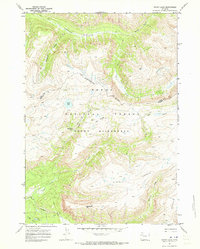
 1970 Valley1973 Print · USGSHigh-country life in the 1970s centered on the South Fork Shoshone River valley and its remote outposts. Genealogists and historians can trace the foundations of this mountain community through the Valley Sch, Valley Cem, and Hawkeye.2 unique versions available
 - 1970 Map of Thorofare Buttes, 1973 Print
 1970 Thorofare Buttes1973 Print · USGSPark County high country is documented here in the early 1970s, showing a vast wilderness of converging national forests and headwater creeks. You can trace early backcountry routes over Ishawooa Pass and Deer Creek Pass past landmarks like Petrified Ridge.2 unique versions available
 - 1970 Map of Pinnacle Mountain, 1983 Print
 1970 Pinnacle Mountain1983 Print · USGSPark County, Wyoming, is documented here in the early 1970s as a high-wilderness landscape where the Shoshone and Teton National Forests converge. Researchers can trace historic access routes along the Pack Trail through Glacier Basin and past Flora Lake.
 - 1978 Map of The Ramshorn, 1979 Print
 1978 The Ramshorn1979 Print · USGSHigh Wyoming mountain country during the late seventies centers on the junction at Dubois, where the Wind River carves through the landscape. Researchers can trace the high-country drainages of the Yellowstone River or locate remote landmarks like Kirwin and Brooks Lake.2 unique versions available
End of results
Showing maps 1-20 of 20
Top cities of Park County
Frequently asked questions
- What are the different types of historical maps available for Park County?
- What is the oldest map of Park County?
- Where can I purchase historical maps of Park County for my home or office?
- Where can I download high-res historical maps of Park County?
- Are there historical topographic maps available for Park County?
- Is there historical aerial imagery available for Park County?
- Where are historical maps of Park County sourced from?