1990s Maps of Park County, Wyoming
Explore 87 historic maps of Park County from the 1990s. These maps offer a rare glimpse into what life looked like during the 1990s — showing old roads, neighborhoods, homes, and landmarks that have changed or disappeared over time.
Whether you're researching your family's past, planning a metal detecting trip, or studying how Park County's landscape evolved across the 1990s, these high-resolution maps are a powerful tool for exploring the history of this region.
- Focus on a specific era: All maps on this page are from the 1990s, giving you a focused view of this time period.
- See what’s changed: Compare century-old streets, trails, and buildings to today's modern landscape using overlays and satellite layers.
- Research with precision: Use these maps for genealogy, historical research, land use analysis, or educational projects.
- View, download, or print: Maps are fully viewable online in high resolution, and can be downloaded or printed for your own records.
Start exploring Park County's history through authentic maps from the 1990s. This is your window into the past.
Park County, WY maps
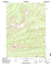
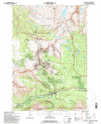
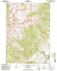
(87)- 1991 Map of Younts Peak
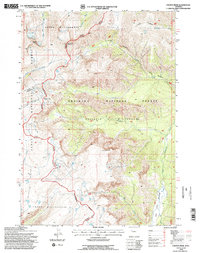 1991 Younts Peak1991 Print · USGSHigh-elevation wilderness in the 1990s marks the meeting point of three national forests along the Continental Divide. Trace the remote headwaters of the South Fork Yellowstone River and landmarks like Younts Peak.2 unique versions available
 - 1991 Map of Francs Peak, 1995 Print
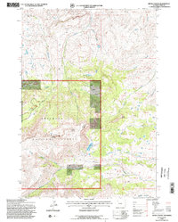
 1991 Francs Peak1995 Print · USGSMining activity in the Absaroka Range is captured here during the early nineties, centered on the high-elevation camp at Kirwin. Trace historical operations at the Gold Reef Tunnel, Anaconda Mine, and Muncie Tunnel.2 unique versions available
 - 1991 Map of Sylvan Lake, 1996 Print
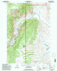
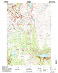
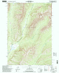
 1991 Sylvan Lake1996 Print · USGSYellowstone's backcountry peaks and geothermal basins are mapped here in the early nineties as the park environment was being carefully documented. Hikers and historians can trace the Thorofare Trail along the Southeast Arm Yellowstone Lake or locate remote Thermal Areas near Brimstone Basin.2 unique versions available
 - 1991 Map of Bald Peak, 1996 Print
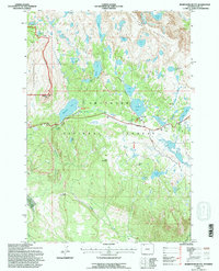
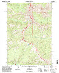
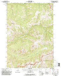
 1991 Bald Peak1996 Print · USGSThe Shoshone National Forest backcountry comes into focus in the early 1990s, where the Yellowstone River meets the rugged drainages of the Absaroka Range. Researchers can trace 4WD trails to Luce Reservoir, the high Bald Peak, and the unique Natural Corral.
 - 1991 Map of Beartooth Butte, 1996 Print
 1991 Beartooth Butte1996 Print · USGSThe high Wyoming backcountry of the early nineties is captured here, centered on the landmark Beartooth Butte. Trace the winding Beartooth Highway past Island Lake and identify numerous alpine waters like Paradise Lake and Beauty Lake.
 - 1991 Map of Clouds Home Peak, 1996 Print
 1991 Clouds Home Peak1996 Print · USGSThe Absaroka Range is captured here in the early nineties, showcasing the intersection of the Shoshone National Forest and Washakie Wilderness. Researchers can trace the watercourses of Ishawooa Creek and locate high-altitude landmarks like Kingfisher Peak.
 - 1991 Map of Dead Indian Peak, 1996 Print
 1991 Dead Indian Peak1996 Print · USGSThe Absaroka Range's high backcountry is documented in the early nineties, showing a landscape defined by the Shoshone National Forest. Trace the alpine drainages of Big Creek and Dead Indian Creek past Big Creek Falls and the summit of Trout Peak.
 - 1991 Map of Eagle Pass, 1996 Print
 1991 Eagle Pass1996 Print · USGSThe Absaroka Range interior is documented here in the early 1990s, where national park and forest boundaries converge. Hikers and researchers can trace the high-elevation Thorofare Trail as it passes Eagle Peak and crosses the rugged Eagle Pass.
 - 1991 Map of Cathedral Peak, 1996 Print
 1991 Cathedral Peak1996 Print · USGSThe high Absaroka Range is captured in the early 1990s as it spans the border of Yellowstone National Park and the North Absaroka Wilderness. Hikers and geologists can trace remote peaks like Cathedral Peak and Pyramid Peak or follow the alpine headwaters of Mist Creek and Jones Creek.
 - 1991 Map of Canoe Lake, 1996 Print
 1991 Canoe Lake1996 Print · USGSThe high boundary between Yellowstone and the Shoshone National Forest is captured here in the early nineties. Researchers can trace remote mountain routes like the Crandall Trail and find the secluded waters of Canoe Lake and Calfee Creek.
 - 1991 Map of Eagle Peak, 1996 Print
 1991 Eagle Peak1996 Print · USGSThe Absaroka Range high country in the early nineties is shown where Yellowstone National Park meets the Washakie Wilderness. Researchers can trace the remote Thorofare Trail and locate prominent summits like Eagle Peak and Mount Schurz.
 - 1991 Map of Aldrich Basin, 1996 Print
 1991 Aldrich Basin1996 Print · USGSPark County's high mountain territory is captured here in the early 1990s, illustrating the protected landscapes of the Shoshone National Forest. Researchers can trace the Wilderness Boundary and locate high-country features like Pines Pass and the remote Aldrich Basin.
 - 1991 Map of Cooke City, 1996 Print
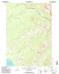
 1991 Cooke City1996 Print · USGSCooke City and Silver Gate sit at the gateway to the high peaks in the early nineties, documenting a landscape defined by mining history and massive wilderness tracts. Researchers can locate old mining works on Scotch Bonnet Mountain and trace the headwaters of the Yellowstone River near Colter Pass.
 - 1991 Map of Devils Tooth, 1996 Print
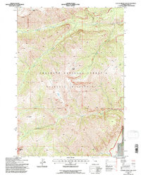
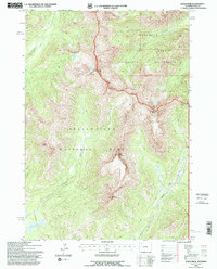
 1991 Devils Tooth1996 Print · USGSPark County high country comes into focus in the early nineties, centered on the heights of Carter Mountain. Researchers can trace the complex stream systems of Meeteetse Creek and find specific landmarks like Pete Miller Park and the sharp Devils Tooth peak.2 unique versions available
 - 1991 Map of Deep Lake, 1996 Print
 1991 Deep Lake1996 Print · USGSThe high country of the Shoshone National Forest is captured here in the early nineties, centered on the alpine plateau. Track high-altitude routes like the Beartooth Scenic Byway and remote landmarks like Sawtooth Mountain and Deep Lake.
 - 1991 Map of Pollux Peak, 1996 Print
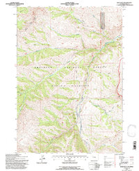
 1991 Pollux Peak1996 Print · USGSYellowstone and the North Absaroka Wilderness meet in the early 1990s at a high-elevation junction of rivers and peaks. Researchers can trace remote backcountry outposts like the Upper Lamar River Patrol Station and the geography of the Hoodoo Basin.
 - 1991 Map of Ptarmigan Mountain, 1996 Print
 1991 Ptarmigan Mountain1996 Print · USGSThe high Absaroka backcountry of Wyoming is captured here in the early 1990s, focusing on the wilderness tracts within the national forest. Researchers can trace the remote settlement at Ishawooa and follow the high-altitude drainages of Hardpan Creek and Ishawooa Creek.
 - 1991 Map of Abiathar Peak, 1996 Print
 1991 Abiathar Peak1996 Print · USGSYellowstone National Park in the early nineties features some of the most dramatic mountain terrain in the American West. Backcountry researchers can trace the course of Soda Butte Creek past Barronette Peak to the isolated Cache Creek Patrol Cabin.
 - 1991 Map of Wapiti, 1996 Print
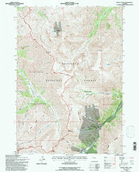
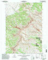
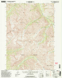
 1991 Wapiti1996 Print · USGSThe North Fork Shoshone River valley in the early nineties remained a vital corridor for high-country ranching and recreation. Researchers can locate family-named landmarks like Bradford Ranch and Dahlman Ranch alongside the settlement of Wapiti.2 unique versions available
 - 1991 Map of Irish Rock, 1997 Print
 1991 Irish Rock1997 Print · USGSHigh in the Absaroka Range during the early nineties, this area was a protected expanse of river valleys and steep timber. You can trace the Greybull River to the Venus Creek Cabin or follow the Warhouse Trail through the Shoshone National Forest.2 unique versions available
 - 1991 Map of Mount Burwell, 1997 Print
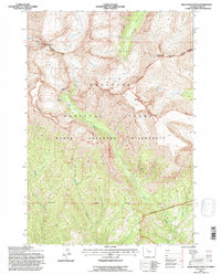
 1991 Mount Burwell1997 Print · USGSThe high Absaroka backcountry of Park County is captured here in the early 1990s, showcasing a landscape of protected wilderness and federal forest land. Researchers can trace the rugged headwaters of the Greybull River and locate remote landmarks like Mount Burwell and Burwell Pass.2 unique versions available
 - 1991 Map of Dick Creek Lakes, 1997 Print
 1991 Dick Creek Lakes1997 Print · USGSPark County's high mountain reaches are captured here in the early nineties as the Forest Service updated its terrain data. You can trace the Wood River past the Double D Ranch to remote landmarks like Dick Creek Lakes and Brown Mountain.
 - 1991 Map of Twin Peaks, 1997 Print
 1991 Twin Peaks1997 Print · USGSThe Absaroka Range in the early nineties is a place of deep wilderness and high summits at the meeting point of three Wyoming counties. Backcountry researchers can trace the historic boundaries of the Washakie Wilderness and Wind River Indian Reservation near Twin Peaks and Standard Peak.
 - 1991 Map of Elkhorn Peak, 1997 Print
 1991 Elkhorn Peak1997 Print · USGSPark County's high-country wilderness is documented here in the early nineties, showing a landscape defined by federal forest and wilderness management. Researchers can locate the Sunlight Ranger Station, the passage through Deweys Gateway, and the peaks around Elkhorn Peak.
 - 1991 Map of Logan Mountain, 1997 Print
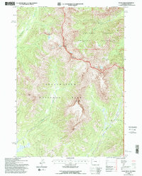
 1991 Logan Mountain1997 Print · USGSThe high country of Park County appears in the early nineties as a network of ridges and drainages within the Shoshone National Forest. Researchers can trace the steep geography of The Palisades or locate remote water sources like Trough Spring and Weber Creek.
Showing maps 1-25 of 87
Top cities of Park County
Frequently asked questions
- What are the different types of historical maps available for Park County?
- What is the oldest map of Park County?
- Where can I purchase historical maps of Park County for my home or office?
- Where can I download high-res historical maps of Park County?
- Are there historical topographic maps available for Park County?
- Is there historical aerial imagery available for Park County?
- Where are historical maps of Park County sourced from?