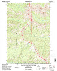
1991 Map of Canoe Lake
USGS Topo · Published 1996About this map
Yellowstone National Park and the Shoshone National Forest meet at a high-elevation boundary on this 1991 revision. The landscape is defined by the high divides between the watersheds of the Absaroka Wilderness. A remote network of footpaths serves as the primary infrastructure for the area, notably the Crandall Trail and the Miller Trail, which navigate the steep drainage systems of South Cache Creek and Timber Creek. Near the center of the sheet, Canoe Lake sits as a high-altitude landmark below the ridge lines. The map captures a wilderness area managed for conservation and recreation, showing the transition from the protected park lands to the national forest and wilderness systems before modern shifts in alpine forest health and fire management regimes altered the high-country canopy.
Find a feature on this map
14 named features on this map. Tap any name to fly to it.
Don’t see what you’re looking for? This feature index may not catch every label — zoom into the map to look around manually.
Map Details
Editions of this 1991 Canoe Lake Map
This is the sole edition of this map. No revisions or reprints were ever made.
Other maps of this area

1886 · Canyon
USGS Topo · 1:125,000

1895 · Canyon
USGS Topo · 1:125,000

1896 · Canyon
USGS Topo · 1:125,000

1896 · Crandall Creek
USGS Topo · 1:125,000

1899 · Crandall
USGS Topo · 1:125,000

1901 · Canyon
USGS Topo · 1:125,000

1907 · Canyon
USGS Topo · 1:125,000

1911 · Canyon
USGS Topo · 1:125,000

1955 · Ashton
USGS Topo · 1:250,000

1955 · Cody
USGS Topo · 1:250,000