
1901 Map of Canyon
USGS Topo · Published 1901About this map
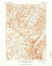
Yellowstone National Park reveals its early federal management and raw geothermal character in this survey based on fieldwork from the mid-1880s. The landscape is a complex network of thermal features and dramatic topography, anchored by the Lamar River and the high peaks of the Absaroka Range. Early travelers and scientists documented specific landmarks such as the Fossil Forest and the treacherous Death Gulch, while early infrastructure like Yanceys and the Hotel near Bridge Bay provided the only permanent human presence in the wilderness.
Find a feature on this map
136 named features on this map. Tap any name to fly to it.
Don’t see what you’re looking for? This feature index may not catch every label — zoom into the map to look around manually.
Map Details
Editions of this 1901 Canyon Map
This is the sole edition of this map. No revisions or reprints were ever made.
Other maps of this area

1885 · Lake
USGS Topo · 1:125,000

1885 · Gallatin
USGS Topo · 1:125,000

1885 · Gallatin
USGS Topo · 1:125,000

1886 · Shoshone
USGS Topo · 1:125,000

1886 · Canyon
USGS Topo · 1:125,000

1888 · Shoshone
USGS Topo · 1:125,000

1891 · Livingston
USGS Topo · 1:250,000

1893 · Livingston
USGS Topo · 1:250,000
1893 · Ishawooa
USGS Topo · 1:125,000

1895 · Shoshone
USGS Topo · 1:125,000