1950s Maps of Park County, Wyoming
Explore 54 historic maps of Park County from the 1950s. These maps offer a rare glimpse into what life looked like during the 1950s — showing old roads, neighborhoods, homes, and landmarks that have changed or disappeared over time.
Whether you're researching your family's past, planning a metal detecting trip, or studying how Park County's landscape evolved across the 1950s, these high-resolution maps are a powerful tool for exploring the history of this region.
- Focus on a specific era: All maps on this page are from the 1950s, giving you a focused view of this time period.
- See what’s changed: Compare century-old streets, trails, and buildings to today's modern landscape using overlays and satellite layers.
- Research with precision: Use these maps for genealogy, historical research, land use analysis, or educational projects.
- View, download, or print: Maps are fully viewable online in high resolution, and can be downloaded or printed for your own records.
Start exploring Park County's history through authentic maps from the 1950s. This is your window into the past.
Park County, WY maps
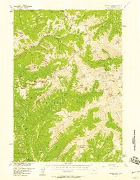
(54)- 1950 Map of Clark, 1952 Print
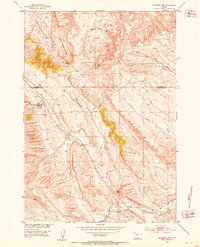
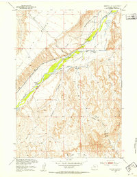
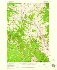
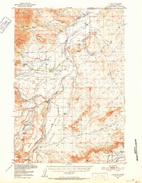 1950 Clark1952 Print · USGSNorthern Wyoming ranching and early petroleum development meet here at the start of the 1950s. Researchers can trace family homesteads like Johnson Ranch and locate local landmarks including Clark Sch and the Clark Cem.3 unique versions available
 - 1950 Map of Deep Lake, 1953 Print
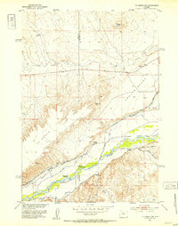
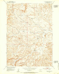
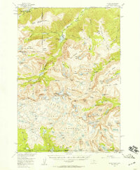
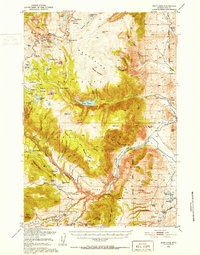 1950 Deep Lake1953 Print · USGSPark County, Wyoming, is captured here during the early fifties, showing the high-altitude reaches of the Beartooth Plateau. Researchers can locate remote high-country landmarks like Camp Sawtooth, the Frank N Hammitt Monument, and several family-held sites like Tolman Ranch.3 unique versions available
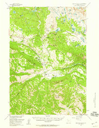
 - 1951 Map of Cody
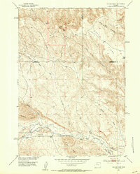
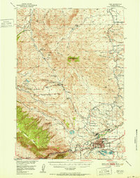 1951 Cody1951 Print · USGSCody and the surrounding Park County ranchlands are shown in the early fifties, a time when irrigation projects and resource extraction were shaping the basin. Genealogists and local historians can trace legacy properties like Stafford Ranch and Lundvall Ranch, or locate the Riverside Cemetery and Buffalo Bill Dam.
 - 1951 Map of Y U Bench NW, 1952 Print
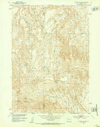
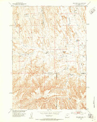
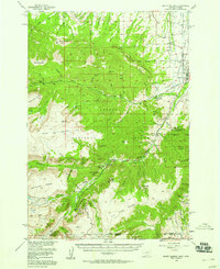
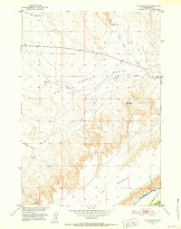 1951 Y U Bench NW1952 Print · USGSPark County ranching country is captured here in the early fifties, centering on the high Yu Bench. Researchers can trace old routes like the Keystone Burlington-Meeteetse Road and find historic landmarks including Lone Tree Crossing and the Wiley Canal (Aban'd).2 unique versions available
 - 1951 Map of Hillberry Rim, 1953 Print
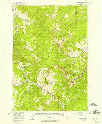
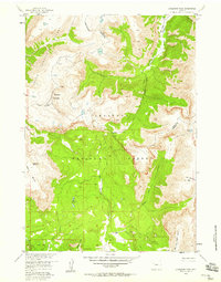
 1951 Hillberry Rim1953 Print · USGSThe Wyoming high plains south of Meeteetse come to life in the early fifties, showing a landscape of livestock ranching and early water management. Researchers can locate specific ranching landmarks like the Dickie Shearing Sheds, the Wild Horse Corral, and irrigation works along Gooseberry Creek.2 unique versions available
 - 1951 Map of Y U Bench NE, 1953 Print
 1951 Y U Bench NE1953 Print · USGSIn the early 1950s, this portion of the Greybull River valley showcases the intensive irrigation systems vital to Wyoming ranching. Researchers can trace historic water rights and family holdings like Thayer Ranch, the Renner-Sims site, and the Fenton School.3 unique versions available
 - 1951 Map of Gillies Draw, 1953 Print
 1951 Gillies Draw1953 Print · USGSHot Springs and Washakie Counties are mapped here in the early fifties, documenting a landscape shaped by water rights and high-desert terrain. Researchers can trace historical irrigation systems like the Quartz Pipe Line Ditch and the Murphy Ditch (Abandoned).2 unique versions available
 - 1951 Map of Tatman Mountain, 1953 Print
 1951 Tatman Mountain1953 Print · USGSThe Bighorn Basin high country is captured here in the early fifties, showing the upland terrain between Park and Big Horn counties. Local historians can trace early routes through Fenton Pass and across landmarks like Tatman Mountain and Sheets Mountain.2 unique versions available
 - 1951 Map of Sheets Flat, 1953 Print
 1951 Sheets Flat1953 Print · USGSThe Greybull River valley in the early fifties shows a landscape shaped by irrigation and ranching. Genealogists and local historians can trace family landmarks and water rights through features like Sheets Flat School, YU Ranch, and the Snyders House.2 unique versions available
 - 1951 Map of Wilson Spring, 1953 Print
 1951 Wilson Spring1953 Print · USGSPark County ranching life is preserved here during the early fifties, showing a landscape shaped by seasonal springs and isolated cabins. Researchers can trace the heritage of local range outposts like the John Miller Ranch, Nohr Cabin, and the uniquely named Baking Powder Springs.2 unique versions available
 - 1951 Map of Dead Indian Hill, 1953 Print
 1951 Dead Indian Hill1953 Print · USGSThe high grazing lands of Park and Big Horn Counties are captured here in the early fifties, showing a remote landscape of canyons and livestock bedgrounds. Researchers can locate specific family landmarks and homesteads like the Mc Donald Cabins, Johnson Cabin, and the Sales Place.2 unique versions available
 - 1954 Map of Billings, 1963 Print
 1954 Billings1963 Print · USGSThe Yellowstone valley during the mid-fifties shows a landscape of thriving rail towns and high-mountain outposts. Genealogists and historians can trace old homesteads and mining routes near Red Lodge, Bearcreek, and along the Bighorn River.4 unique versions available
 - 1955 Map of Bozeman
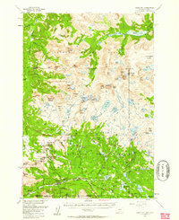
 1955 Bozeman1955 Print · USGSBozeman and the upper Missouri River headwaters are captured here during the mid-fifties, showing the vital rail and river networks of southwestern Montana. Local historians can trace the routes of the Northern Pacific railroad through Livingston and locate smaller settlements like Trident, Anceney, and Jardine.
 - 1955 Map of Crown Butte, 1958 Print
 1955 Crown Butte1958 Print · USGSGallatin County and the Madison Range were emerging as a recreational hub in the mid-1950s as travelers began frequenting the high country. Map collectors and genealogists can trace early mountain properties like Porcupine Ranch, Eldridge 320 Ranch, and the Ophir Sch.5 unique versions available
 - 1955 Map of Miner, 1959 Print
 1955 Miner1959 Print · USGSThe Montana-Wyoming border comes alive in this mid-fifties survey of the Yellowstone corridor. Genealogists and historians can trace the Miner Sch, the OTO Ranch, and the Northern Pacific rail line through Yankee Jim Canyon.4 unique versions available
 - 1955 Map of Ashton, 1967 Print
 1955 Ashton1967 Print · USGSThe Greater Yellowstone ecosystem is captured here during the mid-1950s, showing the high plateaus and remote gateway towns of Idaho and Montana. Researchers can trace the Union Pacific line to Ashton or locate small settlements like Squirrel and Grainville.4 unique versions available
 - 1955 Map of Driggs, 1967 Print
 1955 Driggs1967 Print · USGSEastern Idaho and Western Wyoming appear at a mid-century crossroads as the river valleys were fully settled and the high peaks protected. Genealogists and researchers can trace the rail towns of Rexburg and Driggs or follow the Snake River from Irwin to the Palisades Reservoir.3 unique versions available
 - 1955 Map of Cody, 1969 Print
 1955 Cody1969 Print · USGSThe Bighorn Basin and Absaroka Range meet in the mid-fifties, capturing a landscape defined by mountain wilderness and burgeoning oil fields. Trace family roots in Cody or Meeteetse, and locate industrial landmarks like the Elk Basin Oil and Gas Field and the Chicago Burlington and Quincy RR.2 unique versions available
 - 1955 Map of Thermopolis, 1969 Print
 1955 Thermopolis1969 Print · USGSMid-century Wyoming comes alive in this survey of the Wind River basin and the high Absaroka peaks. Trace the roots of oil and water development through the Hamilton Dome Oil Field and the Boysen Reservoir, or locate local landmarks like the Wyoming Industrial Institute and St. Stephens.2 unique versions available
 - 1956 Map of Alpine, 1957 Print
 1956 Alpine1957 Print · USGSThe Beartooth Range at the mid-century is captured here in immense detail, showing the glacial peaks and alpine lakes of the Montana-Wyoming border. Trace high-altitude landmarks like the Mystic Lake Hydroelectric Plant, the settlement at Alpine, and the rugged paths of the Arch Creek Trail.3 unique versions available
 - 1956 Map of Mount Maurice, 1958 Print
 1956 Mount Maurice1958 Print · USGSRed Lodge sits at the edge of the Beartooth Front in the mid-1950s, a hub for high-country research and recreation. Genealogists and historians can trace local landmarks like Draper Sch, the Red Lodge Cemetery, and Camp Senia along the mountain foothills.4 unique versions available
 - 1956 Map of Shoshone Pass, 1958 Print
 1956 Shoshone Pass1958 Print · USGSHigh in the Absaroka Range during the mid-1950s, this area was a wilderness of pack trails and remote mountain passes. Researchers can trace the historic Crescent Trail past the Stock Cabin or locate the ice-sculpted Du Noir Glacier.2 unique versions available
 - 1956 Map of Sunlight Peak, 1958 Print
 1956 Sunlight Peak1958 Print · USGSThe Absaroka wilderness comes alive in the mid-1950s at the intersection of Yellowstone and the Shoshone National Forest. Local historians can trace early mountain life through the Sunlight Mining Region, the Camp Monaco Historical Marker, and Pahaska Tepee.4 unique versions available
 - 1956 Map of Beartooth Butte, 1958 Print
 1956 Beartooth Butte1958 Print · USGSNorthwestern Wyoming ranching and forest life are captured here in the 1950s. Genealogists and historians can trace high-country outposts like L Bar T Ranch and Hunter Peak Ranch or locate the Crandall Ranger Station.3 unique versions available
 - 1956 Map of Cooke City, 1958 Print
 1956 Cooke City1958 Print · USGSThe Montana-Wyoming border highlands are captured here in the mid-fifties, centered on the mining and forestry outposts of the Beartooth range. Researchers can trace historic extraction sites like Irma Mines and Gold Dust Mine or locate the Big Park Guard Station.5 unique versions available
Showing maps 1-25 of 54
Top cities of Park County
Frequently asked questions
- What are the different types of historical maps available for Park County?
- What is the oldest map of Park County?
- Where can I purchase historical maps of Park County for my home or office?
- Where can I download high-res historical maps of Park County?
- Are there historical topographic maps available for Park County?
- Is there historical aerial imagery available for Park County?
- Where are historical maps of Park County sourced from?