
1951 Map of Schuster Flats
USGS Topo · Published 1952About this map
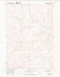
Schuster Flats dominates this portion of Washakie County, Wyoming, as it appeared in the early 1950s. This survey, conducted as part of the Missouri River Basin development program, illustrates a high desert landscape defined by ephemeral drainage systems and early water infrastructure. The presence of the Holland Ditch near the southern boundary and a prominent Pipe Line cutting diagonally across the terrain reflects the region's mid-century focus on resource management and irrigation.
Find a feature on this map
20 named features on this map. Tap any name to fly to it.
Don’t see what you’re looking for? This feature index may not catch every label — zoom into the map to look around manually.
Map Details
Editions of this 1951 Schuster Flats Map
2 editions found
Other maps of this area

1914 · Blue Mesa
USGS Topo · 1:62,500

1916 · Blue Mesa
USGS Topo · 1:62,500

1945 · Kirby
USGS Topo · 1:62,500

1946 · Kirby
USGS Topo · 1:62,500

1951 · Sucker Dam
USGS Topo · 1:24,000

1951 · Schuster Flats NE
USGS Topo · 1:24,000

1951 · Dutch Nick Flat
USGS Topo · 1:24,000

1951 · Schuster Flats NW
USGS Topo · 1:24,000

1951 · Schuster Flats SE
USGS Topo · 1:24,000

1955 · Cody
USGS Topo · 1:250,000