
1951 Map of Dead Indian Hill
USGS Topo · Published 1953About this map
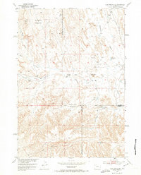
Horseshoe Bedground and Wagon Hound Bedground anchor this Wyoming landscape, reflecting the region's historic livestock grazing patterns at the start of the 1950s. The terrain is marked by a network of drainage systems including Fifteenmile Creek and Big Draw, where small reservoirs like School Section Reservoir and Adair Reservoir were established to manage water in the arid environment. The map provides a unique look at isolated homesteads and seasonal dwellings, identifying several specific sites such as Mc Donald Cabins and the Hewitt Place. Of particular interest to local historians are the noted structures along the gulches, including the Stone Cabin and the Kemick Cabin (Aband). This survey, conducted as part of the Missouri River Basin development program, captures the intersection of three counties — Park, Big Horn, and Washakie — at a time when traditional land use centered on these high bedgrounds and scattered cabins.
Find a feature on this map
20 named features on this map. Tap any name to fly to it.
Don’t see what you’re looking for? This feature index may not catch every label — zoom into the map to look around manually.
Map Details
Editions of this 1951 Dead Indian Hill Map
2 editions found
Other maps of this area

1951 · Hillberry Rim
USGS Topo · 1:24,000

1951 · Dutch Nick Flat SW
USGS Topo · 1:24,000

1951 · Gillies Draw
USGS Topo · 1:24,000

1951 · Sheep Mountain
USGS Topo · 1:24,000

1951 · Tatman Mountain
USGS Topo · 1:24,000

1951 · Sheets Flat
USGS Topo · 1:24,000

1951 · Wilson Spring
USGS Topo · 1:24,000

1951 · Dutch Nick Flat NW
USGS Topo · 1:24,000

1955 · Cody
USGS Topo · 1:250,000

1958 · Cody
USGS Topo · 1:250,000