
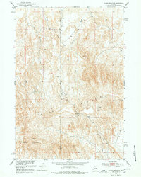
1951 Map of Tatman Mountain
USGS Topo · Published 1953About this map
Tatman Mountain dominates this portion of the Bighorn Basin during the early 1950s, serving as a prominent topographic landmark at the boundary of Park and Big Horn counties. The survey, completed as part of the Missouri River Basin development program, details a network of drainage features such as Roach Gulch, Fenton Draw, and Blackburn Gulch that carve through the high-elevation landscape. The terrain is defined by steep ridges and significant survey points like Vabm 6295 Fenton, providing a clear picture of the land before modern energy development or intensive water management altered the natural drainage patterns. To the south, Sheets Mountain rises near Fenton Pass, illustrating the difficult passage through these uplands in an era when unimproved dirt roads and trails were the primary means of navigating the area.
Find a feature on this map
9 named features on this map. Tap any name to fly to it.
Don’t see what you’re looking for? This feature index may not catch every label — zoom into the map to look around manually.
Map Details
Editions of this 1951 Tatman Mountain Map
2 editions found
Other maps of this area

1951 · Burlington
USGS Topo · 1:24,000

1951 · Y U Bench NW
USGS Topo · 1:24,000

1951 · Y U Bench NE
USGS Topo · 1:24,000

1951 · Sheep Mountain
USGS Topo · 1:24,000

1951 · Sheets Flat
USGS Topo · 1:24,000

1951 · Wilson Spring
USGS Topo · 1:24,000

1951 · Dead Indian Hill
USGS Topo · 1:24,000

1951 · Dutch Nick Flat NW
USGS Topo · 1:24,000

1955 · Cody
USGS Topo · 1:250,000

1958 · Cody
USGS Topo · 1:250,000