
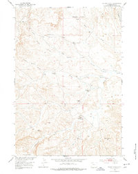
1951 Map of Wilson Spring
USGS Topo · Published 1953About this map
High-desert basins and isolated ranching outposts define this 1951 survey of Park County. The landscape is marked by seasonal drainages and scattered livestock improvements, such as the John Miller Ranch and Joe Miller Cabin located south of Parker Spring Gulch. These small, named settlements and cabins, including Nohr Cabin and Webster Cabin, suggest a pattern of seasonal habitation centered on water sources like Baking Powder Springs and Sand Spring.
Find a feature on this map
22 named features on this map. Tap any name to fly to it.
Don’t see what you’re looking for? This feature index may not catch every label — zoom into the map to look around manually.
Map Details
Editions of this 1951 Wilson Spring Map
2 editions found
Other maps of this area

1911 · Meeteetse
USGS Topo · 1:62,500

1911 · Oregon Basin
USGS Topo · 1:62,500

1913 · Oregon Basin
USGS Topo · 1:62,500

1913 · Meeteetse
USGS Topo · 1:62,500

1951 · Hillberry Rim
USGS Topo · 1:24,000

1951 · Gillies Draw
USGS Topo · 1:24,000

1951 · Tatman Mountain
USGS Topo · 1:24,000

1951 · Sheets Flat
USGS Topo · 1:24,000

1951 · Dead Indian Hill
USGS Topo · 1:24,000

1955 · Cody
USGS Topo · 1:250,000