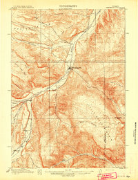
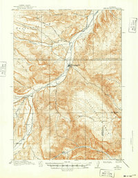
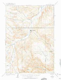
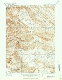
1913 Map of Meeteetse
USGS Topo · Published 1913About this map
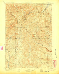
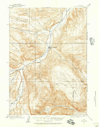
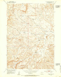
Meeteetse serves as the central hub of this 1911 survey, situated at the confluence of Meeteetse Creek and the Greybull River. The landscape is defined by its early ranching and mining infrastructure, notably the Black Diamond Mine located just north of the town along the Cody Road. The presence of the Antler Canal in the southwestern corner indicates the early efforts to divert water for agricultural use in this arid environment. Further south, the map identifies small settlements like Dumbell and Sunshine, alongside established outposts such as Renner's Ranch. The terrain reveals a complex network of drainage basins, from the broad Little Buffalo Basin to uniquely named landmarks like Hole in the Ground, illustrating the transition from river valleys to the high desert plateaus of the Big Horn Basin. This survey captures the region just as the county lines between Park Co and Hot Springs Co were being firmly established.
Find a feature on this map
23 named features on this map. Tap any name to fly to it.
Don’t see what you’re looking for? This feature index may not catch every label — zoom into the map to look around manually.
Map Details
Editions of this 1913 Meeteetse Map
3 editions found
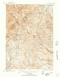
Other maps of this area
1904 · Kirwin
USGS Topo · 1:125,000
1906 · Kirwin
USGS Topo · 1:125,000
1911 · Meeteetse
USGS Topo · 1:62,500
1911 · Oregon Basin
USGS Topo · 1:62,500
1913 · Oregon Basin
USGS Topo · 1:62,500
1913 · Grass Creek Basin
USGS Topo · 1:62,500
1915 · Grass Creek Basin
USGS Topo · 1:62,500
1951 · Hillberry Rim
USGS Topo · 1:24,000
1951 · Sheets Flat
USGS Topo · 1:24,000
1951 · Wilson Spring
USGS Topo · 1:24,000