Old Maps of Dumbell, Wyoming
Explore 11 old maps of Dumbell, spanning from 1911 to today. These high-resolution historic maps reveal how streets, neighborhoods, landmarks, and natural features evolved over time — perfect for genealogy, metal detecting, research, and local history exploration.
What you can do with these maps:
- See how Dumbell changed over time: Compare historical maps to modern-day views to trace roads, homesites, rail lines & more.
- View detailed metadata: Each map includes creators, publishers, year, scale, and archive source.
- Overlay maps with satellite & LiDAR: Visualize the past alongside modern tools to explore terrain & human change.
- Trusted historical sources: Maps sourced from the USGS, Library of Congress, and other archives.
- Access maps your way: View online, download high-res files, or order prints for personal or research use.
Start exploring old maps of Dumbell to uncover forgotten places, hidden landmarks, and the deep history beneath your feet.
Dumbell, WY maps
(11)- 1911 Map of Meeteetse, 1957 Print
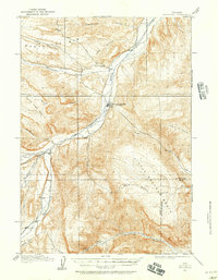 1911 Meeteetse1957 Print · USGSMeeteetse and the Bighorn Basin are captured here in the early twentieth century as ranching and early mining took hold. Researchers can trace the historic Cody Road and locate old landmarks like the Black Diamond Mine and Renner's Ranch.
 - 1913 Map of Meeteetse
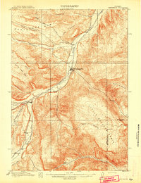 1913 Meeteetse1913 Print · USGSMeeteetse and the surrounding ranchlands are captured here in the years before World War I. Researchers can trace the early road network like Cody Road or locate historical sites such as Dumbell, Sunshine, and the Black Diamond Mine.3 unique versions available
 - 1955 Map of Cody, 1969 Print
 1955 Cody1969 Print · USGSThe Bighorn Basin and Absaroka Range meet in the mid-fifties, capturing a landscape defined by mountain wilderness and burgeoning oil fields. Trace family roots in Cody or Meeteetse, and locate industrial landmarks like the Elk Basin Oil and Gas Field and the Chicago Burlington and Quincy RR.2 unique versions available
 - 1958 Map of Cody
 1958 Cody1958 Print · USGSNorthwestern Wyoming at the peak of the mid-century energy and ranching boom shows a land of high peaks and oil basins. Researchers can trace the Chicago Burlington and Quincy rail lines through Greybull or locate the sprawling Elk Basin Oil and Gas Field.
 - 1962 Map of Cody
 1962 Cody1962 Print · USGSBig Horn Basin energy and agriculture define this mid-century look at Wyoming’s northern frontier. Local historians can trace the irrigation and rail networks connecting Cody and Powell to major energy sites like the Oregon Basin Oil Field.
 - 1982 Map of Basin, 1983 Print
 1982 Basin1983 Print · USGSBig Horn and Park counties in the early eighties were defined by the high-desert benches and the vital waters of the Bighorn River. Researchers can trace the rail-and-river economy through the Burlington Northern line and locate local landmarks like the Eagle Mine or the Bird Reservation at Loch-Katrine.
 - 1985 Map of Iron Creek
 1985 Iron Creek1985 Print · USGSPark County, Wyoming, is captured in the mid-1980s as a landscape of high benches and vital water management. Researchers can trace irrigation networks from the Sunshine Reservoir and find family-named landmarks like Rice Bench and Greybull Bench.
 - 2012 Map of Iron Creek, 2012 Print
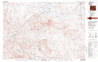
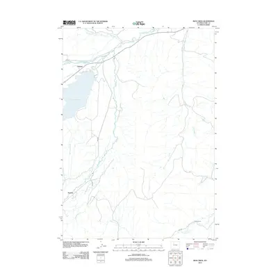 2012 Iron Creek2012 Print · USGSCovers Dumbell, including Sunshine, Park County, and other nearby areas
 - 2015 Map of Iron Creek, 2015 Print
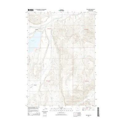 2015 Iron Creek2015 Print · USGSCovers Dumbell, including Sunshine, Park County, and other nearby areas
 - 2017 Map of Iron Creek, 2017 Print
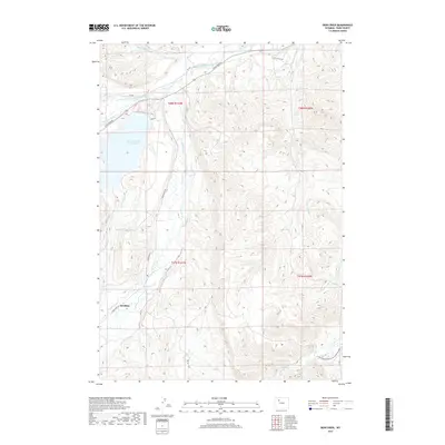 2017 Iron Creek2017 Print · USGSCovers Dumbell, including Sunshine, Park County, and other nearby areas
 - 2021 Map of Iron Creek, 2021 Print
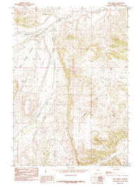
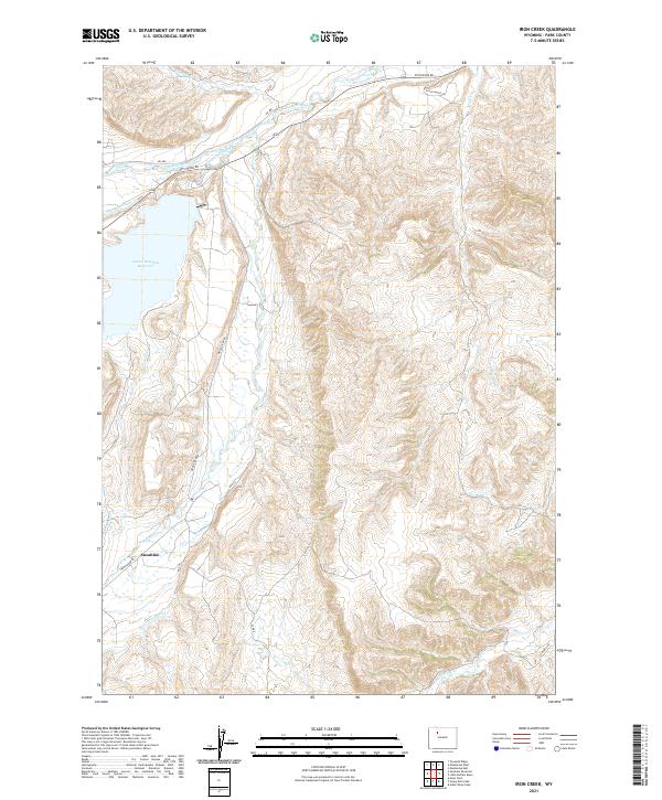 2021 Iron Creek2021 Print · USGSSunshine and the surrounding rangeland are captured here in the early twenty-first century, showing the intricate network of canals supporting the Bighorn Basin. Researchers can trace historic irrigation routes like Only Chance Ditch and Pappapau Ditch near the Lower Sunshine Reservoir.
End of results
Showing maps 1-11 of 11
Top cities near Dumbell
Frequently asked questions
- What are the different types of historical maps available for Dumbell?
- What is the oldest map of Dumbell?
- Where can I purchase historical maps of Dumbell for my home or office?
- Where can I download high-res historical maps of Dumbell?
- Are there historical topographic maps available for Dumbell?
- Is there historical aerial imagery available for Dumbell?
- Where are historical maps of Dumbell sourced from?