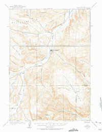
1913 Map of Meeteetse
USGS Topo · Published 1975About this map
The settlement of Meeteetse serves as the focal point for this early 20th-century survey of the Big Horn Basin, where the Greybull River meets its many tributaries. The landscape is defined by its water management and early industry, evidenced by the Antler Canal near Sunshine and the Black Diamond Mine located just north of the township. Local transportation is anchored by the Cody Road, which cuts through the northern drainages of Long Hollow and Cottonwood Creek.
Find a feature on this map
24 named features on this map. Tap any name to fly to it.
Don’t see what you’re looking for? This feature index may not catch every label — zoom into the map to look around manually.
Map Details
Editions of this 1913 Meeteetse Map
3 editions found
Other maps of this area

1904 · Kirwin
USGS Topo · 1:125,000

1906 · Kirwin
USGS Topo · 1:125,000

1911 · Meeteetse
USGS Topo · 1:62,500

1911 · Oregon Basin
USGS Topo · 1:62,500

1913 · Oregon Basin
USGS Topo · 1:62,500

1913 · Meeteetse
USGS Topo · 1:62,500

1913 · Grass Creek Basin
USGS Topo · 1:62,500

1915 · Grass Creek Basin
USGS Topo · 1:62,500

1951 · Hillberry Rim
USGS Topo · 1:24,000

1951 · Sheets Flat
USGS Topo · 1:24,000