
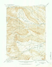
1913 Map of Grass Creek Basin
USGS Topo · Published 1962About this map
Grass Creek Basin defines the landscape of this pre-WWI Wyoming survey, revealing a region dominated by widely dispersed homesteads and livestock operations. The topography is marked by significant drainages such as Gooseberry Creek, Grass Creek, and Cottonwood Creek, which provide the lifeblood for isolated outposts like Dickie Ranch and Richman's Ranch. The distribution of these family-named properties, including Mayfield's Ranch and Gwynn's Ranch, suggests a ranching economy where water rights were paramount. Industrial activity is limited but present at the Putney Mine, while distinctive geological features such as Crater Sink and the Gumbo Hills characterize the varied terrain. The inclusion of Wales Reservoir and Wagonhound Spring highlights the critical importance of managed water resources in this arid environment before modern development changed the basin.
Find a feature on this map
27 named features on this map. Tap any name to fly to it.
Don’t see what you’re looking for? This feature index may not catch every label — zoom into the map to look around manually.
Map Details
Editions of this 1913 Grass Creek Basin Map
2 editions found
Other maps of this area

1911 · Meeteetse
USGS Topo · 1:62,500

1913 · Meeteetse
USGS Topo · 1:62,500

1914 · Blue Mesa
USGS Topo · 1:62,500

1915 · Grass Creek Basin
USGS Topo · 1:62,500

1916 · Blue Mesa
USGS Topo · 1:62,500

1951 · Hillberry Rim
USGS Topo · 1:24,000

1951 · Dutch Nick Flat SW
USGS Topo · 1:24,000

1951 · Gillies Draw
USGS Topo · 1:24,000

1955 · Cody
USGS Topo · 1:250,000

1955 · Thermopolis
USGS Topo · 1:250,000