
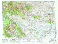
1955 Map of Thermopolis
USGS Topo · Published 1969About this map
The Wind River Indian Reservation dominates the southern landscape of this mid-century survey, where the Wind River flows through the Wind River Diversion Dam toward the extensive Boysen Reservoir. This era shows a region defined by water management and mineral extraction, with the Hamilton Dome Oil Field, Circle Ridge Oil Field, and Winkleman Dome Oil Field signaling the industrial footprint on the high plains. Along the Bighorn River, the town of Thermopolis serves as a gateway to Hot Springs State Park, while the Chicago, Burlington & Quincy RR tracks follow the river corridor through Kirby and Lucerne. In the west, the massive peaks of the Absaroka Range and Wind River Range rise sharply, including the high point at Gannett Peak. This map captures the integration of tribal lands, irrigation projects like the Riverton Reclamation Area, and remote outposts such as the Duncan Ranch School.
Find a feature on this map
56 named features on this map. Tap any name to fly to it.
Don’t see what you’re looking for? This feature index may not catch every label — zoom into the map to look around manually.
Map Details
Editions of this 1955 Thermopolis Map
2 editions found
Other maps of this area

1885 · Lake
USGS Topo · 1:125,000

1893 · Ishawooa
USGS Topo · 1:125,000

1895 · Ishawooa
USGS Topo · 1:125,000

1895 · Lake
USGS Topo · 1:125,000

1896 · Lake
USGS Topo · 1:125,000

1899 · Ishawooa
USGS Topo · 1:125,000

1901 · Lake
USGS Topo · 1:125,000

1902 · Mt Leidy
USGS Topo · 1:125,000

1904 · Kirwin
USGS Topo · 1:125,000

1905 · Younts Peak
USGS Topo · 1:125,000