Old Maps of Grass Creek, Wyoming
Explore 11 old maps of Grass Creek, spanning from 1913 to today. These high-resolution historic maps reveal how streets, neighborhoods, landmarks, and natural features evolved over time — perfect for genealogy, metal detecting, research, and local history exploration.
What you can do with these maps:
- See how Grass Creek changed over time: Compare historical maps to modern-day views to trace roads, homesites, rail lines & more.
- View detailed metadata: Each map includes creators, publishers, year, scale, and archive source.
- Overlay maps with satellite & LiDAR: Visualize the past alongside modern tools to explore terrain & human change.
- Trusted historical sources: Maps sourced from the USGS, Library of Congress, and other archives.
- Access maps your way: View online, download high-res files, or order prints for personal or research use.
Start exploring old maps of Grass Creek to uncover forgotten places, hidden landmarks, and the deep history beneath your feet.
Grass Creek, WY maps
(11)- 1913 Map of Grass Creek Basin, 1962 Print
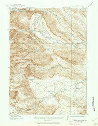 1913 Grass Creek Basin1962 Print · USGSHot Springs County ranching life is preserved here during the early twentieth century, showing a remote landscape of isolated family homesteads and vital water sources. Genealogists and historians can locate early properties like Wales Ranch and Kemp Ranch, or trace the rugged geography of the Putney Mine and Grass Creek Basin.2 unique versions available
 - 1915 Map of Grass Creek Basin
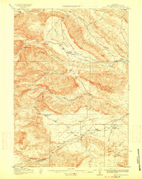 1915 Grass Creek Basin1915 Print · USGSHot Springs County homesteads and early Wyoming resource extraction are documented here in the years before the Great War. Genealogists and historians can locate family-named landmarks like Littlejohn Ranch, Putney Mine, and Wagonhound Spring.3 unique versions available
 - 1955 Map of Thermopolis, 1969 Print
 1955 Thermopolis1969 Print · USGSMid-century Wyoming comes alive in this survey of the Wind River basin and the high Absaroka peaks. Trace the roots of oil and water development through the Hamilton Dome Oil Field and the Boysen Reservoir, or locate local landmarks like the Wyoming Industrial Institute and St. Stephens.2 unique versions available
 - 1958 Map of Thermopolis
 1958 Thermopolis1958 Print · USGSThe Bighorn Basin and Wind River Reservation are shown here in the late fifties, during a period of significant petroleum and agricultural growth. Genealogists and historians can trace rail-towns like Gebo, energy hubs like the Hamilton Dome Oil Field, and the layout of Fort Washakie.2 unique versions available
 - 1962 Map of Thermopolis
 1962 Thermopolis1962 Print · USGSThe Wind River and Bighorn basins are meticulously mapped in the early sixties, showing the vital irrigation and rail networks of the era. Genealogists and historians can locate specific landmarks like the Duncan Ranch School, the Wyoming Industrial Institute, and the Hamilton Dome oil field.
 - 1981 Map of Thermopolis, 1982 Print
 1981 Thermopolis1982 Print · USGSCentral Wyoming in the early eighties shows a landscape of geothermal wonders and energy extraction. Trace the legacy of early settlements and industry near Hot Springs State Park, the rail lines of the Burlington Northern, and outposts like Gebo and Hamilton Dome.
 - 1985 Map of Grass Creek
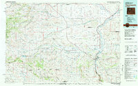
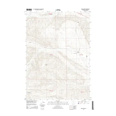
 1985 Grass Creek1985 Print · USGSIn the mid-1980s, this pocket of Hot Springs County was a hub of energy production centered on the Grass Creek settlement. Researchers can trace the extensive footprint of the Grass Creek Oil Field and Grass Creek Gas Field amidst landmarks like Enos and Sand Draw.
 - 2012 Map of Grass Creek, 2012 Print
 2012 Grass Creek2012 Print · USGSCovers Grass Creek, including Hot Springs County, United States, and other nearby areas
 - 2015 Map of Grass Creek, 2015 Print
 2015 Grass Creek2015 Print · USGSCovers Grass Creek, including Hot Springs County, United States, and other nearby areas
 - 2017 Map of Grass Creek, 2017 Print
 2017 Grass Creek2017 Print · USGSCovers Grass Creek, including Hot Springs County, United States, and other nearby areas
 - 2021 Map of Grass Creek, 2021 Print
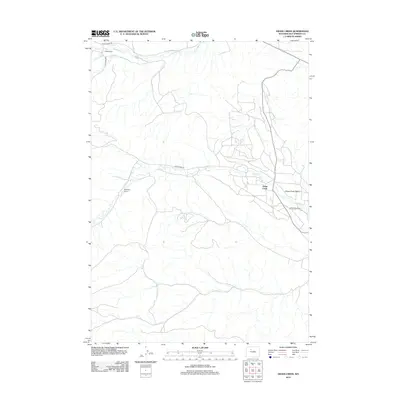
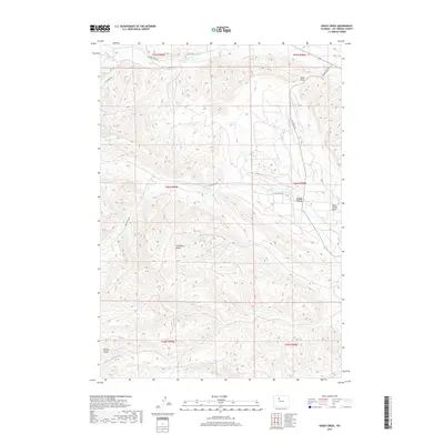
 2021 Grass Creek2021 Print · USGSIn the early twenty-first century, this area of Hot Springs County illustrates a landscape shaped by ranching and energy extraction. Researchers can trace the layout of Grass Creek and follow historic routes like Dickie Ranch Rd past Coalmine Draw.
End of results
Showing maps 1-11 of 11
Top cities near Grass Creek
Frequently asked questions
- What are the different types of historical maps available for Grass Creek?
- What is the oldest map of Grass Creek?
- Where can I purchase historical maps of Grass Creek for my home or office?
- Where can I download high-res historical maps of Grass Creek?
- Are there historical topographic maps available for Grass Creek?
- Is there historical aerial imagery available for Grass Creek?
- Where are historical maps of Grass Creek sourced from?