
1952 Map of Badwater NE
USGS Topo · Published 1954About this map
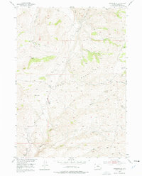
Bighorn Mountains terrain dominates this 1952 study area, where a network of trails and isolated cabins illustrates the ranching and herding life of mid-century Natrona County. The landscape is defined by high-altitude grazing areas like Okie Pasture, supported by numerous seasonal outposts including Balkett Cabin, Larson Cabin, and Bishop Cabin. These remote structures, along with the Sheep Camp and various corrals, highlight a specialized economy reliant on the seasonal movement of livestock through the foothills. Movement across the territory is facilitated by established routes such as the Bighorn Trail and Okie Trail, which follow the natural contours between drainages. Significant water sources like Badwater Creek and Deep Creek carve through the mountain slopes, providing essential irrigation and stock water for the scattered ranching operations depicted.
Find a feature on this map
22 named features on this map. Tap any name to fly to it.
Don’t see what you’re looking for? This feature index may not catch every label — zoom into the map to look around manually.
Map Details
Editions of this 1952 Badwater NE Map
2 editions found
Other maps of this area

1952 · Deadman Butte
USGS Topo · 1:24,000

1952 · Badwater
USGS Topo · 1:24,000

1952 · Grave Spring
USGS Topo · 1:24,000

1952 · Sioux Pass
USGS Topo · 1:24,000

1952 · Badwater SE
USGS Topo · 1:24,000

1955 · Arminto
USGS Topo · 1:250,000

1958 · Arminto
USGS Topo · 1:250,000

1962 · Arminto
USGS Topo · 1:250,000
1967 · Cornell Gulch
USGS Topo · 1:24,000
1967 · Cherry Creek Hill
USGS Topo · 1:24,000