
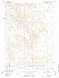
1951 Map of Dutch Nick Flat SW
USGS Topo · Published 1953About this map
The rugged drainage systems of the Bighorn Basin are the defining characteristic of this 1951 survey, where Middle Fork Fifteenmile Creek and South Fork Fifteenmile Creek carve through the arid terrain. The landscape is dominated by East Ridge and the broad expanse of Dutch Nick Flat, revealing a topography shaped by intermittent watercourses like Paradise Alley and Timber Creek.
Find a feature on this map
16 named features on this map. Tap any name to fly to it.
Don’t see what you’re looking for? This feature index may not catch every label — zoom into the map to look around manually.
Map Details
Editions of this 1951 Dutch Nick Flat SW Map
2 editions found
Other maps of this area

1913 · Grass Creek Basin
USGS Topo · 1:62,500

1914 · Blue Mesa
USGS Topo · 1:62,500

1915 · Grass Creek Basin
USGS Topo · 1:62,500

1916 · Blue Mesa
USGS Topo · 1:62,500

1951 · Sucker Dam
USGS Topo · 1:24,000

1951 · Dutch Nick Flat
USGS Topo · 1:24,000

1951 · Gillies Draw
USGS Topo · 1:24,000

1951 · Dead Indian Hill
USGS Topo · 1:24,000

1951 · Dutch Nick Flat NW
USGS Topo · 1:24,000

1955 · Cody
USGS Topo · 1:250,000