1960s Maps of Washakie County, Wyoming
Explore 46 historic maps of Washakie County from the 1960s. These maps offer a rare glimpse into what life looked like during the 1960s — showing old roads, neighborhoods, homes, and landmarks that have changed or disappeared over time.
Whether you're researching your family's past, planning a metal detecting trip, or studying how Washakie County's landscape evolved across the 1960s, these high-resolution maps are a powerful tool for exploring the history of this region.
- Focus on a specific era: All maps on this page are from the 1960s, giving you a focused view of this time period.
- See what’s changed: Compare century-old streets, trails, and buildings to today's modern landscape using overlays and satellite layers.
- Research with precision: Use these maps for genealogy, historical research, land use analysis, or educational projects.
- View, download, or print: Maps are fully viewable online in high resolution, and can be downloaded or printed for your own records.
Start exploring Washakie County's history through authentic maps from the 1960s. This is your window into the past.
Washakie County, WY maps
(46)- 1960 Map of Coyote Hill, 1962 Print
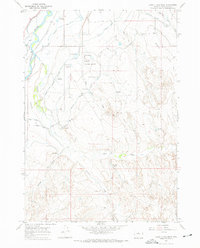
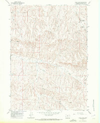
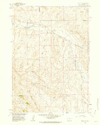 1960 Coyote Hill1962 Print · USGSMid-century petroleum development in the Wyoming basins is captured here just as energy infrastructure began to crisscross the county line. Researchers can trace early energy sites like the Kirby Creek Oil Field and Murphy Dome, or locate specific landmarks like Wild Horse Butte and Malcolm Spring.2 unique versions available
 - 1960 Map of Packsaddle Creek, 1962 Print
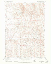
 1960 Packsaddle Creek1962 Print · USGSThe high basins of Hot Springs County were a hub of energy extraction in the early 1960s. Researchers can trace the infrastructure of the Murphy Dome Oil Field and Black Mountain Oil Field, alongside family-named landmarks like Gardner Creek and Olsen Draw.
 - 1962 Map of Thermopolis
 1962 Thermopolis1962 Print · USGSThe Wind River and Bighorn basins are meticulously mapped in the early sixties, showing the vital irrigation and rail networks of the era. Genealogists and historians can locate specific landmarks like the Duncan Ranch School, the Wyoming Industrial Institute, and the Hamilton Dome oil field.
 - 1962 Map of Sheridan
 1962 Sheridan1962 Print · USGSThe Big Horn Mountains and Powder River country are captured here in the early sixties as energy production and ranching shaped northern Wyoming. Researchers can locate specific sites like the Kleenburn Coal Tipple, Eaton Bros Ranch, and the Fort McKenzie Veteran Hospital.
 - 1962 Map of Arminto
 1962 Arminto1962 Print · USGSCentral Wyoming in the early sixties reveals a landscape shaped by the Chicago and North Western railroad and early energy development. Trace the history of the region through remote outposts like Arminto, the US Naval Petroleum Reserve, and the geologic landmark at Hells Half Acre.
 - 1962 Map of Cody
 1962 Cody1962 Print · USGSBig Horn Basin energy and agriculture define this mid-century look at Wyoming’s northern frontier. Local historians can trace the irrigation and rail networks connecting Cody and Powell to major energy sites like the Oregon Basin Oil Field.
 - 1966 Map of Monument Hill, 1970 Print
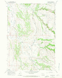
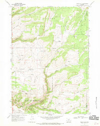
 1966 Monument Hill1970 Print · USGSWashakie County during the mid-sixties reveals a landscape of high-country ranching and remote mountain outposts. Researchers can locate isolated landmarks like Wilkes Cabin, the high Monument Hill, and the primitive Mazet Landing Strip in this high-altitude terrain.
 - 1966 Map of Big Trails, 1970 Print
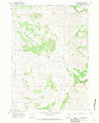
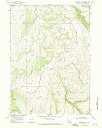
 1966 Big Trails1970 Print · USGSWashakie County ranching life is preserved here in the mid-1960s, showing the remote drainages where the Big Horn Basin meets the foothills. Researchers can trace the path of the Big Trails Stock Drive Road and find the site of the Big Trails Ch and Big Spring.2 unique versions available
 - 1966 Map of Big Trails NE, 1970 Print
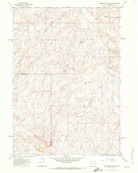
 1966 Big Trails NE1970 Print · USGSWashakie County ranchlands are documented here in the mid-sixties, showing a landscape defined by seasonal water and isolated livestock operations. Researchers can locate remote sites like Taylor Bros Ranch, a small Cem, and the Landing Strip near Otter Creek.2 unique versions available
 - 1966 Map of Deadline Draw, 1971 Print
 1966 Deadline Draw1971 Print · USGSWashakie County ranch lands are captured here in the mid-1960s, showing a remote landscape of high ridges and deep coulees. Researchers can trace land use through features like the Blue Bank Shearing Pens, Millys Well, and the unusual formations of The Honeycombs.
 - 1966 Map of Zimmerman Buttes, 1971 Print
 1966 Zimmerman Buttes1971 Print · USGSWashakie and Hot Springs Counties were characterized by isolated ranching infrastructure and cattle range in the mid-sixties. Researchers can locate specific water improvements like Neiber Well, Zimmerman Springs, and several named reservoirs.2 unique versions available
 - 1966 Map of Banjo Flats West, 1971 Print
 1966 Banjo Flats West1971 Print · USGSThe Bighorn River valley in the mid-1960s shows a landscape transformed by complex irrigation and ranching. Genealogists and local historians can trace the paths of the Highland Hanover Canal or locate landmarks like Banjo Ranch and the Worland Municipal Airport.3 unique versions available
 - 1966 Map of Tallon Spring, 1971 Print
 1966 Tallon Spring1971 Print · USGSWashakie and Johnson counties are shown in the mid-1960s as a high-altitude ranching landscape defined by remote springs and rugged forks. Researchers can trace historic stock routes and remote landmarks like the Stock Drive Road, Tallon Spring, and the unique topography of The Vees.
 - 1966 Map of Indian Creek, 1971 Print
 1966 Indian Creek1971 Print · USGSWashakie County ranching country is documented here in the mid-1960s, showing a landscape defined by seasonal water and remote trails. Genealogists and historians can trace livestock infrastructure through landmarks like Best Place Reservoir, Blue Bank Road, and Homestead Reservoir.
 - 1966 Map of Sand Point, 1971 Print
 1966 Sand Point1971 Print · USGSThe ranching and resource-extraction landscape of the Washakie County border is captured here in the mid-1960s. Genealogists and historians can trace the remote Orchards Cow Camp and numerous water developments including Hiawatha Well and the Cottonwood Trail.
 - 1966 Map of Cabin Fork, 1971 Print
 1966 Cabin Fork1971 Print · USGSWashakie County during the mid-sixties reveals an arid landscape of resource extraction and water management. Researchers can trace the cattle and oil history of the region via Lyman Reservoir No 1, Denver Jake Dam, and the Macaroni Pit.2 unique versions available
 - 1966 Map of Joe Emge Creek, 1971 Print
 1966 Joe Emge Creek1971 Print · USGSWashakie County ranch lands are documented here in the mid-1960s as the regional livestock economy relied on a network of isolated water sources. Researchers can trace land use through features like Bunning Reservoir, Spring Creek Rd, and Fiscus Gulch.2 unique versions available
 - 1966 Map of Wagon Prong, 1972 Print
 1966 Wagon Prong1972 Print · USGSWashakie County ranching country is mapped here in the mid-1960s, showing a landscape shaped by water management and high-desert terrain. Genealogists and historians can trace livestock heritage through sites like Meleskie Camp, Hayes Cow Camp, and the Old Quaker Reservoir.2 unique versions available
 - 1966 Map of Bader Draw, 1972 Print
 1966 Bader Draw1972 Print · USGSThe high desert of Washakie County comes into focus in the mid-1960s, showing a landscape defined by ranching and petroleum extraction. Researchers can locate remote sites like Holland Winter Camp, the Seaman Ranch, and the Black Mountain Oil Field.
 - 1966 Map of Henry Draw, 1972 Print
 1966 Henry Draw1972 Print · USGSWashakie County in the mid-1960s reveals a workspace of oil exploration and water management in the Bighorn Basin. Genealogists and researchers can trace local landmarks like McCarthy Well and the network of water storage at Scorpion Hill Reservoir and Pinky Reservoir.2 unique versions available
 - 1966 Map of Banjo Flats East, 1972 Print
 1966 Banjo Flats East1972 Print · USGSWashakie County was a landscape of energy exploration and complex drainages in the mid-sixties. Geologists and local historians can trace the development of Marconi Road and find individual sites like Roush Well No 2 and the Flowing Well.2 unique versions available
 - 1966 Map of Castle Gardens, 1972 Print
 1966 Castle Gardens1972 Print · USGSWashakie County in the mid-1960s was a landscape of carved formations and essential water improvements. Researchers can trace the drainage of Nowater Creek and locate remote catchments like Rice No 3 Reservoir and Witness Corner Reservoir.
 - 1967 Map of Onion Gulch, 1970 Print
 1967 Onion Gulch1970 Print · USGSThe high-plateau grazing lands of the Bighorns are captured here in the late sixties. Researchers can locate seasonal outposts and family landmarks like the Tolman Homestead, Rice Cow Camp, and Basset Cabin.2 unique versions available
 - 1967 Map of Old Maid Gulch, 1970 Print
 1967 Old Maid Gulch1970 Print · USGSWashakie County ranching and recreation are captured here in the late sixties as the forest road winds through the canyon. Researchers can trace the layout of the Circle J Ranch, the Tensleep Fish Hatchery, and historic sites like Williams Mill and the Leigh Monument.
 - 1967 Map of Mahogany Butte, 1971 Print
 1967 Mahogany Butte1971 Print · USGSThe ranching country of Washakie County is captured here in the late sixties as a network of canyons and jeep trails. Researchers can locate the Upper Nowood Sch, the Hampton Ranch Airstrip, and remote landmarks like Mahogany Butte.2 unique versions available
Showing maps 1-25 of 46
Top cities of Washakie County
Frequently asked questions
- What are the different types of historical maps available for Washakie County?
- What is the oldest map of Washakie County?
- Where can I purchase historical maps of Washakie County for my home or office?
- Where can I download high-res historical maps of Washakie County?
- Are there historical topographic maps available for Washakie County?
- Is there historical aerial imagery available for Washakie County?
- Where are historical maps of Washakie County sourced from?